North Central Gulf Area of Interest

This is the general tropical discussion area. Anyone can take their shot at predicting a storms path.

Moderator: S2k Moderators

Forum rules

The posts in this forum are NOT official forecasts and should not be used as such. They are just the opinion of the poster and may or may not be backed by sound meteorological data. They are NOT endorsed by any professional institution or STORM2K. For official information, please refer to products from the National Hurricane Center and National Weather Service.

Help Support Storm2K
Message
Author
User avatar
cycloneye
Admin
Admin
Posts: 145382
Age: 68
Joined: Thu Oct 10, 2002 10:54 am
Location: San Juan, Puerto Rico

North Central Gulf Area of Interest

#1 Postby cycloneye » Tue Jul 22, 2025 6:46 pm

Tropical Weather Outlook
NWS National Hurricane Center Miami FL
800 PM EDT Tue Jul 22 2025

For the North Atlantic...Caribbean Sea and the Gulf of America:

North-Central Gulf:
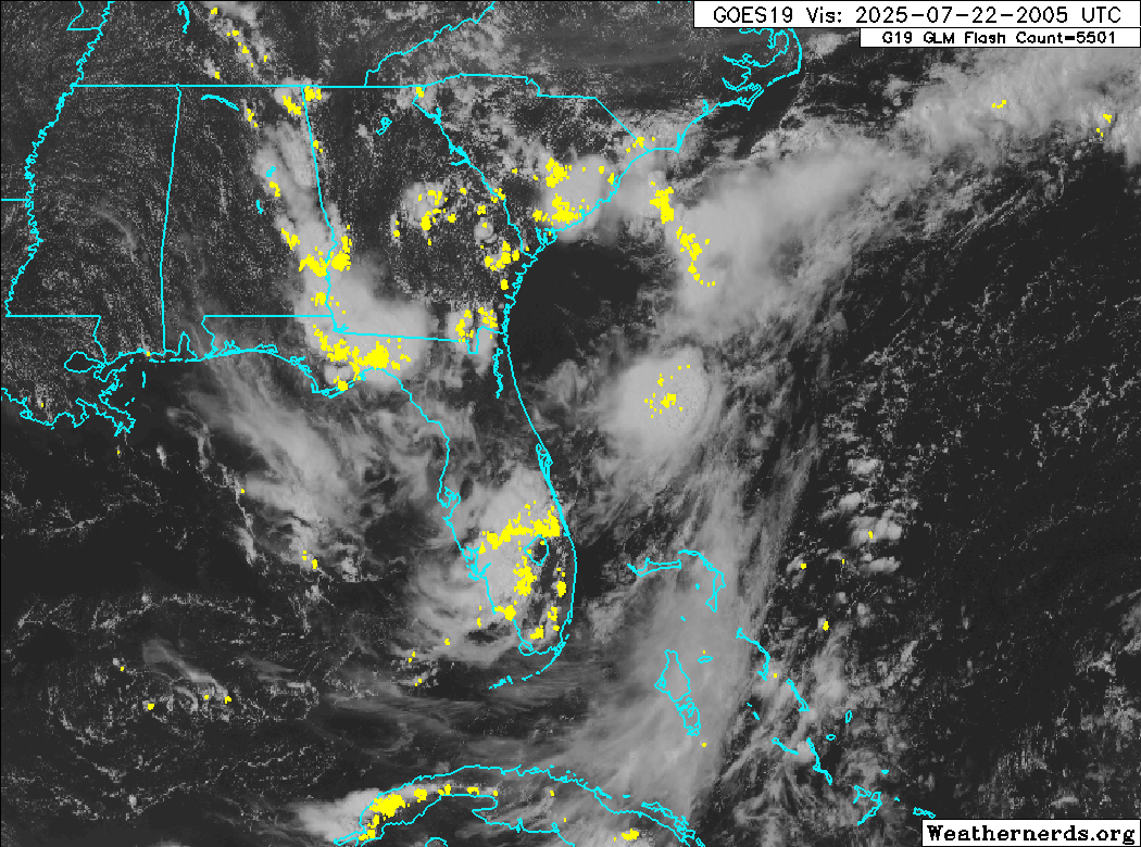
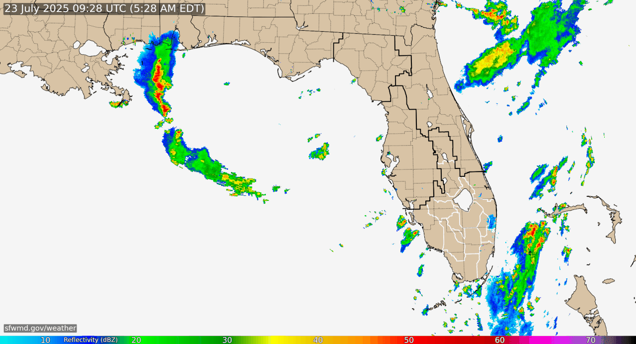
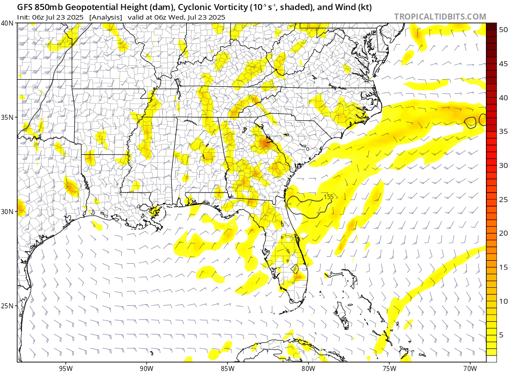
A trough of low pressure on the southern end of a frontal boundary
is currently located just offshore of the Southeastern U.S. coast.
Over the next few days, this system is forecast to move
west-southwestward into the north-central portion of the Gulf, where
environmental conditions could allow for some slow development if
the system remains far enough offshore. By this weekend, the system
is likely to move inland, ending its chances for development.
Regardless of formation, heavy rainfall could be possible for
portions of the northern Gulf coast through this weekend.
* Formation chance through 48 hours...low...10 percent.
* Formation chance through 7 days...low...10 percent.

$$
Forecaster Papin


Image
3 likes   
Visit the Caribbean-Central America Weather Thread where you can find at first post web cams,radars
and observations from Caribbean basin members Click Here

BobHarlem
Category 5
Category 5
Posts: 2117
Joined: Thu Oct 20, 2005 6:11 pm

Re: Let's do it again: North Central Gulf Area of Interest

#2 Postby BobHarlem » Tue Jul 22, 2025 6:48 pm

Round 2... fight.

Reposting, since I just had posted this in the 93L thread, since it's effectively a long term continuation (rebirth) of it:

Last visible loop of the day on the area and a radar image
Image

Image

Maybe the area due east of Daytona?

18z GFS doesn't do much with it, however it loops back into the Atlantic and again into the Gulf for a 3rd time later, when it eventually does. Round 3?
1 likes   

User avatar
Category5Kaiju
Category 5
Category 5
Posts: 4100
Joined: Thu Dec 24, 2020 12:45 pm
Location: Seattle

Re: Let's do it again: North Central Gulf Area of Interest

#3 Postby Category5Kaiju » Tue Jul 22, 2025 6:59 pm

So, if an invest suddenly springs back to life, then does it get a new name or its old name?
1 likes   
Unless explicitly stated, all info in my posts is based on my own opinions and observations. Tropical storms and hurricanes can be extremely dangerous. Do not think you can beat Mother Nature. Refer to an accredited weather research agency or meteorologist if you need to make serious decisions regarding an approaching storm.

User avatar
cycloneye
Admin
Admin
Posts: 145382
Age: 68
Joined: Thu Oct 10, 2002 10:54 am
Location: San Juan, Puerto Rico

Re: Let's do it again: North Central Gulf Area of Interest

#4 Postby cycloneye » Tue Jul 22, 2025 7:01 pm

Category5Kaiju wrote:So, if an invest suddenly springs back to life, then does it get a new name or its old name?


Would be 95L.
0 likes   
Visit the Caribbean-Central America Weather Thread where you can find at first post web cams,radars
and observations from Caribbean basin members Click Here

BobHarlem
Category 5
Category 5
Posts: 2117
Joined: Thu Oct 20, 2005 6:11 pm

Re: Let's do it again: North Central Gulf Area of Interest

#5 Postby BobHarlem » Tue Jul 22, 2025 7:11 pm

Category5Kaiju wrote:So, if an invest suddenly springs back to life, then does it get a new name or its old name?


New name, it's heavily related but not the same. Parts of 93L are also over the Texas hill country now too.
1 likes   

Wampadawg
Tropical Storm
Tropical Storm
Posts: 239
Joined: Wed Oct 14, 2020 10:28 am
Location: South Texas

Re: Let's do it again: North Central Gulf Area of Interest

#6 Postby Wampadawg » Tue Jul 22, 2025 7:48 pm

Category5Kaiju wrote:So, if an invest suddenly springs back to life, then does it get a new name or its old name?

Part Deux
0 likes   
Harvey,Hanna,Beta,Texas Winter storm2021,Nicholas,Beryl

BobHarlem
Category 5
Category 5
Posts: 2117
Joined: Thu Oct 20, 2005 6:11 pm

Re: Let's do it again: North Central Gulf Area of Interest

#7 Postby BobHarlem » Wed Jul 23, 2025 6:10 am

It looks very disorganized this go around east of Florida.

Image
0 likes   

User avatar
cycloneye
Admin
Admin
Posts: 145382
Age: 68
Joined: Thu Oct 10, 2002 10:54 am
Location: San Juan, Puerto Rico

Re: Let's do it again: North Central Gulf Area of Interest

#8 Postby cycloneye » Wed Jul 23, 2025 6:35 am

Tropical Weather Outlook
NWS National Hurricane Center Miami FL
800 AM EDT Wed Jul 23 2025

For the North Atlantic...Caribbean Sea and the Gulf of America:

North-Central Gulf:
A trough of low pressure near the southeastern U.S. coast is
producing disorganized showers and thunderstorms. Over the next day
or two, this system is forecast to move west-southwestward into the
north-central portion of the Gulf where some slow development is
possible. By this weekend, the system is likely to move inland,
ending its chances for development. Regardless of tropical cyclone
formation, locally heavy rainfall is possible for portions of
Florida over the next day or so, and for the northern Gulf coast
through this weekend.
* Formation chance through 48 hours...low...10 percent.
* Formation chance through 7 days...low...10 percent.

$$
Forecaster Pasch
0 likes   
Visit the Caribbean-Central America Weather Thread where you can find at first post web cams,radars
and observations from Caribbean basin members Click Here

BobHarlem
Category 5
Category 5
Posts: 2117
Joined: Thu Oct 20, 2005 6:11 pm

Re: Let's do it again: North Central Gulf Area of Interest

#9 Postby BobHarlem » Wed Jul 23, 2025 7:18 am

6z GFS doesn't do much with it this go around, (although wait for it to loop around again after part of it splits into Texas the first time)

Image
0 likes   

User avatar
wxman57
Moderator-Pro Met
Moderator-Pro Met
Posts: 22980
Age: 67
Joined: Sat Jun 21, 2003 8:06 pm
Location: Houston, TX (southwest)

Re: North Central Gulf Area of Interest

#10 Postby wxman57 » Wed Jul 23, 2025 8:30 am

I'm not sure why the NHC has it east of northern FL today. Its vorticity crossed Florida and moved into the NE Gulf last night. Should be south of LA tomorrow. No model support for any significant development beyond a weak surface low.
1 likes   

jaguars_22
Category 2
Category 2
Posts: 593
Joined: Tue Jun 20, 2017 2:26 pm
Location: Victoria TX

Re: North Central Gulf Area of Interest

#11 Postby jaguars_22 » Wed Jul 23, 2025 8:35 am

Is it just me or does the area of convection near Mississippi have rotation to it and a recent burst of convection near the spin?
0 likes   

User avatar
Ivanhater
Storm2k Moderator
Storm2k Moderator
Posts: 11162
Age: 38
Joined: Fri Jul 01, 2005 8:25 am
Location: Pensacola

Re: North Central Gulf Area of Interest

#12 Postby Ivanhater » Wed Jul 23, 2025 8:55 am

When it loops around again for the 3rd time next week looks more interesting. 3rd time the charm? :lol:

Either way. Heavy rain which is welcome with this oppressive heat
1 likes   
Michael

TomballEd
Category 2
Category 2
Posts: 715
Age: 61
Joined: Wed Aug 16, 2023 4:52 pm
Location: Spring/Klein area, not Tomball

Re: North Central Gulf Area of Interest

#13 Postby TomballEd » Wed Jul 23, 2025 9:47 am

500 mb and 850 mb maxes at landfall on Euro are not quite as far apart on 'landfall' of the 850 and 500 mb vort maxes, but they are still not aligned. Again, the system is moving just behind a more favorable area of shear but it experiencing enough shear not to organize,

Still bringing PW well over 2 inches, Port O'Connor right at 2.5 inches 18Z Friday per GFS. About an inch of rain in SETX per Euro, GFS and ensembles. I was expecting more.

{"data":{"error":"Imgur is temporarily over capacity. Please try again later."},"success":false,"status":403}
0 likes   


Return to “Talkin' Tropics”

Who is online

Users browsing this forum: Cdenton12, hurricanes1234, NingNing, TampaWxLurker and 41 guests