000
WOPZ41 KNHC 260800
DSAEP
SPECIAL TROPICAL DISTURBANCE STATEMENT
NWS TPC/NATIONAL HURRICANE CENTER MIAMI FL
1255 AM PDT MON JUL 26 2004
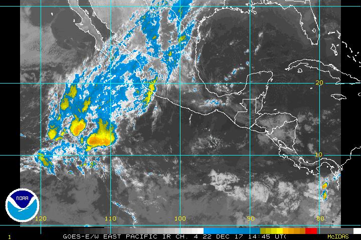
SATELLITE IMAGES INDICATE THUNDERSTORM ACTIVITY...ASSOCIATED WITH
STRONG TROPICAL DISTURBANCE CENTERED ABOUT 765 MILES
SOUTH-SOUTHWEST OF THE SOUTHERN TIP OF BAJA CALIFORNIA...HAS BECOME
MUCH BETTER ORGANIZED THIS MORNING. IF THUNDERSTORMS CONTINUE TO
DEVELOP NEAR THE LOW-LEVEL CIRCULATION CENTER...THEN A TROPICAL
DEPRESSION WOULD LIKELY FORM LATER TODAY. THE DISTURBANCE IS MOVING
WESTWARD AT ABOUT 15 MPH.
FORECASTER STEWART
$$
I think it has a good chance to be a TD as it looks well organized but no threat to land.
Special Tropical Disturbance Statement from TPC for EPAC
Moderator: S2k Moderators
Forum rules
The posts in this forum are NOT official forecasts and should not be used as such. They are just the opinion of the poster and may or may not be backed by sound meteorological data. They are NOT endorsed by any professional institution or STORM2K. For official information, please refer to products from the National Hurricane Center and National Weather Service.
- cycloneye
- Admin

- Posts: 148761
- Age: 69
- Joined: Thu Oct 10, 2002 10:54 am
- Location: San Juan, Puerto Rico
Special Tropical Disturbance Statement from TPC for EPAC
Last edited by cycloneye on Mon Jul 26, 2004 7:25 am, edited 4 times in total.
0 likes
Visit the Caribbean-Central America Weather Thread where you can find at first post web cams,radars
and observations from Caribbean basin members Click Here
and observations from Caribbean basin members Click Here
- The Dark Knight
- Category 3

- Posts: 800
- Joined: Fri Jun 18, 2004 11:18 am
- Location: Mashpee, Cape Cod, MA
- Contact:
- cycloneye
- Admin

- Posts: 148761
- Age: 69
- Joined: Thu Oct 10, 2002 10:54 am
- Location: San Juan, Puerto Rico

This is the EPAC system well away from land.
0 likes
Visit the Caribbean-Central America Weather Thread where you can find at first post web cams,radars
and observations from Caribbean basin members Click Here
and observations from Caribbean basin members Click Here
Who is online
Users browsing this forum: Ulf and 45 guests
