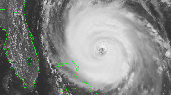
lets' just say Jeanne does decide to visit Fla..
what will her strength be at landfall..
I'm predicting 120... what do you guys think..?
Jeanne's strength at landfall..
Moderator: S2k Moderators
Forum rules

The posts in this forum are NOT official forecasts and should not be used as such. They are just the opinion of the poster and may or may not be backed by sound meteorological data. They are NOT endorsed by any professional institution or STORM2K. For official information, please refer to products from the National Hurricane Center and National Weather Service.
-
charleston_hugo_veteran

- S2K Supporter

- Posts: 1590
- Joined: Thu Sep 04, 2003 12:47 pm
- Location: Charleston, S.C.
Re: Jeanne's strength at landfall..
Josephine96 wrote:lets' just say Jeanne does decide to visit Fla..
what will her strength be at landfall..
I'm predicting 120... what do you guys think..?
LOW 2
0 likes
-
adelphi_sky

- Tropical Storm

- Posts: 193
- Joined: Mon Aug 09, 2004 11:12 pm
- Location: Adelphi, MD
-
Hurricane Cheese

- Category 1

- Posts: 365
- Joined: Thu Aug 12, 2004 12:40 am
- Location: Green Bay, WI (UWGB Earth Science Alum)

-
Guest
-
cape_escape

- Category 2

- Posts: 745
- Age: 56
- Joined: Fri Aug 13, 2004 2:39 am
- Location: Cape Coral Florida
- Contact:

-
Josephine96

-
SouthernWx
Whenever a tropical cyclone turns westward underneath a building high pressure ridge over tropical waters...there's always the possibility of rapid deepening. Hurricane Andrew was a vivid example in 1992.
We're into late September now, so mercifully I don't believe a 150+ mph monster is possible in that area (at least I hope not)....but a landfalling major hurricane appears likely, and a 135-145 mph cat-4 isn't out of the question.
I'm currently forecasting 120 mph at landfall (between Fort Lauderdale and Stuart), but if the impact of dry air and shear are minimal....120 mph may well be a conservative forecast.
0 likes
-
Wacahootaman
- Tropical Storm
- Posts: 221
- Joined: Tue Aug 31, 2004 7:54 am
- Location: North Florida
I gotta a bad feeling about this one.
with that big high north of her enhancing her spin like an overdrive gear, no shear, and warmer water, and the dry air lessening, she could be a cat 4 at land fall.
Considering that she has been over the same area with upwelling cool water for many days, with dry air nearby and she has held her own and even gotten stronger, she is one together babe.
Cant say what will happen for sure in 2 days, but I will guess 140 at landfall.
I am Wacahootaman, a rank amateur and not a meterologist, and I approve this message.
0 likes
-
Josephine96
Who is online
Users browsing this forum: jconsor and 90 guests