
Lets not forget..........
Moderator: S2k Moderators
Forum rules

The posts in this forum are NOT official forecasts and should not be used as such. They are just the opinion of the poster and may or may not be backed by sound meteorological data. They are NOT endorsed by any professional institution or STORM2K. For official information, please refer to products from the National Hurricane Center and National Weather Service.
-
chadtm80
Lets not forget..........
I know 94L is MUCH closer to home, but lets not forget 93L out in atl... Realy seems to be holding its own out there... So while staring at 94L, dont forget to glance East every now and again over the next couple of days
0 likes
-
JetMaxx
-
Toni - 574

- Category 1

- Posts: 493
- Joined: Wed May 28, 2003 9:20 pm
- Location: W. Central Florida
-
cycloneye

- Admin

- Posts: 149730
- Age: 69
- Joined: Thu Oct 10, 2002 10:54 am
- Location: San Juan, Puerto Rico
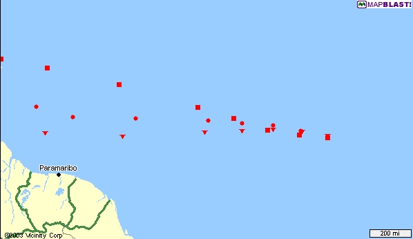
93L is my most interest system for me as I live in Puerto Rico not meaning at all that I am not watching 94L because I am doing forecasts here and i have to watch the entire atlantic.
0 likes
Visit the Caribbean-Central America Weather Thread where you can find at first post web cams,radars
and observations from Caribbean basin members Click Here
and observations from Caribbean basin members Click Here
-
Toni - 574
- Category 1
- Posts: 493
- Joined: Wed May 28, 2003 9:20 pm
- Location: W. Central Florida
That is perfectly understandable Cyc. The system has more of a chance affecting PR. Then who knows if it is really hardy it might get closer to the lower 48.
To Bottom line it the tropics are starting to get active, after all this is what we have been waiting on! If the tropics are going to be as busy as predicted we will most likely have more than one system at a time to monitor. Keep up the good work Cyc!
To Bottom line it the tropics are starting to get active, after all this is what we have been waiting on! If the tropics are going to be as busy as predicted we will most likely have more than one system at a time to monitor. Keep up the good work Cyc!
0 likes
-
chadtm80
93L info
000
WHXX01 KWBC 261236
CHGHUR
DISCLAIMER...NUMERICAL MODELS ARE SUBJECT TO LARGE ERRORS.
PLEASE REFER TO TPC/NHC OFFICIAL FORECASTS FOR TROPICAL CYCLONES.
.....THE FOLLOWING IS A TEST MESSAGE.....
NATIONAL HURRICANE CENTER NORTH ATLANTIC OBJECTIVE AIDS FOR
TROPICAL DEPRESSION INVEST (AL932003) ON 20030626 1200 UTC
...00 HRS... ...12 HRS... ...24 HRS... ...36 HRS...
030626 1200 030627 0000 030627 1200 030628 0000
LAT LON LAT LON LAT LON LAT LON
BAMD 8.5N 36.4W 9.0N 38.3W 9.4N 40.2W 9.6N 42.4W
BAMM 8.5N 36.4W 8.8N 38.2W 9.0N 40.2W 8.9N 42.4W
A98E 8.5N 36.4W 8.7N 38.4W 9.1N 40.6W 9.9N 43.0W
SHIP 25KTS 30KTS 35KTS 38KTS
DSHP 25KTS 30KTS 35KTS 38KTS
...48 HRS... ...72 HRS... ...96 HRS... ..120 HRS...
030628 1200 030629 1200 030630 1200 030701 1200
LAT LON LAT LON LAT LON LAT LON
BAMD 9.8N 44.8W 9.9N 49.9W 9.9N 54.3W 10.5N 56.9W
BAMM 8.8N 45.0W 8.5N 50.8W 8.6N 56.2W 9.5N 60.2W
A98E 10.7N 45.5W 12.2N 51.1W 13.2N 56.2W 13.7N 59.6W
SHIP 42KTS 45KTS 40KTS 37KTS
DSHP 42KTS 45KTS 40KTS 37KTS
...INITIAL CONDITIONS...
LATCUR = 8.5N LONCUR = 36.4W DIRCUR = 270DEG SPDCUR = 9KT
LATM12 = 8.4N LONM12 = 35.0W DIRM12 = 270DEG SPDM12 = 9KT
LATM24 = 8.5N LONM24 = 32.9W
WNDCUR = 25KT RMAXWD = 25NM WNDM12 = 20KT
CENPRS = 1009MB OUTPRS = 1012MB OUTRAD = 150NM SDEPTH = D
RD34NE = 0NM RD34SE = 0NM RD34SW = 0NM RD34NW = 0NM
.....THE ABOVE HAS BEEN A TEST MESSAGE.....
0 likes
-
wx247

- S2K Supporter

- Posts: 14279
- Age: 42
- Joined: Wed Feb 05, 2003 10:35 pm
- Location: Monett, Missouri
- Contact:
It will be interesting to see if the NHC mentions this in their outlook this afternoon. So far they have been mum about this area.
0 likes
Personal Forecast Disclaimer:
The posts in this forum are NOT official forecast and should not be used as such. They are just the opinion of the poster and may or may not be backed by sound meteorological data. They are NOT endorsed by any professional institution or storm2k.org. For official information, please refer to the NHC and NWS products.
The posts in this forum are NOT official forecast and should not be used as such. They are just the opinion of the poster and may or may not be backed by sound meteorological data. They are NOT endorsed by any professional institution or storm2k.org. For official information, please refer to the NHC and NWS products.
-
wx247
- S2K Supporter
- Posts: 14279
- Age: 42
- Joined: Wed Feb 05, 2003 10:35 pm
- Location: Monett, Missouri
- Contact:
Are there any inhibiting factors in its continued development in the next 36 hours or so? It looks well organized to me despite its lack of deep persistent convection.
0 likes
Personal Forecast Disclaimer:
The posts in this forum are NOT official forecast and should not be used as such. They are just the opinion of the poster and may or may not be backed by sound meteorological data. They are NOT endorsed by any professional institution or storm2k.org. For official information, please refer to the NHC and NWS products.
The posts in this forum are NOT official forecast and should not be used as such. They are just the opinion of the poster and may or may not be backed by sound meteorological data. They are NOT endorsed by any professional institution or storm2k.org. For official information, please refer to the NHC and NWS products.
-
cycloneye
- Admin
- Posts: 149730
- Age: 69
- Joined: Thu Oct 10, 2002 10:54 am
- Location: San Juan, Puerto Rico
Garrett an inhibitor factor is that it is in a very low latidud at 7n the low so it has to get up to at least 9-10n to develop because of the equator coriolis effect.
0 likes
Visit the Caribbean-Central America Weather Thread where you can find at first post web cams,radars
and observations from Caribbean basin members Click Here
and observations from Caribbean basin members Click Here
-
vbhoutex

- Storm2k Executive
- Posts: 29150
- Age: 74
- Joined: Wed Oct 09, 2002 11:31 pm
- Location: Cypress, TX
- Contact:
The biggest inhibiting factor I see right now is how low it is in the ITCZ. It actually could hit SA before it has a chance. Past that, shear is not terrible and is expected to lessen some to it's west. Lots of dry air out there, but it doesn't seem to be inhibiting it ATT. In fact there are indications that outfolow is trying to set up in all quadrants. Not the time of year for a CV for sure, but this one bears watching.
From the latest TWD-TROPICAL WAVE ALONG 35W S OF 17N MOVING W 10-15 KT. 1012 MB LOW
PRESSURE CENTER ALONG WAVE NEAR 7N. THE LOW IS IMPROVING IN
ORGANIZATION WITH THE BEGINNING OF CURVED BAND FEATURES ALONG
WITH PLENTY OF CONVECTION. HOWEVER IT IS RATHER FAR TO THE S
AND TROPICAL CYCLONES S OF 8N IN THE ATLC BASIN ARE EXTREMELY
RARE. SCATTERED MODERATE FROM 6N-10N BETWEEN 34W-38W.
0 likes
Skywarn, C.E.R.T.
Please click below to donate to STORM2K to help with the expenses of keeping the site going:

Please click below to donate to STORM2K to help with the expenses of keeping the site going:
-
wx247
- S2K Supporter
- Posts: 14279
- Age: 42
- Joined: Wed Feb 05, 2003 10:35 pm
- Location: Monett, Missouri
- Contact:
Thanks for the info. everyone. Looks like it needs to be watched.
0 likes
Personal Forecast Disclaimer:
The posts in this forum are NOT official forecast and should not be used as such. They are just the opinion of the poster and may or may not be backed by sound meteorological data. They are NOT endorsed by any professional institution or storm2k.org. For official information, please refer to the NHC and NWS products.
The posts in this forum are NOT official forecast and should not be used as such. They are just the opinion of the poster and may or may not be backed by sound meteorological data. They are NOT endorsed by any professional institution or storm2k.org. For official information, please refer to the NHC and NWS products.
-
weatherlover427
-
chadtm80
-
Toni - 574
- Category 1
- Posts: 493
- Joined: Wed May 28, 2003 9:20 pm
- Location: W. Central Florida
Who is online
Users browsing this forum: Kingarabian and 125 guests