EPAC Invest

This is the general tropical discussion area. Anyone can take their shot at predicting a storms path.

Moderator: S2k Moderators

Forum rules

The posts in this forum are NOT official forecasts and should not be used as such. They are just the opinion of the poster and may or may not be backed by sound meteorological data. They are NOT endorsed by any professional institution or STORM2K. For official information, please refer to products from the National Hurricane Center and National Weather Service.

Help Support Storm2K
Message
Author
chadtm80

EPAC Invest

#1 Postby chadtm80 » Fri Jul 04, 2003 12:41 pm

000
ABPZ20 KNHC 041628
TWOEP
TROPICAL WEATHER OUTLOOK
NWS TPC/NATIONAL HURRICANE CENTER MIAMI FL
10 AM PDT FRI JUL 4 2003

FOR THE EASTERN NORTH PACIFIC...EAST OF 140 DEGREES WEST LONGITUDE..

A TROPICAL DISTURBANCE LOCATED ABOUT 900 MILES SOUTH OF
SOUTHERN TIP OF BAJA MEXICO CONTINUES MOVING WESTWARD AT 5 TO 10
MPH. UPPER-LEVEL WINDS REMAIN FAVORABLE FOR DEVELOPMENT...AND A
TROPICAL DEPRESSION COULD FORM DURING THE NEXT DAY OR TWO.

ELSEWHERE...TROPICAL STORM FORMATION IS NOT EXPECTED THROUGH
SATURDAY.

FORECASTER JARVINEN
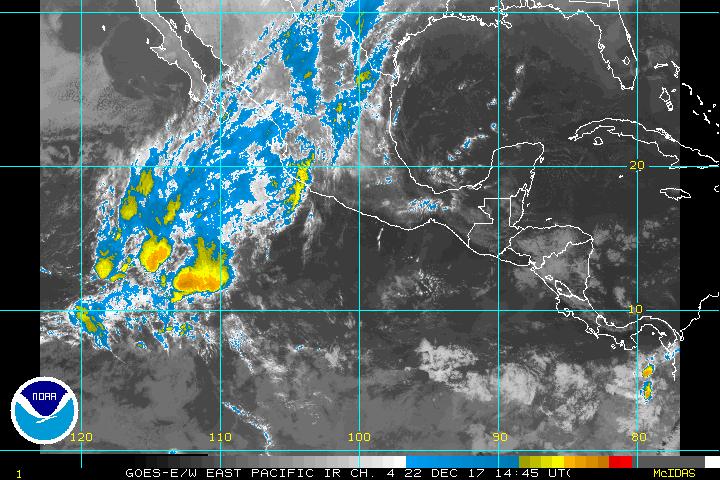

Image


http://www.ssd.noaa.gov/PS/TROP/DATA/RT ... -loop.html
0 likes   

Derek Ortt

#2 Postby Derek Ortt » Fri Jul 04, 2003 12:50 pm

Assuming this develops, this may end up being a system to watch if the models are correct in predicting the ridge of high pressure to the north to persist
0 likes   

User avatar
Colin
Category 5
Category 5
Posts: 5086
Joined: Fri Apr 18, 2003 4:17 pm
Location: Catasauqua, PA
Contact:

#3 Postby Colin » Fri Jul 04, 2003 2:08 pm

Thanks for the info Derek and Chad............will be very interesting to watch............... ;) ;)
0 likes   


Return to “Talkin' Tropics”

Who is online

Users browsing this forum: No registered users and 45 guests