I didn't want to get too off topic, so I decided to start a new thread.
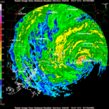
wxman57 wrote:There seems to be a bit of confusion with the original question. It asks when the last tme your area experienced Cat 3+ wind conditions, not whether you've been on the fringes of a Cat 3 hurricane. Very few inland locations have ever seen true 111+ mph 1-minute sustained wind, even with a Cat 3 making landfall. Frictional effects reduce the wind speeds to below Cat 3 almost immediately upon landfall, so only some beach areas might see spotty Cat 3 winds with a Cat 3-4 making landfall.
Now this is interesting. So, I am 5 miles inland. If there is a cat 4 hurricane headed my way, typically, by the time you reach 1 mile in-land, frictional effects will reduce the windspeed to something lower than a cat 3. Right? What is the dropoff for 5 miles inland?
I always wondered about this. Over the water I would think that the flow would be laminar. As soon as it hits land, it would become much more turbulant and create a much larger boundry layer... dozens of feet? I forget the calculation for that. This is the region where things become chaotic and difficult to quantify. Although, this turbulance can be one explanation for micro-bursts.


