Invest 90E,Sat Pics,Analysis and Models
Moderator: S2k Moderators
Forum rules
The posts in this forum are NOT official forecasts and should not be used as such. They are just the opinion of the poster and may or may not be backed by sound meteorological data. They are NOT endorsed by any professional institution or STORM2K. For official information, please refer to products from the National Hurricane Center and National Weather Service.
Invest 90E,Sat Pics,Analysis and Models
Sat pics of this area show some turning, with weak T-storms refiring near what I think will be the center. It should move WNW into warmer waters and seperate itself from the ITCZ. It at least Bears watching.
http://hadar.cira.colostate.edu/ramsdis ... al/186.jpg
http://hadar.cira.colostate.edu/ramsdis ... al/179.jpg
http://hadar.cira.colostate.edu/ramsdis ... al/186.jpg
http://hadar.cira.colostate.edu/ramsdis ... al/179.jpg
0 likes
- gtalum
- S2K Supporter

- Posts: 4749
- Age: 50
- Joined: Tue Sep 07, 2004 3:48 pm
- Location: Bradenton, FL
- Contact:
Re: Possible Low delevoping at 10N 87.5W
tailgater wrote:...Bears watching.
Like these bears?

0 likes
- cycloneye
- Admin

- Posts: 148752
- Age: 69
- Joined: Thu Oct 10, 2002 10:54 am
- Location: San Juan, Puerto Rico


Floater 1 of the Eastern Pacific is focused in that area.Will Alvin form here?
0 likes
Visit the Caribbean-Central America Weather Thread where you can find at first post web cams,radars
and observations from Caribbean basin members Click Here
and observations from Caribbean basin members Click Here
- AnnularCane
- S2K Supporter

- Posts: 2949
- Joined: Thu Jun 08, 2006 9:18 am
- Location: Wytheville, VA
- SouthFloridawx
- S2K Supporter

- Posts: 8346
- Age: 47
- Joined: Tue Jul 26, 2005 1:16 am
- Location: Sarasota, FL
- Contact:
Well perhaps GFS was on about some development in the EPAC....
http://www.storm2k.org/phpbb2/viewtopic.php?t=94727
http://www.storm2k.org/phpbb2/viewtopic.php?t=94727
0 likes
- SouthFloridawx
- S2K Supporter

- Posts: 8346
- Age: 47
- Joined: Tue Jul 26, 2005 1:16 am
- Location: Sarasota, FL
- Contact:
TROPICAL WEATHER DISCUSSION
NWS TPC/NATIONAL HURRICANE CENTER MIAMI FL
2205 UTC THU MAY 24 2007
TROPICAL WEATHER DISCUSSION FOR THE EASTERN PACIFIC OCEAN FROM
THE EQUATOR TO 32N...EAST OF 140W.
BASED ON 1800 UTC SURFACE ANALYSIS AND SATELLITE IMAGERY THROUGH
2100 UTC.
...ITCZ...
INTERTROPICAL CONVERGENCE ZONE AXIS IS ALONG THE LINE...11N86W
11N89W 10N98W 12N108W 9N122W 7N140W. SCATTERED MODERATE TO
STRONG WITHIN 120 NM OF AXIS BETWEEN 90W AND 98W. SCATTERED
MODERATE TO STRONG FROM 11N TO 14N BETWEEN 105W AND 108W.
SCATTERED MODERATE TO ISOLATED STRONG FROM 6N TO 9N BETWEEN 125W
AND 128W.
...DISCUSSION...
UPPER LEVEL ANTICYCLONE CENTERED NEAR 11N89W IS SUPPORTING FLARE
UP OF CONVECTION ALONG ITCZ NEAR A SURFACE TROUGH ALONG 90W.
MORNING QUIKSCAT IMAGERY SHOWED MODERATE TO FRESH S TO SW CROSS
EQUATORIAL FLOW S OF THIS FEATURE AND S OF THE ITCZ ACCOMPANIED
BY MODERATE SLY SWELL.


CMC
http://moe.met.fsu.edu/cyclonephase/cmc ... 00/61.html
GFS
http://moe.met.fsu.edu/cyclonephase/gfs ... 12/75.html
NOGAPS
http://moe.met.fsu.edu/cyclonephase/ngp ... 00/38.html
UKMET
http://moe.met.fsu.edu/cyclonephase/ukm ... 2/109.html
Windshear
http://cimss.ssec.wisc.edu/tropic/real- ... 10shr.html
Upper Level Divergence
http://cimss.ssec.wisc.edu/tropic/real- ... 10dvg.html
Low Level Convergence
http://cimss.ssec.wisc.edu/tropic/real- ... 0conv.html
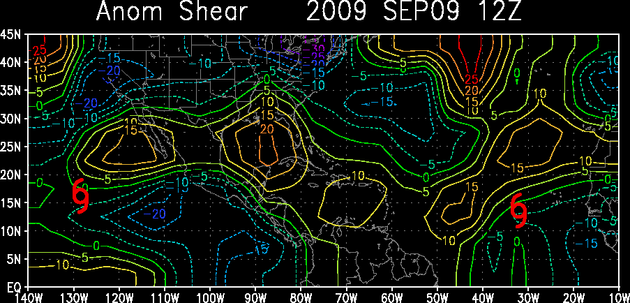
GFS showing that wind shear shouldn't be too much of a factor
http://moe.met.fsu.edu/cgi-bin/gfstc2.c ... =Animation
NWS TPC/NATIONAL HURRICANE CENTER MIAMI FL
2205 UTC THU MAY 24 2007
TROPICAL WEATHER DISCUSSION FOR THE EASTERN PACIFIC OCEAN FROM
THE EQUATOR TO 32N...EAST OF 140W.
BASED ON 1800 UTC SURFACE ANALYSIS AND SATELLITE IMAGERY THROUGH
2100 UTC.
...ITCZ...
INTERTROPICAL CONVERGENCE ZONE AXIS IS ALONG THE LINE...11N86W
11N89W 10N98W 12N108W 9N122W 7N140W. SCATTERED MODERATE TO
STRONG WITHIN 120 NM OF AXIS BETWEEN 90W AND 98W. SCATTERED
MODERATE TO STRONG FROM 11N TO 14N BETWEEN 105W AND 108W.
SCATTERED MODERATE TO ISOLATED STRONG FROM 6N TO 9N BETWEEN 125W
AND 128W.
...DISCUSSION...
UPPER LEVEL ANTICYCLONE CENTERED NEAR 11N89W IS SUPPORTING FLARE
UP OF CONVECTION ALONG ITCZ NEAR A SURFACE TROUGH ALONG 90W.
MORNING QUIKSCAT IMAGERY SHOWED MODERATE TO FRESH S TO SW CROSS
EQUATORIAL FLOW S OF THIS FEATURE AND S OF THE ITCZ ACCOMPANIED
BY MODERATE SLY SWELL.


CMC
http://moe.met.fsu.edu/cyclonephase/cmc ... 00/61.html
GFS
http://moe.met.fsu.edu/cyclonephase/gfs ... 12/75.html
NOGAPS
http://moe.met.fsu.edu/cyclonephase/ngp ... 00/38.html
UKMET
http://moe.met.fsu.edu/cyclonephase/ukm ... 2/109.html
Windshear
http://cimss.ssec.wisc.edu/tropic/real- ... 10shr.html
Upper Level Divergence
http://cimss.ssec.wisc.edu/tropic/real- ... 10dvg.html
Low Level Convergence
http://cimss.ssec.wisc.edu/tropic/real- ... 0conv.html
GFS showing that wind shear shouldn't be too much of a factor
http://moe.met.fsu.edu/cgi-bin/gfstc2.c ... =Animation
0 likes
These aren't labeled invests yet countless other invests from other basins worldwide look like a few clouds without convection (aka should not be invests). There is something wrong here.
I believe one of these will have a shot of becoming the first tropical cyclone of the 2007 eastern Pacific hurricane season. On the NHC website, each of the floaters have "invest" as the sub-header.
I believe one of these will have a shot of becoming the first tropical cyclone of the 2007 eastern Pacific hurricane season. On the NHC website, each of the floaters have "invest" as the sub-header.
0 likes
- cycloneye
- Admin

- Posts: 148752
- Age: 69
- Joined: Thu Oct 10, 2002 10:54 am
- Location: San Juan, Puerto Rico
000
ABPZ20 KNHC 242245
TWOEP
TROPICAL WEATHER OUTLOOK
NWS TPC/NATIONAL HURRICANE CENTER MIAMI FL
400 PM PDT THU MAY 24 2007
FOR THE EASTERN NORTH PACIFIC...EAST OF 140 DEGREES WEST LONGITUDE..
A NEARLY-STATIONARY AREA OF LOW PRESSURE HAS FORMED ABOUT
550 MILES SOUTH-SOUTHWEST OF MANZANILLO MEXICO. ENVIRONMENTAL
CONDITIONS ARE MARGINALLY FAVORABLE AND SLOW DEVELOPMENT IS
POSSIBLE DURING THE NEXT DAY OR TWO.
ELSEWHERE...TROPICAL CYCLONE FORMATION IS NOT EXPECTED DURING THE
NEXT 48 HOURS.
$$
FORECASTER BROWN
This is for the area farther away from CentralAmerica.
0 likes
Visit the Caribbean-Central America Weather Thread where you can find at first post web cams,radars
and observations from Caribbean basin members Click Here
and observations from Caribbean basin members Click Here
- SouthFloridawx
- S2K Supporter

- Posts: 8346
- Age: 47
- Joined: Tue Jul 26, 2005 1:16 am
- Location: Sarasota, FL
- Contact:
- cycloneye
- Admin

- Posts: 148752
- Age: 69
- Joined: Thu Oct 10, 2002 10:54 am
- Location: San Juan, Puerto Rico
If I say,we have invest 90E? Guess what,it has poped up at NRL.
http://www.nrlmry.navy.mil/tc_pages/tc_home.html
tailgater,edited title of thread.
http://www.nrlmry.navy.mil/tc_pages/tc_home.html
tailgater,edited title of thread.
0 likes
- cycloneye
- Admin

- Posts: 148752
- Age: 69
- Joined: Thu Oct 10, 2002 10:54 am
- Location: San Juan, Puerto Rico
25/0000 UTC 12.1N 108.3W T1.0/1.0 90E -- East Pacific Ocean
http://www.ssd.noaa.gov/PS/TROP/positions.html
http://www.ssd.noaa.gov/PS/TROP/positions.html
0 likes
Visit the Caribbean-Central America Weather Thread where you can find at first post web cams,radars
and observations from Caribbean basin members Click Here
and observations from Caribbean basin members Click Here
Not looking to bad with some weak banding. Would not be surprised to see the first EPAC TD or Alvin.
0 likes
The following post is NOT an official forecast and should not be used as such. It is just the opinion of the poster and may or may not be backed by sound meteorological data. It is NOT endorsed by any professional institution including storm2k.org For Official Information please refer to the NHC and NWS products.
- ncupsscweather
- Category 1

- Posts: 321
- Age: 38
- Joined: Tue Jan 02, 2007 8:05 pm
- Location: Hickory,North Carolina
- Dr. Jonah Rainwater
- Category 2

- Posts: 569
- Joined: Sat Jul 23, 2005 2:45 pm
- Location: Frisco, Texas
- Contact:
-
Matt-hurricanewatcher
http://www.ssd.noaa.gov/goes/west/epac/avn-l.jpg
This is a Itcz distrabance, so only slow development should be expected.
This is a Itcz distrabance, so only slow development should be expected.
0 likes
Who is online
Users browsing this forum: Google [Bot], Team Ghost and 39 guests


