The Graphical Tropical Weather Outlook

This is the general tropical discussion area. Anyone can take their shot at predicting a storms path.

Moderator: S2k Moderators
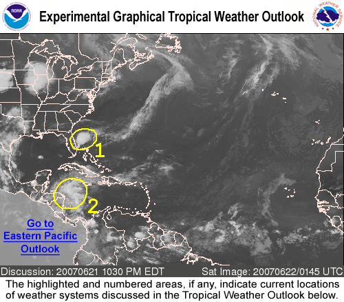
Forum rules

The posts in this forum are NOT official forecasts and should not be used as such. They are just the opinion of the poster and may or may not be backed by sound meteorological data. They are NOT endorsed by any professional institution or STORM2K. For official information, please refer to products from the National Hurricane Center and National Weather Service.

Help Support Storm2K
Message
Author
User avatar
cycloneye
Admin
Admin
Posts: 145888
Age: 69
Joined: Thu Oct 10, 2002 10:54 am
Location: San Juan, Puerto Rico

The Graphical Tropical Weather Outlook

#1 Postby cycloneye » Mon Jul 09, 2007 1:01 pm

http://www.nhc.noaa.gov/gtwo_atl.shtml

http://www.nhc.noaa.gov/aboutgtwo.shtml

Image

It will be a neat product to see where the systems mentioned in the Tropical Weather Outlooks are and how they look.It will start on July 15th.
0 likes   

Windsurfer_NYC
Tropical Storm
Tropical Storm
Posts: 233
Joined: Wed Jun 07, 2006 3:27 pm
Location: New York, NY

#2 Postby Windsurfer_NYC » Mon Jul 09, 2007 1:38 pm

Post subject: The Grapfical Tropical Weather Outlook


Thanfks! :wink: :lol:
0 likes   

JonathanBelles
Professional-Met
Professional-Met
Posts: 11430
Age: 35
Joined: Sat Dec 24, 2005 9:00 pm
Location: School: Florida State University (Tallahassee, FL) Home: St. Petersburg, Florida
Contact:

#3 Postby JonathanBelles » Mon Jul 09, 2007 1:57 pm

I saw that earlier when I got on to check. It looks like a very good product.
0 likes   

Aric Dunn
Category 5
Category 5
Posts: 21238
Age: 42
Joined: Sun Sep 19, 2004 9:58 pm
Location: Ready for the Chase.
Contact:

#4 Postby Aric Dunn » Mon Jul 09, 2007 2:00 pm

cool
0 likes   

User avatar
Decomdoug
Tropical Storm
Tropical Storm
Posts: 177
Age: 72
Joined: Sun Aug 29, 2004 8:34 am
Location: Port St. Lucie, Florida

#5 Postby Decomdoug » Mon Jul 09, 2007 3:01 pm

Great idea! This gives us an immediate reference.
0 likes   

User avatar
Aquawind
Category 5
Category 5
Posts: 6714
Age: 62
Joined: Mon Jun 16, 2003 10:41 pm
Location: Salisbury, NC
Contact:

Re: The Graphical Tropical Weather Outlook

#6 Postby Aquawind » Mon Jul 09, 2007 3:13 pm

Excellent.. When we have 3 or more systems to monitor this will be great to come back to if your gone for a couple days.. 8-)
0 likes   

User avatar
alan1961
Category 2
Category 2
Posts: 771
Joined: Mon Mar 20, 2006 11:58 am
Location: Derby, Derbyshire, England
Contact:

Re: The Graphical Tropical Weather Outlook

#7 Postby alan1961 » Mon Jul 09, 2007 3:57 pm

Is this some kind of reference similar to the NRL MONTEREY site only less graphical?
0 likes   

User avatar
cycloneye
Admin
Admin
Posts: 145888
Age: 69
Joined: Thu Oct 10, 2002 10:54 am
Location: San Juan, Puerto Rico

Re: The Graphical Tropical Weather Outlook

#8 Postby cycloneye » Sat Jul 14, 2007 8:31 pm

The new feature (The Graphical) Tropical Weather Outlook's starts with the Sunday's 5:30 AM EDT Tropical Weather Outlook.
0 likes   

User avatar
Chacor
Category 5
Category 5
Posts: 10229
Joined: Mon Oct 02, 2006 10:43 pm
Location: Singapore

#9 Postby Chacor » Sat Jul 14, 2007 8:35 pm

cycloneye wrote:The new feature (The Graphical) Tropical Weather Outlook's starts with the Sunday's 5:30 AM EDT Tropical Weather Outlook.
5. Availability

The experimental Graphical TWO will be issued twice daily during the 2007 hurricane season from 15 July-30 November. For the Atlantic basin, the Graphical TWO will be issued at 11:30 am and 10:30 pm ET. For the Pacific basin, the Graphical TWO will be issued at 10 am and 10 pm PT.

http://www.nhc.noaa.gov/aboutgtwo5.shtml?
0 likes   

User avatar
cycloneye
Admin
Admin
Posts: 145888
Age: 69
Joined: Thu Oct 10, 2002 10:54 am
Location: San Juan, Puerto Rico

Re:

#10 Postby cycloneye » Sat Jul 14, 2007 8:38 pm

Chacor wrote:
cycloneye wrote:The new feature (The Graphical) Tropical Weather Outlook's starts with the Sunday's 5:30 AM EDT Tropical Weather Outlook.
5. Availability

The experimental Graphical TWO will be issued twice daily during the 2007 hurricane season from 15 July-30 November. For the Atlantic basin, the Graphical TWO will be issued at 11:30 am and 10:30 pm ET. For the Pacific basin, the Graphical TWO will be issued at 10 am and 10 pm PT.

http://www.nhc.noaa.gov/aboutgtwo5.shtml?


Thanks for posting the clarification about the times it will be out.
0 likes   

User avatar
windstorm99
S2K Supporter
S2K Supporter
Posts: 1578
Age: 47
Joined: Sat May 26, 2007 8:10 am
Location: Miami, Florida
Contact:

Re: The Graphical Tropical Weather Outlook

#11 Postby windstorm99 » Sun Jul 15, 2007 11:28 am

Here it is folks the very first view of the graphical TWO now put out by the NHC twice a day.

Image
0 likes   

JonathanBelles
Professional-Met
Professional-Met
Posts: 11430
Age: 35
Joined: Sat Dec 24, 2005 9:00 pm
Location: School: Florida State University (Tallahassee, FL) Home: St. Petersburg, Florida
Contact:

#12 Postby JonathanBelles » Sun Jul 15, 2007 12:35 pm

I just took my first look at it. This looks more helpful that I had expected. I might start going here before the advisories.
0 likes   

wobblehead
Tropical Storm
Tropical Storm
Posts: 133
Joined: Fri Jul 15, 2005 12:51 pm
Location: Mobile.Al

#13 Postby wobblehead » Sun Jul 15, 2007 1:12 pm

A picture is worth a thousand words. Great idea from the NHC.
0 likes   

Aric Dunn
Category 5
Category 5
Posts: 21238
Age: 42
Joined: Sun Sep 19, 2004 9:58 pm
Location: Ready for the Chase.
Contact:

Re: The Graphical Tropical Weather Outlook

#14 Postby Aric Dunn » Sun Jul 15, 2007 2:58 pm

Image
0 likes   

User avatar
canegrl04
Category 5
Category 5
Posts: 2486
Joined: Thu Aug 26, 2004 5:37 pm
Location: Texas

#15 Postby canegrl04 » Sun Jul 15, 2007 3:24 pm

Cool 8-)
0 likes   

Opal storm

Re: The Graphical Tropical Weather Outlook

#16 Postby Opal storm » Sun Jul 15, 2007 3:30 pm

I like it.
0 likes   

philnyc
S2K Supporter
S2K Supporter
Posts: 313
Joined: Thu Jun 07, 2007 1:14 am
Location: Brooklyn, New York City, New York
Contact:

Re: The Graphical Tropical Weather Outlook

#17 Postby philnyc » Sun Jul 15, 2007 4:00 pm

Opal storm wrote:I like it.


Very cool.
0 likes   

MiamiensisWx

Re: The Graphical Tropical Weather Outlook

#18 Postby MiamiensisWx » Sun Jul 15, 2007 4:22 pm

This is a nice addition. The visual aspect is great. In addition, it is easier to access the TWOs for both basins (Atlantic and EPAC). It provides timely information. I think it is an excellent graphical option.
0 likes   

User avatar
windstorm99
S2K Supporter
S2K Supporter
Posts: 1578
Age: 47
Joined: Sat May 26, 2007 8:10 am
Location: Miami, Florida
Contact:

Re: The Graphical Tropical Weather Outlook

#19 Postby windstorm99 » Sun Jul 15, 2007 4:26 pm

Indeed very cool...

Image
0 likes   

JonathanBelles
Professional-Met
Professional-Met
Posts: 11430
Age: 35
Joined: Sat Dec 24, 2005 9:00 pm
Location: School: Florida State University (Tallahassee, FL) Home: St. Petersburg, Florida
Contact:

#20 Postby JonathanBelles » Sun Jul 15, 2007 4:27 pm

I thought it was only updated at 10a/p
0 likes   


Return to “Talkin' Tropics”

Who is online

Users browsing this forum: Cpv17, Kennethb, Lizzytiz1 and 43 guests