


Tropical Weather Outlook
NWS National Hurricane Center Miami FL
800 PM EDT Mon Jul 14 2025
For the North Atlantic...Caribbean Sea and the Gulf of America:
East of the Florida Peninsula into the Northeastern Gulf (AL93):
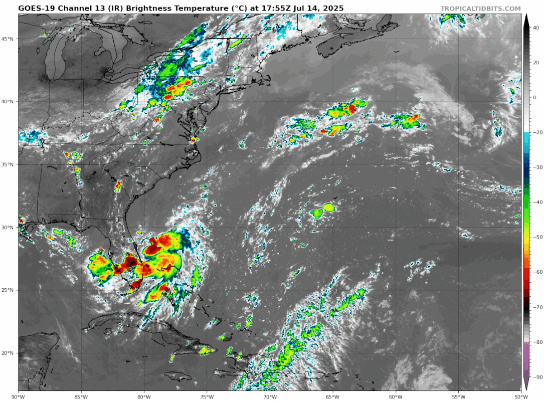
An area of low pressure located offshore of the east coast of
Florida continues to produce disorganized showers and thunderstorms
primarily south of the center. This system is forecast to move
westward across the Florida Peninsula on Tuesday and Tuesday night,
eventually moving into the northeastern Gulf by the middle part of
this week. Environmental conditions appear generally favorable for
additional development if the system remains offshore, and a
tropical depression could form as the system moves across the
northeastern and north-central Gulf by the middle to latter part of
this week.
Regardless of development, heavy rainfall could produce localized
flash flooding over portions of Florida and the north-central Gulf
coast through the middle to latter portion of this week.
* Formation chance through 48 hours...low...30 percent.
* Formation chance through 7 days...medium...40 percent.
$$
Forecaster Papin
NWS National Hurricane Center Miami FL
800 PM EDT Mon Jul 14 2025
For the North Atlantic...Caribbean Sea and the Gulf of America:
East of the Florida Peninsula into the Northeastern Gulf (AL93):
An area of low pressure located offshore of the east coast of
Florida continues to produce disorganized showers and thunderstorms
primarily south of the center. This system is forecast to move
westward across the Florida Peninsula on Tuesday and Tuesday night,
eventually moving into the northeastern Gulf by the middle part of
this week. Environmental conditions appear generally favorable for
additional development if the system remains offshore, and a
tropical depression could form as the system moves across the
northeastern and north-central Gulf by the middle to latter part of
this week.
Regardless of development, heavy rainfall could produce localized
flash flooding over portions of Florida and the north-central Gulf
coast through the middle to latter portion of this week.
* Formation chance through 48 hours...low...30 percent.
* Formation chance through 7 days...medium...40 percent.
$$
Forecaster Papin


