Satellite imagery and radar clearly show that Invest 93L has a tilted structure with height. Let's begin with radar, which provides a solid depiction of the system's evolution since this morning. Below are the last 200 radar frames from Melbourne, primarily tracking the mid-level circulation (MLC) later in the sequence. These images reveal a clear westward trajectory toward the GOM:

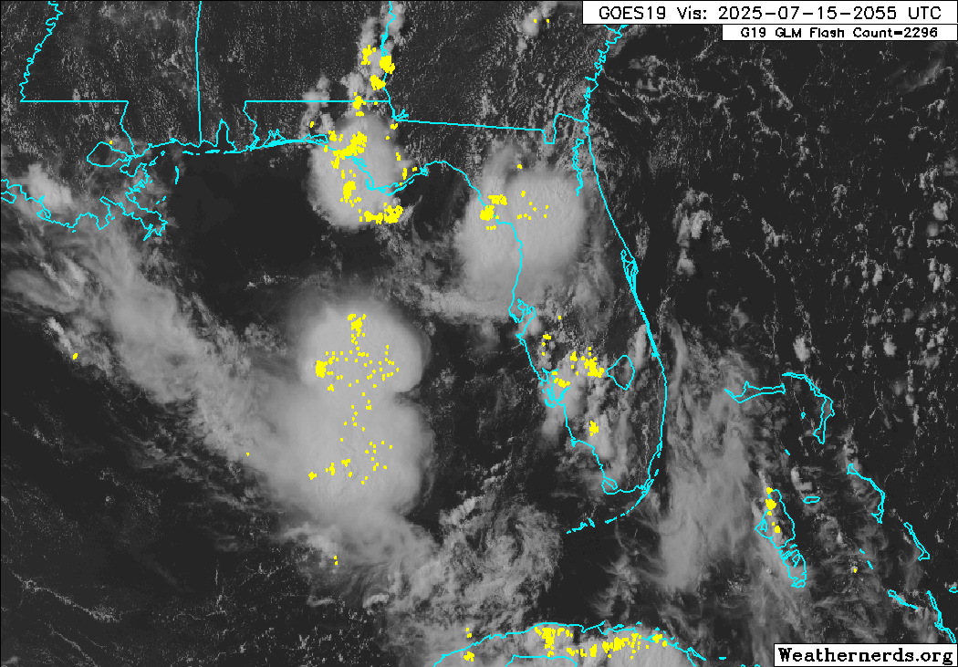
Meanwhile, satellite imagery is still clearly showing our LLC, but we also are starting to see signs this is becoming elongated and stretched out from the NE to SW as it heads more WNW (i.e., opening more into a trough):

CIMSS 850mb vorticity products also corroborates this:

Another way to visualize the tilt is using Earth.null (
https://earth.nullschool.net/) and selecting the different layers of the atmosphere. Here I've created an animated gif of the 850mb (low), 700mb (mid), and 500 mb (upper) level vorticity:

Where is this going and what are the chances of sneaking out a name? I do believe this was classifiable earlier today, and that was the first window (which is now closed imo). It seems the 12z HAFS-B and ECMWF have the best grasp on the evolution so far. The evident vorticity and shear was accurately captured here on the HAFS-B:

So let's take kind of a step back and look at what the HAFS-B Parent is fully showing us. We already talked about the tilt with height, and we can see in the 850mb analysis below we still have the semblance of a trough feature again here (highlighted in pink). We see this sort of dipole of vorticity maximums embedded in the trough axis (blue arrows roughly indicating future trajectory), and focusing on the northern vorticity (where our LLC is), this should track through northern Florida/Georgia tonight and remerge in the GOM tomorrow. Meanwhile, our MLC (not featured here but roughly green arrow) will continue westward:

If we play out the full animation here (and this is where models differ), how quickly the vorticity can be reestablished in the GOM will determine if it can develop enough to be classified. If it can scrape along the coast of Louisiana, I think it has a solid chance:

Trend for last 3 ECMWF runs: