Peaks around 8AM Monday north of Hispaniola.
Right about where the CoC and ULL, driving the poleward outflow channel, are at the same latitude.


Moderators: hurricanetrack, S2k Moderators


GCANE wrote:60 hrs out and 75% chance of a Cat4, 35% for Cat5.
Peaks around 8AM Monday north of Hispaniola.
Right about where the CoC and ULL, driving the poleward outflow channel, are at the same latitude.
https://rammb-data.cira.colostate.edu/tc_realtime/products/storms/2025al05/problcat/2025al05_problcat_202508150600.png
https://www.nhc.noaa.gov/storm_graphics/AT05/refresh/AL052025_5day_cone_no_line_and_wind+png/151736_5day_cone_no_line_and_wind.png


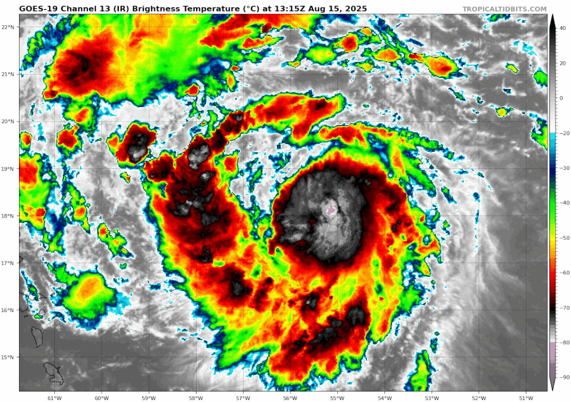
cheezyWXguy wrote:We’ll see what recon finds, but erin could already have a pressure well into the 980s now. That huge burst has been wrapped around the core and seems to be comprising the full cdo now. New pink dots showing up around the eyewall and maybe a slight rewarming of the eye. Think it’s go time.

aspen wrote:cheezyWXguy wrote:We’ll see what recon finds, but erin could already have a pressure well into the 980s now. That huge burst has been wrapped around the core and seems to be comprising the full cdo now. New pink dots showing up around the eyewall and maybe a slight rewarming of the eye. Think it’s go time.
You called it. 983.5mb extrap, with hurricane force FL winds in that newly filled NW quadrant.

LarryWx wrote:If Erin reaches cat 4 and sustains it for a couple of days or at least on and off, I think that at least getting close to 30 total ACE would be attainable.


MarioProtVI wrote:aspen wrote:cheezyWXguy wrote:We’ll see what recon finds, but erin could already have a pressure well into the 980s now. That huge burst has been wrapped around the core and seems to be comprising the full cdo now. New pink dots showing up around the eyewall and maybe a slight rewarming of the eye. Think it’s go time.
You called it. 983.5mb extrap, with hurricane force FL winds in that newly filled NW quadrant.
This is NOAA though which has a known low MSLP bias so the real pressure is probably around 986-987 (pending VDM/dropsonde). Still solid deepening


Return to “Active Storms/Invests - Atlantic/EastPAC/CentralPAC/MED”
Users browsing this forum: abajan and 67 guests