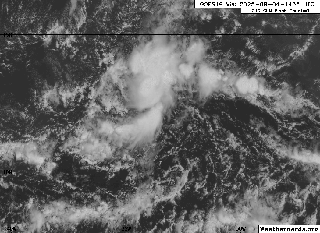
This particular disturbance strikes me to be more complex than most

My initial impression was that 91L would be a fairly broad tropical cyclone from the onset but now I can see the opposite will hold true. Notice how the Invest is centered at (about) 12.5 N. While I do see that point for a broader East/West LLC, a more obvious circulation that I would associate with the MLC appears to be north of that point co-located with the more intense convection. That lead me to think that the disturbance was being impacted by a TUTT-like feature impacting southwesterly shear while also somewhat inhibiting vertical organization by impacting a northerly "tug" to the MLC. At least this was how I initially interpreted the satellite. This does not appear to be the case however.
Looking at the analysis, upper level shear is not a factor. It is not uncommon for us to see the LLC and MLC quite disjointed during the formative stages of development. Well, it appears that 91L is forecast to develop somewhat "unconventionally". What we have here is an axis where the stronger mid level energy is not only to the north of the weaker broad LLC, but one which the MLC appears with time to maintain its identity and slowly seperate from the LLC... as both features continue to move primarily westward in the near to mid term. Rather than the LLC to redevelop further north under the mid level feature, 91L is "at least forecast" to slowly organize its own vertical structure while remaining a few degrees further south.
If I'm interpreting 91L's forecasted evolution correctly, this would be why the strengthening process would be rather slow prior to reaching 50W (or even further west). All the while, mid level ridging over the Central Atlantic and North of 91L appears to expand westward and even strengthen from 594 to 597 height levels. I'm not really understanding how/why the LLC doesn't simply reorganize a few degrees further north under the more vigorous MLC feature but the models seem confident that it will develop between 12N - 13N.
I'll be especially eager to hear Levi's breakdown of the present environmental set-up and his take on this seperate mid level energy that will likely be forecast to remain a somewhat disruptive feature for a good part of next week. All of this simply adds to the typical murkyness of any long range track projections and in my opinion simply suggests that any and all long term model forecasts at this point are practically valueless.