https://ftp.nhc.noaa.gov/atcf/btk/bal922025.dat
Thread at Talking Tropics that was made for this area.
https://www.storm2k.org/phpbb2/viewtopi ... 1&t=124953
Moderator: S2k Moderators


cycloneye wrote:I say, members who like to follow the tropics, should comment on this system even if it is going to the fishes. If you are an enthusiastic fan of tropical weather, no matter where it goes, you watch it and if you want to make comments about a possible strong hurricane,then come.


cycloneye wrote:Tropical Weather Outlook
NWS National Hurricane Center Miami FL
Issued by the NWS Weather Prediction Center College Park MD
200 PM EDT Mon Sep 15 2025
For the North Atlantic...Caribbean Sea and the Gulf of America:
Central Tropical Atlantic (AL92):
A broad area of low pressure has formed roughly midway between the
Windward Islands and the coast of west Africa. This system has
become better organized since yesterday and is expected to move
through a favorable environment for further development. A
tropical depression or tropical storm is likely to form by the
middle to latter part of this week as the system moves
west-northwestward at 10 to 15 mph over the central tropical
Atlantic.
* Formation chance through 48 hours...medium...50 percent.
* Formation chance through 7 days...high...90 percent.
$$
Forecaster Blake/Putnam

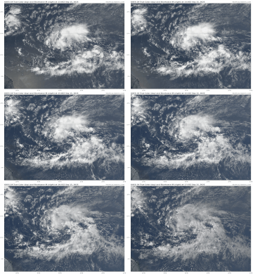
chaser1 wrote:There appears to be an established albeit broad circulation. Could take some time to consolidate. Maintaining strong convection near some centerpoint seems to be this season's Achilles heel


Teban54 wrote:This already looks much better than when 91L was 60/90.
https://i.postimg.cc/HnLMJTJ8/goes19-truecolor-92-L-202509151305.gif
Teban54 wrote:This already looks much better than when 91L was 60/90.
https://i.postimg.cc/HnLMJTJ8/goes19-truecolor-92-L-202509151305.gif


Teban54 wrote:This already looks much better than when 91L was 60/90.


Users browsing this forum: No registered users and 75 guests