


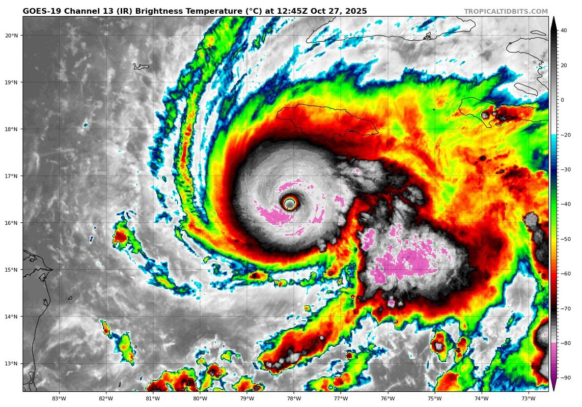
Blown Away wrote: https://i.postimg.cc/sgPtRP8N/Melissa.jpg
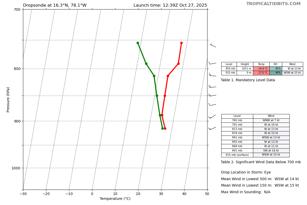
Melissa is supposed to be going N at 78.1W and continues moving WNW. This should move the landfall point farther W on Jamaica.
I think not for certain? If it is further south when the trough grabs it, there's more time for it to be pulled east. So there's two opposing factors, the W movement and the lack of N movement.


