Hurricane Kiko Discussion Number 23
NWS National Hurricane Center Miami FL EP112025
Issued by the NWS Weather Prediction Center College Park MD
1100 AM HST Fri Sep 05 2025
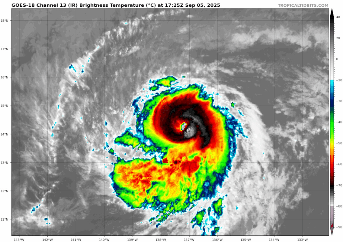
The satellite presentation of Kiko has shown significant improvement
since the last advisory, with the eye clearing out and its coldest
cloud tops more fully encircling it. The most recent subjective
Dvorak current intensity estimates from TAFB and SAB were T6.0/115
kt and T5.5/102 kt. Objective estimates from UW-CIMSS have been
increasing, with the latest ADT estimate up to to 115 knots.
Considering the continuing improvement since the time of the 1800
UTC fixes, the intensity has been set at 115 kts, which could be
conservative as the eye continues to clear out.
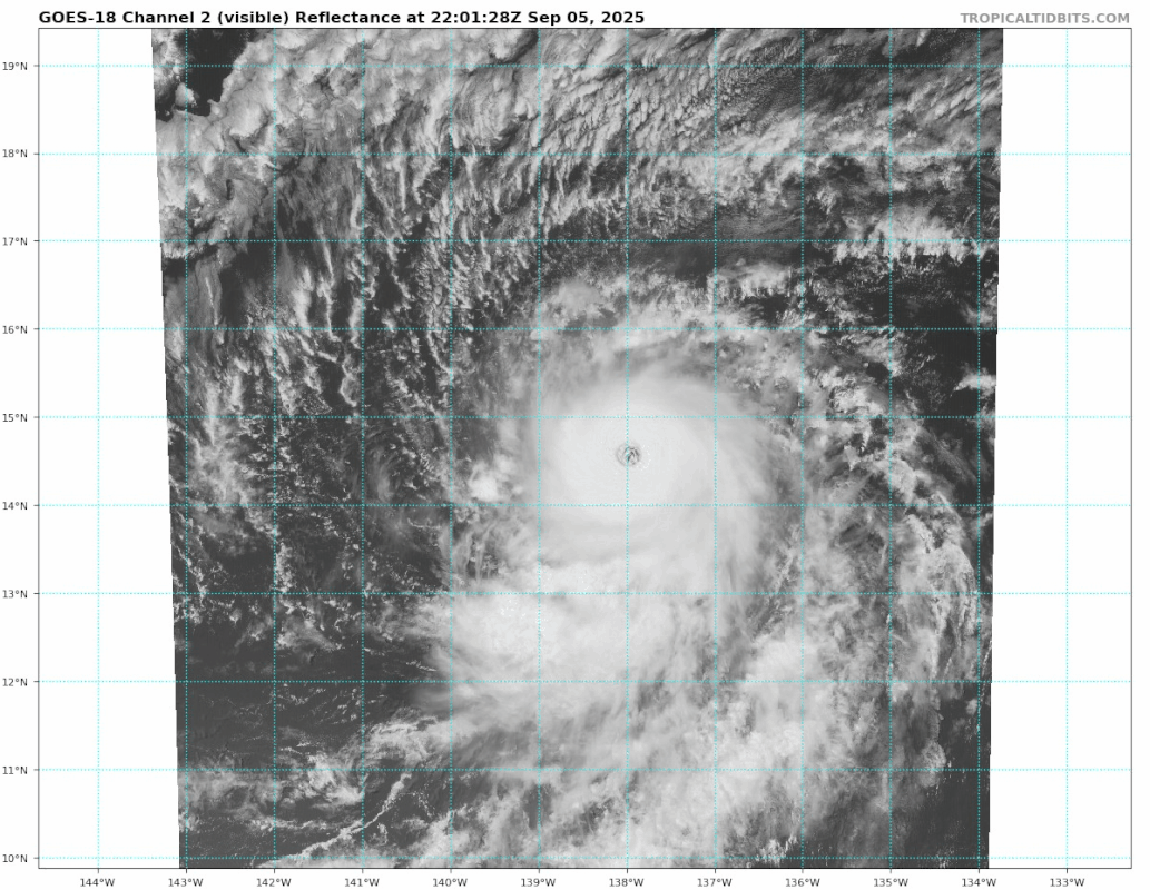
Kiko continues to move to the west-northwest, or 290 degrees, at 9
kt. The western extent of a subtropical ridge to the north of the
cyclone is eroding due to a developing upper-level low north of
Hawaii. This general west-northwestward motion along with a gradual
increase in forward speed is forecast into early next week, as Kiko
moves along the southwest periphery of this subtropical ridge and
towards the upper-level low to the north and northwest of the
Hawaiian Islands. The track forecast has shifted northward due to
the slightly more northward initial motion, and poleward shift in
the track guidance. Based on the forecast track Kiko is expected to
cross 140W into the central Pacific Ocean overnight into Saturday
morning. The track forecast remains close to the HCCA consensus
aid. By the end of the forecast track, Kiko may turn more westward
as it becomes increasingly steered by the low-level flow.
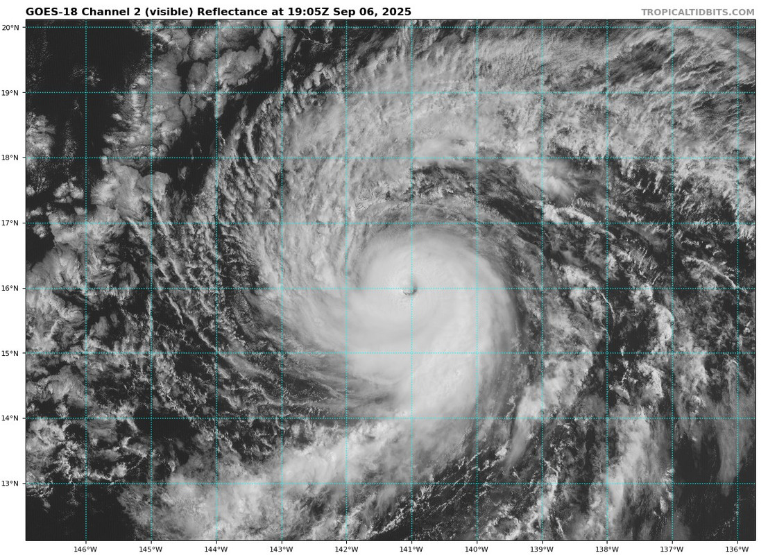
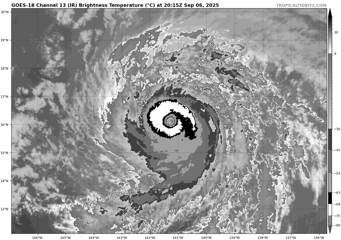
The hurricane will remain over warm waters of 27–28C for the next 12
hours, while influenced by light northeasterly vertical wind shear
embedded in a drier than normal mid-level environment. These
environmental factors should keep Kiko a smaller than average sized
storm as the dry air prevents more prominent outer rain bands from
forming. Conditions still appear favorable for additional
intensification, so the latest intensity and given the current
improving structure, more intensification is shown than before, well
above all of the available guidance. This forecast also fits in
with the possibility for Kiko developing annular structure which
could keep it stronger than the forecast intensity guidance.
Thereafter, Kiko will move over cooler waters and an even drier
mid-level environment. After 48 hours, west-southwesterly vertical
wind shear increases steadily, exceeding 30 kt by Wednesday. This
shear may help import the nearby environmental dry air into Kiko's
small core. Thus, rapid weakening of the tropical cyclone is
forecast as Kiko passes to the northeast of the Hawaiian Islands by
the end of the forecast. After the initial bump in short-term
intensity, this forecast trends back to the middle of the consensus
envelope early next week, and then trends lower by the end of the
forecast period.
Key Messages:
1. Kiko is forecast to approach the Hawaiian Islands during the
early to the middle portion of next week. Impacts from rain and wind
remain a possibility, but it is too soon to determine the exact
location or magnitude of these impacts, and interests there should
continue to monitor the progress of this storm.
FORECAST POSITIONS AND MAX WINDS
INIT 05/2100Z 14.5N 137.8W 115 KT 130 MPH
12H 06/0600Z 14.9N 139.1W 125 KT 145 MPH
24H 06/1800Z 15.6N 141.0W 120 KT 140 MPH
36H 07/0600Z 16.3N 143.0W 115 KT 130 MPH
48H 07/1800Z 17.2N 145.0W 100 KT 115 MPH
60H 08/0600Z 18.2N 147.0W 90 KT 105 MPH
72H 08/1800Z 19.4N 149.1W 75 KT 85 MPH
96H 09/1800Z 21.7N 153.5W 50 KT 60 MPH
120H 10/1800Z 23.7N 158.2W 35 KT 40 MPH
$$
Forecaster Roth/Papin
NWS National Hurricane Center Miami FL EP112025
Issued by the NWS Weather Prediction Center College Park MD
1100 AM HST Fri Sep 05 2025
The satellite presentation of Kiko has shown significant improvement
since the last advisory, with the eye clearing out and its coldest
cloud tops more fully encircling it. The most recent subjective
Dvorak current intensity estimates from TAFB and SAB were T6.0/115
kt and T5.5/102 kt. Objective estimates from UW-CIMSS have been
increasing, with the latest ADT estimate up to to 115 knots.
Considering the continuing improvement since the time of the 1800
UTC fixes, the intensity has been set at 115 kts, which could be
conservative as the eye continues to clear out.
Kiko continues to move to the west-northwest, or 290 degrees, at 9
kt. The western extent of a subtropical ridge to the north of the
cyclone is eroding due to a developing upper-level low north of
Hawaii. This general west-northwestward motion along with a gradual
increase in forward speed is forecast into early next week, as Kiko
moves along the southwest periphery of this subtropical ridge and
towards the upper-level low to the north and northwest of the
Hawaiian Islands. The track forecast has shifted northward due to
the slightly more northward initial motion, and poleward shift in
the track guidance. Based on the forecast track Kiko is expected to
cross 140W into the central Pacific Ocean overnight into Saturday
morning. The track forecast remains close to the HCCA consensus
aid. By the end of the forecast track, Kiko may turn more westward
as it becomes increasingly steered by the low-level flow.
The hurricane will remain over warm waters of 27–28C for the next 12
hours, while influenced by light northeasterly vertical wind shear
embedded in a drier than normal mid-level environment. These
environmental factors should keep Kiko a smaller than average sized
storm as the dry air prevents more prominent outer rain bands from
forming. Conditions still appear favorable for additional
intensification, so the latest intensity and given the current
improving structure, more intensification is shown than before, well
above all of the available guidance. This forecast also fits in
with the possibility for Kiko developing annular structure which
could keep it stronger than the forecast intensity guidance.
Thereafter, Kiko will move over cooler waters and an even drier
mid-level environment. After 48 hours, west-southwesterly vertical
wind shear increases steadily, exceeding 30 kt by Wednesday. This
shear may help import the nearby environmental dry air into Kiko's
small core. Thus, rapid weakening of the tropical cyclone is
forecast as Kiko passes to the northeast of the Hawaiian Islands by
the end of the forecast. After the initial bump in short-term
intensity, this forecast trends back to the middle of the consensus
envelope early next week, and then trends lower by the end of the
forecast period.
Key Messages:
1. Kiko is forecast to approach the Hawaiian Islands during the
early to the middle portion of next week. Impacts from rain and wind
remain a possibility, but it is too soon to determine the exact
location or magnitude of these impacts, and interests there should
continue to monitor the progress of this storm.
FORECAST POSITIONS AND MAX WINDS
INIT 05/2100Z 14.5N 137.8W 115 KT 130 MPH
12H 06/0600Z 14.9N 139.1W 125 KT 145 MPH
24H 06/1800Z 15.6N 141.0W 120 KT 140 MPH
36H 07/0600Z 16.3N 143.0W 115 KT 130 MPH
48H 07/1800Z 17.2N 145.0W 100 KT 115 MPH
60H 08/0600Z 18.2N 147.0W 90 KT 105 MPH
72H 08/1800Z 19.4N 149.1W 75 KT 85 MPH
96H 09/1800Z 21.7N 153.5W 50 KT 60 MPH
120H 10/1800Z 23.7N 158.2W 35 KT 40 MPH
$$
Forecaster Roth/Papin