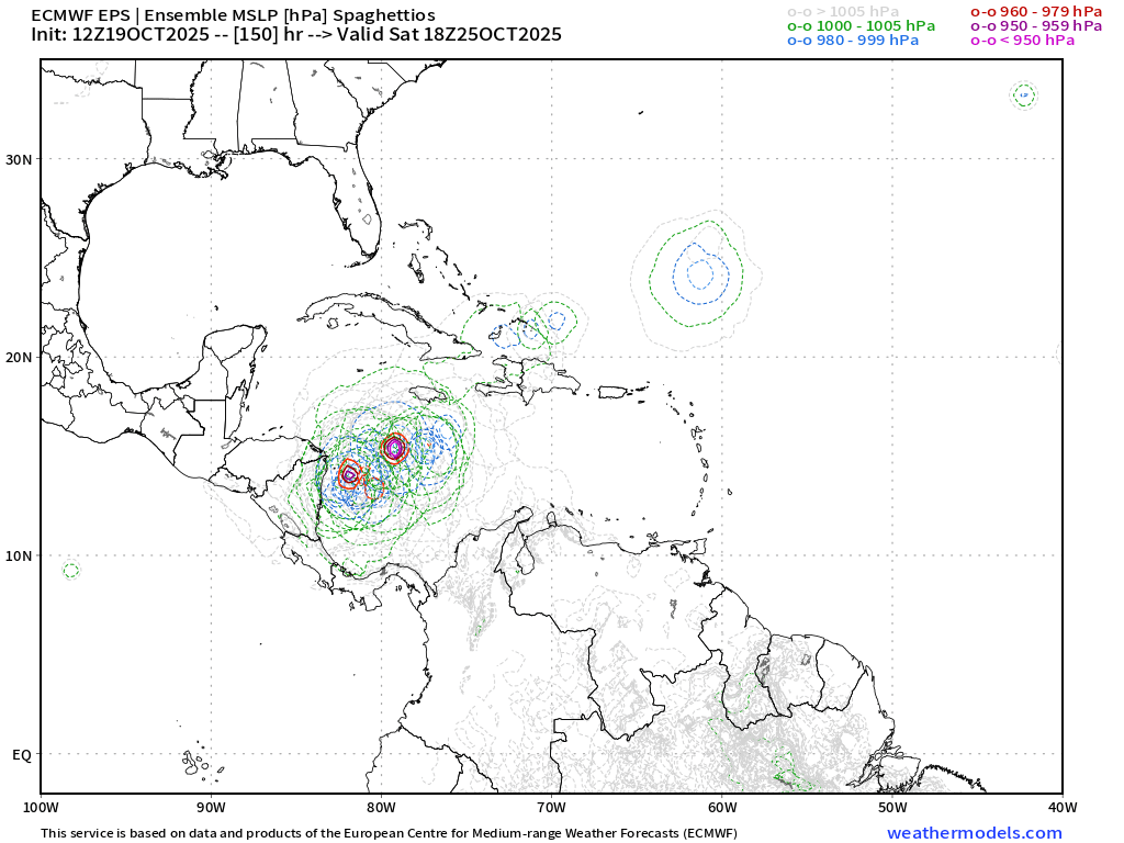
#75 Postby LarryWx » Mon Oct 20, 2025 9:00 am
As I just posted in the 98L discussion thread, there’s the 3rd main model option, that of many UKMET runs in a row (including today’s 0Z) that never get it much more organized than it is now due to a splitting off of the main H5 vorticity, which turns sharply north in the E Car leaving behind just a weak surface low. That weak low then continues westward in the S Caribbean with the run then ending (168) with just a 1007 low near the Nicaragua coast that’s likely about to dissipate underneath a pretty solid ridge.
The JMA had been similar though the latest run (yesterday’s 12Z) developed it into a 1004-5 TD to possibly low end TS that skims the N coast of Honduras to S Belize at 192 (end).
Interestingly, the 0Z CMC was kind of similar to yesterday’s 12Z JMA though it survives Honduras and then turns NE as a TS over WC Cuba and then the NW Bahamas.
We’ll see whether or not this is one of those cases of the UKMET being genesis shy/too weak due to the splitting of energy. It (along with the JMA for the most part) has a good chance to either bust badly or score a coup.
1 likes
Personal Forecast Disclaimer:
The posts in this forum are NOT official forecasts and should not be used as such. They are just the opinion of the poster and may or may not be backed by sound meteorological data. They are NOT endorsed by any professional institution or storm2k.org. For official information, please refer to the NHC and NWS products.