ATL: ERIN - Hurricane - Discussion
Moderators: hurricanetrack, S2k Moderators

The posts in this forum are NOT official forecasts and should not be used as such. They are just the opinion of the poster and may or may not be backed by sound meteorological data. They are NOT endorsed by any professional institution or STORM2K. For official information, please refer to products from the National Hurricane Center and National Weather Service.

-
eastcoastFL

- Category 5

- Posts: 3922
- Age: 43
- Joined: Thu Apr 12, 2007 12:29 pm
- Location: Palm City, FL
Re: ATL: ERIN - Hurricane - Discussion
Is Erin in range of any of the island radars?
0 likes
Personal Forecast Disclaimer:
The posts in this forum are NOT official forecast and should not be used as such. They are just the opinion of the poster and may or may not be backed by sound meteorological data. They are NOT endorsed by any professional institution or storm2k.org. For official information, please refer to the NHC and NWS products.
The posts in this forum are NOT official forecast and should not be used as such. They are just the opinion of the poster and may or may not be backed by sound meteorological data. They are NOT endorsed by any professional institution or storm2k.org. For official information, please refer to the NHC and NWS products.
-
tropicwatch

- Category 5
- Posts: 3399
- Age: 61
- Joined: Sat Jun 02, 2007 10:01 am
- Location: Panama City Florida
- Contact:
Re: ATL: ERIN - Hurricane - Discussion
Puerto RicoeastcoastFL wrote:Is Erin in range of any of the island radars?
0 likes
Tropicwatch
Agnes 72', Eloise 75, Elena 85', Kate 85', Charley 86', Florence 88', Beryl 94', Dean 95', Erin 95', Opal 95', Earl 98', Georges 98', Ivan 2004', Arlene 2005', Dennis 2005', Ida 2009' Debby 2012' Irma 2017' Michael 2018'
Agnes 72', Eloise 75, Elena 85', Kate 85', Charley 86', Florence 88', Beryl 94', Dean 95', Erin 95', Opal 95', Earl 98', Georges 98', Ivan 2004', Arlene 2005', Dennis 2005', Ida 2009' Debby 2012' Irma 2017' Michael 2018'
-
Hypercane_Kyle

- Category 5
- Posts: 3376
- Joined: Sat Mar 07, 2015 7:58 pm
- Location: Cape Canaveral, FL
Re: ATL: ERIN - Hurricane - Discussion
The only analog at this point is Irma and Maria… so glad it’s going away from land.
1 likes
My posts are my own personal opinion, defer to the National Hurricane Center (NHC) and other NOAA products for decision making during hurricane season.
Re: ATL: ERIN - Hurricane - Discussion
eastcoastFL wrote:Is Erin in range of any of the island radars?
6 likes
-
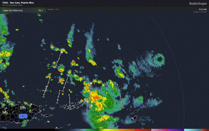
cycloneye

- Admin

- Posts: 146106
- Age: 69
- Joined: Thu Oct 10, 2002 10:54 am
- Location: San Juan, Puerto Rico
Re: ATL: ERIN - Hurricane - Discussion
eastcoastFL wrote:Is Erin in range of any of the island radars?
The San Juan NWS radar.
1 likes
Visit the Caribbean-Central America Weather Thread where you can find at first post web cams,radars
and observations from Caribbean basin members Click Here
and observations from Caribbean basin members Click Here

Re: ATL: ERIN - Hurricane - Discussion
Given Erin's strength I would bet the anti-cyclone itself is the main-factor steering Erin.
If that is the case, the longer before an EWRC can occur, the longer Erin tracks due west.
If that is the case, the longer before an EWRC can occur, the longer Erin tracks due west.
1 likes

Re: ATL: ERIN - Hurricane - Discussion
919.9mb extrapolated and 155 kt FL in the NW quad.
Yeah there’s little doubt this is a 5.
Yeah there’s little doubt this is a 5.
5 likes
Irene '11 Sandy '12 Hermine '16 5/15/2018 Derecho Fay '20 Isaias '20 Elsa '21 Henri '21 Ida '21
I am only a meteorology enthusiast who knows a decent amount about tropical cyclones. Look to the professional mets, the NHC, or your local weather office for the best information.
I am only a meteorology enthusiast who knows a decent amount about tropical cyclones. Look to the professional mets, the NHC, or your local weather office for the best information.
-
Cachondo23
- Tropical Depression

- Posts: 96
- Joined: Wed May 25, 2022 5:56 am
Re: ATL: ERIN - Hurricane - Discussion
eastcoastFL wrote:Is Erin in range of any of the island radars?
https://radar.weather.gov/ridge/standard/TJUA_loop.gif
0 likes
-
HurricaneAndre2008

- Category 1

- Posts: 338
- Age: 27
- Joined: Wed Jul 31, 2019 9:51 pm
- Contact:
Re: ATL: ERIN - Hurricane - Discussion
919.9 mb
(~ 27.17 inHg
(~ 27.17 inHg
0 likes
Cindy(2005), Katrina(2005), Rita(2005), Erin(2007), Isaac(2012)
-
ScottNAtlanta

- Category 5
- Posts: 2419
- Joined: Sat May 25, 2013 3:11 pm
- Location: Atlanta, GA
Re: ATL: ERIN - Hurricane - Discussion
This is now quite a bit south of the forecast point, and it keeps going west.
0 likes
The posts in this forum are NOT official forecast and should not be used as such. They are just the opinion of the poster and may or may not be backed by sound meteorological data. They are NOT endorsed by any professional institution or storm2k.org. For official information, please refer to the NHC and NWS products.
-
jlauderdal
- S2K Supporter

- Posts: 7200
- Joined: Wed May 19, 2004 5:46 am
- Location: NE Fort Lauderdale
- Contact:
Re: ATL: ERIN - Hurricane - Discussion
GCANE wrote:Given Erin's strength I would bet the anti-cyclone itself is the main-factor steering Erin.
If that is the case, the longer before an EWRC can occur, the longer Erin tracks due west.
The westerly component matched up well with the intensification process we saw earlier today. I wont overdo it with creating its own environment but there is no doubt at this intensity, the system has more influence than usual with the direction of travel as it pushes on the ridge. Get your protractor out because its all about the angle of approach next week.
1 likes
-
MarioProtVI
- Category 4

- Posts: 946
- Age: 24
- Joined: Sun Sep 29, 2019 7:33 pm
- Location: New Jersey
Re: ATL: ERIN - Hurricane - Discussion
Just realized the fly in the ointment is the 155 kt FL was at 750 mb which rounds down (0.87 reduction) to 135.7 kt, so it’s gonna be very close to whether or not NHC goes Cat 5. I’d assume the dropping pressure should lean towards it? Depends on whether AF (flying at 700mb) gets higher winds before the advisory and looming EWRC.
2 likes
-
skillz305
- Category 1
- Posts: 283
- Joined: Sat Sep 08, 2018 11:10 am
- Location: Miami, Florida --> Vero Beach, Florida
Re: ATL: ERIN - Hurricane - Discussion
At what point do we get concerned in Florida? Highly unlikely anything happens over here but I think we are now starting to hope for a WNW movement anytime now…
0 likes
 Hurricanes: Andrew 1992 - Irene 1999 - Frances 2004 - Jeanne 2004 - Katrina 2005 - Wilma 2005 - Matthew 2016 - Irma 2017 - Ian 2022 - Nicole 2022 - Milton 2024
-
ScottNAtlanta
- Category 5
- Posts: 2419
- Joined: Sat May 25, 2013 3:11 pm
- Location: Atlanta, GA
Re: ATL: ERIN - Hurricane - Discussion
I don't see the weakness as of yet

1 likes
The posts in this forum are NOT official forecast and should not be used as such. They are just the opinion of the poster and may or may not be backed by sound meteorological data. They are NOT endorsed by any professional institution or storm2k.org. For official information, please refer to the NHC and NWS products.
-
eastcoastFL
- Category 5
- Posts: 3922
- Age: 43
- Joined: Thu Apr 12, 2007 12:29 pm
- Location: Palm City, FL
Re: ATL: ERIN - Hurricane - Discussion
GCANE wrote:Given Erin's strength I would bet the anti-cyclone itself is the main-factor steering Erin.
If that is the case, the longer before an EWRC can occur, the longer Erin tracks due west.
Is that the anti-cyclone north of Hispaniola tugging it westward?
0 likes
Personal Forecast Disclaimer:
The posts in this forum are NOT official forecast and should not be used as such. They are just the opinion of the poster and may or may not be backed by sound meteorological data. They are NOT endorsed by any professional institution or storm2k.org. For official information, please refer to the NHC and NWS products.
The posts in this forum are NOT official forecast and should not be used as such. They are just the opinion of the poster and may or may not be backed by sound meteorological data. They are NOT endorsed by any professional institution or storm2k.org. For official information, please refer to the NHC and NWS products.

Re: ATL: ERIN - Hurricane - Discussion
Hypercane_Kyle wrote:The only analog at this point is Irma and Maria… so glad it’s going away from land.
But is it actually going away from land?
1 likes
-
ScottNAtlanta
- Category 5
- Posts: 2419
- Joined: Sat May 25, 2013 3:11 pm
- Location: Atlanta, GA
Re: ATL: ERIN - Hurricane - Discussion
eastcoastFL wrote:GCANE wrote:Given Erin's strength I would bet the anti-cyclone itself is the main-factor steering Erin.
If that is the case, the longer before an EWRC can occur, the longer Erin tracks due west.
Is that the anti-cyclone north of Hispaniola tugging it westward?
It looks to me like the high pressure over the southeastern US is stronger than forecast, also that trough in the TN valley doesn't look right either
1 likes
The posts in this forum are NOT official forecast and should not be used as such. They are just the opinion of the poster and may or may not be backed by sound meteorological data. They are NOT endorsed by any professional institution or storm2k.org. For official information, please refer to the NHC and NWS products.

Re: ATL: ERIN - Hurricane - Discussion
Erin very well may end up making a run at Irma’s record for most intense hurricane by MSLP in the open Atlantic, which stands at 914 mb.
5 likes
-
WaveBreaking

- Category 2

- Posts: 602
- Joined: Sun Jun 30, 2024 11:33 am
- Location: US
Re: ATL: ERIN - Hurricane - Discussion

8 likes
I am NOT a professional meteorologist, so take all of my posts with a grain of salt. My opinions are mine and mine alone.
-
eastcoastFL
- Category 5
- Posts: 3922
- Age: 43
- Joined: Thu Apr 12, 2007 12:29 pm
- Location: Palm City, FL
Re: ATL: ERIN - Hurricane - Discussion
The hurricane has been moving a bit to the left of the previous
forecast track with the initial motion of 280/15. The track guidance
suggests that Erin will turn back to the west-northwest with a
decrease in forward speed during the next 6-12 h on the south side
of a subtropical ridge. This motion should then continue through
the weekend, taking the core of Erin to the north of the eastern
Caribbean Islands through Sunday.
1 likes
Personal Forecast Disclaimer:
The posts in this forum are NOT official forecast and should not be used as such. They are just the opinion of the poster and may or may not be backed by sound meteorological data. They are NOT endorsed by any professional institution or storm2k.org. For official information, please refer to the NHC and NWS products.
The posts in this forum are NOT official forecast and should not be used as such. They are just the opinion of the poster and may or may not be backed by sound meteorological data. They are NOT endorsed by any professional institution or storm2k.org. For official information, please refer to the NHC and NWS products.
Return to “Active Storms/Invests - Atlantic/EastPAC/CentralPAC/MED”
Who is online
Users browsing this forum: No registered users and 124 guests