cycloneye wrote:AL, 95, 2022062900, , BEST, 0, 265N, 932W, 20, 1013, LO
CE....if I may ask, could you please explain what that means?
Moderator: S2k Moderators
cycloneye wrote:AL, 95, 2022062900, , BEST, 0, 265N, 932W, 20, 1013, LO


underthwx wrote:cycloneye wrote:AL, 95, 2022062900, , BEST, 0, 265N, 932W, 20, 1013, LO
CE....if I may ask, could you please explain what that means?


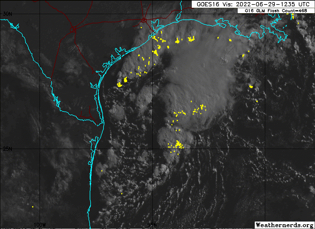
underthwx wrote:95L looking a bit less organized on satellite imagery this evening, I assume from the loss of daytime heating?
captainbarbossa19 wrote:underthwx wrote:95L looking a bit less organized on satellite imagery this evening, I assume from the loss of daytime heating?
DMIN. It may look completely different around 6 or 7 am.

underthwx wrote:cycloneye wrote:AL, 95, 2022062900, , BEST, 0, 265N, 932W, 20, 1013, LO
CE....if I may ask, could you please explain what that means?
Craters wrote:underthwx wrote:cycloneye wrote:AL, 95, 2022062900, , BEST, 0, 265N, 932W, 20, 1013, LO
CE....if I may ask, could you please explain what that means?
Underthwx --
Take a look here https://www.nrlmry.navy.mil/atcf_web/docs/database/new/abdeck.txt for probably more than you want to know. To attempt a quick summary (referring to cycloneye's data listing):
Al = Atlantic Basin
95 = Invest 95
2022062900 = data and time it was issued (June 26, 2022, 00Z)
[blank] = "objective technique sorting number, minutes for best track: 00 - 99" [I don't know why it's blank here.]
BEST = Best track data (Duh.)
0 = "forecast period," which is always 0 for best track data (I'm guessing because it's an instantaneous measurement and the time is given in the third data group.)
265N = Latitude of the system (26.5 N)
932W = Longitude of the system (93.2W)
20 = Maximum sustained wind speed in knots
1013 = Minimum sea-level pressure in millibars (1 atmosphere = 1013.25 millibars, so 95L was barely a low at the time, technically speaking.)
LO = highest level of tropical-cyclone development, in this case, just a low
Hope that helps...


captainbarbossa19 wrote:underthwx wrote:95L looking a bit less organized on satellite imagery this evening, I assume from the loss of daytime heating?
DMIN. It may look completely different around 6 or 7 am.


underthwx wrote:I appreciate your reply...that's a big help!...Thanks!
weeniepatrol wrote:underthwx wrote:I appreciate your reply...that's a big help!...Thanks!
Here's an additional pertinent source just to add to the conversation.
https://www.nhc.noaa.gov/data/hurdat/hurdat2-format-atl-1851-2021.pdf

lrak wrote:SoupBone wrote:And now we know why Houston news isn't talking about this a whole lot.
Yeah going to be a slow thread for a while, I think STORM2K has maybe 3 members south of Victoria/Laredo line.
wxman57 wrote:Not impressed at all with its appearance today. Could be a weak swirl or two out there, but it's not a depression. Winds generally 10-15 kts across the NW Gulf, though a heavy thunderstorm at one rig is producing a wind to 25 kts. There's a chance the NHC could call it a TD tomorrow as it moves inland. Won't make any difference. No wind, just well-needed rain.


Users browsing this forum: No registered users and 39 guests