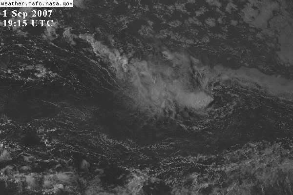
Invest 98L,Central Atlantic
Moderator: S2k Moderators

-
storms in NC

- S2K Supporter

- Posts: 2338
- Joined: Thu Jul 28, 2005 2:58 pm
- Location: Wallace,NC 40 miles NE of Wilm
- Contact:
-
Hurricaneman

- Category 5

- Posts: 7404
- Age: 45
- Joined: Tue Aug 31, 2004 3:24 pm
- Location: central florida
Re: Invest 98L,Central Atlantic-Discussions-Analysis & Imagery
I think this will develop, and be a a threat all the way from maine to Key West, because if the possible home brew develops it will go north, but if it doesnt, it goes into Florida
0 likes
-
vacanechaser

- Category 5
- Posts: 1461
- Joined: Wed Dec 03, 2003 9:34 pm
- Location: Portsmouth, Va
- Contact:
Re: Re:
storms in NC wrote:vacanechaser wrote:ok, all the talk here recently about the homepage being updated, where are the models and images for 98L... just asking
Jesse V. Bass III
http://www.vastormphoto.com
Hurricane Intercept Research Team
3day week_end on the Beach LOL
lol good point
Jesse V. Bass III
http://www.vastormphoto.com
Hurricane Intercept Research Team
0 likes
-
Extremeweatherguy

- Category 5
- Posts: 11095
- Joined: Mon Oct 10, 2005 8:13 pm
- Location: Florida
Re: Invest 98L,Central Atlantic-Discussions-Analysis & Imagery
Maine to Key West? I think it should be more like Mexico to Newfoundland. If this goes through the Caribbean, then it will likely be a GOM storm in the long run and if it goes into the central bahamas then it will likely be a SE U.S. or east coast threat.Hurricaneman wrote:I think this will develop, and be a a threat all the way from maine to Key West, because if the possible home brew develops it will go north, but if it doesnt, it goes into Florida
0 likes
-
hurricanetrack

- HurricaneTrack.com
- Posts: 1781
- Joined: Tue Dec 02, 2003 10:46 pm
- Location: Wilmington, NC
- Contact:
-
bvigal

- S2K Supporter
- Posts: 2276
- Joined: Sun Jul 24, 2005 8:49 am
- Location: British Virgin Islands
- Contact:
Re: Invest 98L,Central Atlantic-Discussions-Analysis & Imagery
Weatherfreak000 wrote:..., hope you guys enjoy active late seasons...
Weatherfreak,
 I keep hearing this over and over again, and confess I'm confused, and scratching my head. What do you mean by "late season"? The peak of hurricane season is, what, Sept 10? or Sept 14? We are 2weeks from the peak, and just had 6th named system born yesterday. So, how does the phrase "late season" come into play here? I'm REALLY curious what you mean! Do you think we are instore for 6 more storms (which would be right, since we are ALMOST half-way.) Or, do you think we have 12-15 more coming?
0 likes
-
vacanechaser
- Category 5
- Posts: 1461
- Joined: Wed Dec 03, 2003 9:34 pm
- Location: Portsmouth, Va
- Contact:
Re: Invest 98L,Central Atlantic-Discussions-Analysis & Imagery
bvigal wrote:Weatherfreak000 wrote:..., hope you guys enjoy active late seasons...
Weatherfreak,
maybe he means this could spill over into mid and late october.. since it seems now is the time that the cape verde is getting started... just a thought... meaning the season could go longer into october than normal.. just a guess
Jesse V. Bass III
http://www.vastormphoto.com
Hurricane Intercept Research Team
0 likes


-
bvigal
- S2K Supporter
- Posts: 2276
- Joined: Sun Jul 24, 2005 8:49 am
- Location: British Virgin Islands
- Contact:
Re: Invest 98L,Central Atlantic-Discussions-Analysis & Imagery
vacanechaser wrote:bvigal wrote:Weatherfreak000 wrote:..., hope you guys enjoy active late seasons...
Weatherfreak,
maybe he means this could spill over into mid and late october.. since it seems now is the time that the cape verde is getting started... just a thought... meaning the season could go longer into october than normal.. just a guess
Jesse V. Bass III
http://www.vastormphoto.com
Hurricane Intercept Research Team
Ah CAPE VERDE SEASON! I didn't think of that. Yes, that makes sense. It's usually August, no?
Thanks Jesse, I was really, really confused over that!
0 likes
-
windstorm99

- S2K Supporter
- Posts: 1578
- Age: 48
- Joined: Sat May 26, 2007 8:10 am
- Location: Miami, Florida
- Contact:
Re: Invest 98L,Central Atlantic-Discussions-Analysis & Imagery
Models at this point aren't showing to much of a northward trend to them...Mostly want to bring into guess what the caribbean once again. Its somewhat rare for a system at this latitude to make it in the caribbean.

0 likes
-
bvigal
- S2K Supporter
- Posts: 2276
- Joined: Sun Jul 24, 2005 8:49 am
- Location: British Virgin Islands
- Contact:
Re: Invest 98L,Central Atlantic-Discussions-Analysis & Imagery
Those models sure don't agree with latest 24,48,72hr surface maps, ridge is GONE west of 45-50W. I hope they are correct, but having a hard time buying it!
0 likes
-
Hurricaneman
- Category 5
- Posts: 7404
- Age: 45
- Joined: Tue Aug 31, 2004 3:24 pm
- Location: central florida
Re: Invest 98L,Central Atlantic-Discussions-Analysis & Imagery
I think this is more likely if you look at the maps to go between where the clp5 and the consensus of the models
0 likes
-
windstorm99
- S2K Supporter
- Posts: 1578
- Age: 48
- Joined: Sat May 26, 2007 8:10 am
- Location: Miami, Florida
- Contact:
Re:
Scorpion wrote:There is no way that this is taking a similar path to Dean and Felix
we have been saying the same thing all year but that high has been stuck in the same place all year long.
0 likes
-
chadtm80
Re: Re:
vacanechaser wrote:storms in NC wrote:vacanechaser wrote:ok, all the talk here recently about the homepage being updated, where are the models and images for 98L... just asking
Jesse V. Bass III
http://www.vastormphoto.com
Hurricane Intercept Research Team
3day week_end on the Beach LOL
lol good point
Jesse V. Bass III
http://www.vastormphoto.com
Hurricane Intercept Research Team
Sorry it is there now
0 likes


Who is online
Users browsing this forum: No registered users and 27 guests