Ex Tropical Depression KAREN: Discussions & Images

Moderator: S2k Moderators

Message
Author
Brent
S2K Supporter
S2K Supporter
Posts: 37988
Age: 36
Joined: Sun May 16, 2004 10:30 pm
Location: Tulsa Oklahoma
Contact:

Re: INVEST 96L: East Atlantic : Discussions & Images

#101 Postby Brent » Sun Sep 23, 2007 8:33 pm

AnnularCane wrote:This was probably asked already, but why is there no floater? Is it too far east?


Yep. Tomorrow it should be in range.
0 likes   

User avatar
N2FSU
S2K Supporter
S2K Supporter
Posts: 1062
Joined: Thu Sep 04, 2003 2:04 pm
Location: Tallahassee, FL

Re: INVEST 96L: East Atlantic : Discussions & Images

#102 Postby N2FSU » Sun Sep 23, 2007 8:36 pm

Great shot of it here:

NRL Image
0 likes   

O Town
S2K Supporter
S2K Supporter
Posts: 5205
Age: 51
Joined: Wed Sep 07, 2005 9:37 pm
Location: Orlando, Florida 28°35'35"N 81°22'55"W

Re: INVEST 96L: Global & BAM Models

#103 Postby O Town » Sun Sep 23, 2007 8:47 pm

Image
Image
0 likes   

CrazyC83
Professional-Met
Professional-Met
Posts: 34001
Joined: Tue Mar 07, 2006 11:57 pm
Location: Deep South, for the first time!

Re: INVEST 96L: East Atlantic : Discussions & Images

#104 Postby CrazyC83 » Sun Sep 23, 2007 9:02 pm

N2FSU wrote:Great shot of it here:

NRL Image


That has the look of a storm right there...
0 likes   

Coredesat

#105 Postby Coredesat » Sun Sep 23, 2007 9:03 pm

Not quite, but it does have a well-established outflow channel to the north.
0 likes   

User avatar
hurricanetrack
HurricaneTrack.com
HurricaneTrack.com
Posts: 1781
Joined: Tue Dec 02, 2003 10:46 pm
Location: Wilmington, NC
Contact:

#106 Postby hurricanetrack » Sun Sep 23, 2007 9:08 pm

Wonder why Dr. Masters does not "like the looks of this one"? Just curious....
0 likes   

User avatar
GeneratorPower
S2K Supporter
S2K Supporter
Posts: 1648
Age: 45
Joined: Sun Dec 18, 2005 11:48 pm
Location: Huntsville, AL

#107 Postby GeneratorPower » Sun Sep 23, 2007 9:09 pm

Mark, where is Mike Watkins?
0 likes   

User avatar
HurricaneMaster_PR
Category 2
Category 2
Posts: 795
Joined: Tue Jul 22, 2003 6:23 pm
Location: San Juan, Puerto Rico

Re: INVEST 96L: East Atlantic : Discussions=10:30 PM TWO Shortly

#108 Postby HurricaneMaster_PR » Sun Sep 23, 2007 9:32 pm

TROPICAL WEATHER OUTLOOK
NWS TPC/NATIONAL HURRICANE CENTER MIAMI FL
1030 PM EDT SUN SEP 23 2007

FOR THE NORTH ATLANTIC...CARIBBEAN SEA AND THE GULF OF MEXICO...

THE NATIONAL HURRICANE CENTER IS ISSUING ADVISORIES ON TROPICAL
STORM JERRY...LOCATED ABOUT 1045 MILES WEST OF THE AZORES.

DISORGANIZED SHOWERS AND THUNDERSTORMS EXTEND FROM A WEAK AREA OF
LOW PRESSURE NEAR THE YUCATAN PENINSULA NORTHWARD ACROSS THE
CENTRAL GULF OF MEXICO. STRONG SOUTHERLY UPPER-LEVEL WINDS IN THE
WESTERN GULF OF MEXICO SHOULD KEEP DEVELOPMENT...IF ANY...SLOW TO
OCCUR.

AN AREA OF LOW PRESSURE ASSOCIATED WITH A TROPICAL WAVE IS LOCATED
ABOUT 200 MILES EAST OF THE SOUTHERN WINDWARD ISLANDS. THIS SYSTEM
HAS CHANGED LITTLE IN ORGANIZATION TODAY...BUT HAS THE POTENTIAL TO
DEVELOP INTO A TROPICAL DEPRESSION DURING THE NEXT DAY OR SO. THIS
SYSTEM IS EXPRECTED TO BRING SQUALLY WEATHER TO THE WINDWARD
ISLANDS ON MONDAY...AND THIS WEATHER COULD SPREAD NORTHWESTWARD
INTO THE LEEWARD ISLANDS ON TUESDAY. INTERESTS IN THE LESSER
ANTILLES SHOULD MONITOR THE PROGRESS OF THIS SYSTEM.

AN AREA OF LOW PRESSURE ASSOCIATED WITH A TROPICAL WAVE IS LOCATED
ABOUT 650 MILES SOUTH-SOUTHWEST OF THE CAPE VERDE ISLANDS. THIS
LARGE SYSTEM CONTINUES TO SHOW SIGNS OF ORGANIZATION...AND COULD
BECOME A TROPICAL DEPRESSION DURING THE NEXT DAY OR TWO AS IT MOVES
WEST-NORTHWESTWARD AT ABOUT 15 MPH.


ELSEWHERE...TROPICAL CYCLONE FORMATION IS NOT EXPECTED DURING THE
NEXT 48 HOURS.
PUBLIC ADVISORIES ON JERRY ARE ISSUED UNDER WMO HEADER WTNT31 AND
UNDER AWIPS HEADER MIATCPAT1. FORECAST/ADVISORIES ON JERRY ARE
ISSUED UNDER WMO HEADER WTNT21 AND UNDER AWIPS HEADER MIATCMAT1.
$$
FORECASTER FRANKLIN
0 likes   

User avatar
cycloneye
Admin
Admin
Posts: 143863
Age: 68
Joined: Thu Oct 10, 2002 10:54 am
Location: San Juan, Puerto Rico

Re: 96L: East Atlantic : Discussions=10:30 PM TWO at page 5

#109 Postby cycloneye » Sun Sep 23, 2007 9:47 pm

Being so big,it takes a while to consolidate but slowly is getting close to TD status.
0 likes   

Matt-hurricanewatcher

Re: INVEST 96L: East Atlantic : Discussions & Images

#110 Postby Matt-hurricanewatcher » Sun Sep 23, 2007 10:12 pm

This needs to do one thing, that is blow a large 120 mile wide minus 70 area of convection right in the middle of that. Once it does that this should start to develop, maybe even fast. We will see. Yes its 2007 but hey its not impossible.
0 likes   

Derek Ortt

#111 Postby Derek Ortt » Sun Sep 23, 2007 10:34 pm

2007 has not been a dead year at all.

10 named storms and 2 cat 5's... yet we are seeing posts about "it's 2007"

We could end up with 15-20 names storms this year, which would be above the last 12 year average
0 likes   

RL3AO
Moderator-Pro Met
Moderator-Pro Met
Posts: 16308
Joined: Thu Jun 14, 2007 10:03 pm
Location: NC

Re:

#112 Postby RL3AO » Sun Sep 23, 2007 10:36 pm

Derek Ortt wrote:2007 has not been a dead year at all.

10 named storms and 2 cat 5's... yet we are seeing posts about "it's 2007"

We could end up with 15-20 names storms this year, which would be above the last 12 year average


20? I was thinking we could hit 16 but not 20.
0 likes   

Matt-hurricanewatcher

Re:

#113 Postby Matt-hurricanewatcher » Sun Sep 23, 2007 10:38 pm

Derek Ortt wrote:2007 has not been a dead year at all.

10 named storms and 2 cat 5's... yet we are seeing posts about "it's 2007"

We could end up with 15-20 names storms this year, which would be above the last 12 year average


Derek, I'm talking about the ACE level. Why is so many systems weak and short trackers this year?

Yes Dean and Felix where...But there seems to be many a subtropical system this year.
0 likes   

User avatar
rainydaze
Category 1
Category 1
Posts: 486
Joined: Wed Oct 09, 2002 9:07 pm
Location: Jupiter, FL

Re: INVEST 96L: East Atlantic : Discussions & Images

#114 Postby rainydaze » Sun Sep 23, 2007 10:49 pm

Wow, that storm is huge! Will it stay big if it develops or will it trim down?
0 likes   

User avatar
'CaneFreak
Category 5
Category 5
Posts: 1486
Joined: Mon Jun 05, 2006 10:50 am
Location: New Bern, NC

Re: INVEST 96L: East Atlantic : Discussions & Images

#115 Postby 'CaneFreak » Sun Sep 23, 2007 11:03 pm

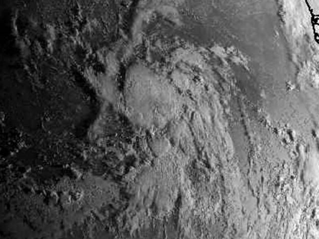
rainydaze wrote:Wow, that storm is huge! Will it stay big if it develops or will it trim down?


It will trim down but this large envelope of moisture will help this system fight off any dry air that tries to impede into the system and will hopefully keep the LLC alive until this gains enough latitude which will in turn help out with low level vorticity (spin) as well. In essence, we would be killing two birds with one stone if this can keep a fairly large envelope. This reminds me of some of the storms of 2004 as they came off of Africa. :eek:
0 likes   

User avatar
Typhoon_Willie
Category 5
Category 5
Posts: 1042
Joined: Mon Jun 09, 2003 3:19 pm
Location: Greenacres City, Florida

Re: INVEST 96L: East Atlantic : Discussions & Images

#116 Postby Typhoon_Willie » Mon Sep 24, 2007 12:29 am

Tropical Cyclone Formation Alert on 96L. Here is the link!
0 likes   

vegastar
Category 1
Category 1
Posts: 320
Age: 48
Joined: Fri Aug 03, 2007 9:13 am
Location: Trofa, Portugal (41.33º N 8.55º W)

Re: INVEST 96L: East Atlantic : Discussions & Images

#117 Postby vegastar » Mon Sep 24, 2007 4:36 am

ABNT20 KNHC 240929
TWOAT
TROPICAL WEATHER OUTLOOK
NWS TPC/NATIONAL HURRICANE CENTER MIAMI FL
530 AM EDT MON SEP 24 2007

AN AREA OF LOW PRESSURE ASSOCIATED WITH A TROPICAL WAVE IS LOCATED
ABOUT 650 MILES SOUTHWEST OF THE CAPE VERDE ISLANDS. SHOWER AND
THUNDERSTORM ACTIVITY HAS BECOME MORE CONCENTRATED OVERNIGHT...AND
THIS LARGE SYSTEM CONTINUES TO SHOW SIGNS OF ORGANIZATION. IT
COULD BECOME A TROPICAL DEPRESSION DURING THE NEXT DAY OR SO AS IT
MOVES WEST-NORTHWESTWARD AT ABOUT 15 MPH.

FORECASTER KNABB
0 likes   

User avatar
Typhoon_Willie
Category 5
Category 5
Posts: 1042
Joined: Mon Jun 09, 2003 3:19 pm
Location: Greenacres City, Florida

Re: INVEST 96L: East Atlantic : Discussions & Images

#118 Postby Typhoon_Willie » Mon Sep 24, 2007 4:48 am

Visible floater is now on 96L...

Here is the link!

Pretty good rotation with this system! :eek:
0 likes   

User avatar
HURAKAN
Professional-Met
Professional-Met
Posts: 46086
Age: 38
Joined: Thu May 20, 2004 4:34 pm
Location: Key West, FL
Contact:

#119 Postby HURAKAN » Mon Sep 24, 2007 4:50 am

Image

96L GETTING BETTER ORGANIZED.
0 likes   

User avatar
cycloneye
Admin
Admin
Posts: 143863
Age: 68
Joined: Thu Oct 10, 2002 10:54 am
Location: San Juan, Puerto Rico

Re: INVEST 96L: Global & BAM Models

#120 Postby cycloneye » Mon Sep 24, 2007 5:23 am

Image

If you look at the models,the BAMS takes 96L fishing,while the globals GFDL and NOGAPS takes it more westward.
0 likes   


Return to “2007”

Who is online

Users browsing this forum: No registered users and 15 guests