

http://euler.atmos.colostate.edu/~vigh/ ... early1.png
Seems like there could be trouble ahead for intensity.
TD INGRID: Discussions & Images - Last Advisory
Moderator: S2k Moderators

Re: Trop Dep EIGHT (ATL): Discussions & Images 5 PM EDT page 59
MetroMike wrote:http://euler.atmos.colostate.edu/~vigh/guidance/northatlantic/intensity_early1.png
Seems like there could be trouble ahead for intensity.
I cant get the link to work. Do you mean trouble for us, or the storm?
It looks like convection is blossoming on the northern side, near where the center is
0 likes
-
windstorm99

- S2K Supporter

- Posts: 1578
- Age: 48
- Joined: Sat May 26, 2007 8:10 am
- Location: Miami, Florida
- Contact:

-
windstorm99
- S2K Supporter
- Posts: 1578
- Age: 48
- Joined: Sat May 26, 2007 8:10 am
- Location: Miami, Florida
- Contact:
Re: Trop Dep EIGHT (ATL): Discussions & Images 5 PM EDT page 59
TD8 looks sick...

Continues to look sheared to me.
Continues to look sheared to me.
0 likes
-
cycloneye

- Admin

- Posts: 149314
- Age: 69
- Joined: Thu Oct 10, 2002 10:54 am
- Location: San Juan, Puerto Rico
Re: Trop Dep EIGHT (ATL): Discussions & Images 5 PM EDT page 59
The LLC is in the NE part of the convection.
0 likes

-
Andrew92

- S2K Supporter
- Posts: 3247
- Age: 42
- Joined: Mon Jun 16, 2003 12:35 am
- Location: Phoenix, Arizona
The following post is NOT an official forecast and should not be used as such. It is just the opinion of the poster and may or may not be backed by sound meteorological data. It is NOT endorsed by any professional institution or storm2k.org. For official information, please refer to the NHC and NWS products.
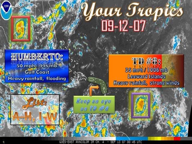
TD #8 is looking a little disorganized, but there is very ample opportunity for it to become Ingrid tomorrow if it gets its act together. Water temperatures are warm, shear is fairly low, and there is lots of moisture to be had. If no Ingrid tomorrow, Friday for almost certain.
My initial guess is that this depression will head west-northwest for a couple days, then westward towards the Leeward Islands. It will like approach the area sometime on Monday. By then, I expect it to be a minimal C1 hurricane.
All bets are off beyond there, but my best guess is that the ridge off the East Coast will allow the system to make its way through the Bahamas before curving northward. This would put the Carolinas at highest risk for a visit from this system, if it gets going.
HOWEVER, the last idea is a very radical one and only one of many possibilities that could happen down the road. Now is NOT the time to be alarmed or panicked; simply have a plan in case the depression develops further and heads your way.
-Andrew92
0 likes

Re: Trop Dep EIGHT (ATL): Discussions & Images 5 PM EDT page 59
Is there a blocking ridge oriented NE-SW pushing the convection WSW?
If there is this could spring in a poleward direction when it frees or track more west. I'm not sure. Maybe it will continue WNW after this weird swing.
If there is this could spring in a poleward direction when it frees or track more west. I'm not sure. Maybe it will continue WNW after this weird swing.
0 likes
-
windstorm99
- S2K Supporter
- Posts: 1578
- Age: 48
- Joined: Sat May 26, 2007 8:10 am
- Location: Miami, Florida
- Contact:
Re: Trop Dep EIGHT (ATL): Discussions & Images 5 PM EDT page 59
delete post...
Last edited by windstorm99 on Wed Sep 12, 2007 9:29 pm, edited 1 time in total.
0 likes
-
CrazyC83
- Professional-Met

- Posts: 34315
- Joined: Tue Mar 07, 2006 11:57 pm
- Location: Deep South, for the first time!
This seems to be holding steady this evening. I think it is a 35 kt tropical storm personally (pressure 1005mb), based on the old T2.5 and the brown barbs on QuikSCAT. Will it ramp up with DMax?
Last edited by CrazyC83 on Wed Sep 12, 2007 9:28 pm, edited 1 time in total.
0 likes
-
windstorm99
- S2K Supporter
- Posts: 1578
- Age: 48
- Joined: Sat May 26, 2007 8:10 am
- Location: Miami, Florida
- Contact:
Re: Trop Dep EIGHT (ATL): Discussions & Images 5 PM EDT page 59
cycloneye wrote:The LLC is in the NE part of the convection.

0 likes

-
Brent
- S2K Supporter
- Posts: 38731
- Age: 37
- Joined: Sun May 16, 2004 10:30 pm
- Location: Tulsa Oklahoma
- Contact:
Re:
CrazyC83 wrote:This seems to be holding steady this evening. I think it is a 35 kt tropical storm personally, based on the old T2.5 and the brown barbs on QuikSCAT. Will it ramp up with DMax?
I'm thinking yes. Dean took 24 hours to become a TS and also struggled.
0 likes

-
CrazyC83
- Professional-Met
- Posts: 34315
- Joined: Tue Mar 07, 2006 11:57 pm
- Location: Deep South, for the first time!
Re:
RL3AO wrote:Considering the convection has been sheared SW, I will say no upgrade at 11.
Same here (at least for consistency sake), although some mets at the NHC probably think this is a tropical storm (which I personally think as well - and has been since this afternoon).
0 likes
-
Brent
- S2K Supporter
- Posts: 38731
- Age: 37
- Joined: Sun May 16, 2004 10:30 pm
- Location: Tulsa Oklahoma
- Contact:
Re: Re:
CrazyC83 wrote:RL3AO wrote:Considering the convection has been sheared SW, I will say no upgrade at 11.
Same here (at least for consistency sake), although some mets at the NHC probably think this is a tropical storm (which I personally think as well - and has been since this afternoon).
Agreed, plus the 0z models and NRL still say NONAME, so I'll be shocked if it's upgraded at 11.
0 likes
-
Matt-hurricanewatcher
Re: Trop Dep EIGHT (ATL): Discussions & Images 5 PM EDT page 59
I believe this has been a tropical storm for the last 6 hours. But the LLC is on the northeast side of the convection, I don't understand the need to hold off on it. But I guest they will intill it forms over the center.
0 likes
-
CrazyC83
- Professional-Met
- Posts: 34315
- Joined: Tue Mar 07, 2006 11:57 pm
- Location: Deep South, for the first time!
QuikSCAT (from 10:03 pm EDT) still shows 35 kt uncontaminated winds...
http://manati.orbit.nesdis.noaa.gov/dat ... MBas26.png
http://manati.orbit.nesdis.noaa.gov/dat ... MBas26.png
0 likes
-
Matt-hurricanewatcher
Re:
CrazyC83 wrote:QuikSCAT (from 10:03 pm EDT) still shows 35 kt uncontaminated winds...
http://manati.orbit.nesdis.noaa.gov/dat ... MBas26.png
Its soild as a rock. I believe the subtropical ridge is starting to build to its north....We will see.
0 likes
-
gatorcane

- S2K Supporter
- Posts: 23708
- Age: 48
- Joined: Sun Mar 13, 2005 3:54 pm
- Location: Boca Raton, FL
If this thing crawls WNW for nearly a week, you would think a CONUS front would eventually come in and turn it out...
The Leewards are at risk for sure. The CONUS I'm not so sure honestly.
By the time it gets to the CONUS based on NHC guidance you would think in late September short waves would be pushing off the EC.
Just my thinking now.
If this thing speeds up though...could be a different story.
The Leewards are at risk for sure. The CONUS I'm not so sure honestly.
By the time it gets to the CONUS based on NHC guidance you would think in late September short waves would be pushing off the EC.
Just my thinking now.
If this thing speeds up though...could be a different story.
0 likes
Who is online
Users browsing this forum: No registered users and 22 guests