Hurricane FELIX: Caribbean-Discussions
Moderator: S2k Moderators
-
fasterdisaster
- Category 5

- Posts: 1868
- Joined: Mon Sep 19, 2005 4:41 pm
- Location: Miami, Florida


Re: Hurricane FELIX:Caribbean-Discussions & Imagery 11 PM pag 73
My guess from reading the discussion, without TPC will just us the ADT numbers for intensity, until this storm makes landfall. As of 8:15UTC they CI #is at 6.5, ADJ is at 6.7
http://cimss.ssec.wisc.edu/tropic/adt/odt06L.html
http://cimss.ssec.wisc.edu/tropic/adt/odt06L.html
0 likes

It's probably been mentioned earlier in the thread but let's pray this isn't a repeat of the '98 disaster caused by the flooding rains and accompanying mudslides in association with Mitch - another Cat5 hurricane (though not at landfall).
This general area seems to attract powerful canes: Janet, Gilbert, Mitch, to name a few that come readily to mind.
This general area seems to attract powerful canes: Janet, Gilbert, Mitch, to name a few that come readily to mind.
0 likes
Re: Hurricane FELIX:Caribbean-Discussions & Imagery 11 PM pag 73
8:45 UTC: CI# 6.6, ADJ #6.8
The ADJ numbers appear to be closer to actual intensity of this storm:
http://cimss.ssec.wisc.edu/tropic/adt/odt06L.html
The ADJ numbers appear to be closer to actual intensity of this storm:
http://cimss.ssec.wisc.edu/tropic/adt/odt06L.html
0 likes


-
KBBOCA
- S2K Supporter

- Posts: 1559
- Joined: Fri Sep 05, 2003 5:27 am
- Location: Formerly Boca Raton, often West Africa. Currently Charlotte NC
Re: Hurricane FELIX:Caribbean-Discussions & Imagery 11 PM pag 73
Just noticed this graph on the CIMSS site. That is a pretty darn good illustration of rapid intensification... looks like it fell off a cliff!

0 likes
http://philadelphiaweather.blogspot.com ... ay-am.html
Updated TV Captures of Felix, including evacuation efforts in Honduras.
Updated TV Captures of Felix, including evacuation efforts in Honduras.
0 likes

-
Matt-hurricanewatcher
Re: Hurricane FELIX:Caribbean-Discussions & Imagery 11 PM pag 73
When on earth does the recon get into this system?
I would not be suprized if they found 160 knot flight level now.
I would not be suprized if they found 160 knot flight level now.
0 likes
Re:
Normandy wrote:Bet the farm when recon gets in they find SCARY flight level winds....eye warmed drastically over the past hour and convection is just intense as ever.
In my unprofessional opinion, you have a Cat 5 out there right now.
0 likes


Re: Hurricane FELIX:Caribbean-Discussions & Imagery 11 PM pag 73
Matt-hurricanewatcher wrote:When on earth does the recon get into this system?
I would not be suprized if they found 160 knot flight level now.
I was thinking the same thing right now. Scary looks really really good!!
0 likes
Re: Hurricane FELIX:Caribbean-Discussions & Imagery 11 PM pag 73
Matt-hurricanewatcher wrote:When on earth does the recon get into this system?
I would not be suprized if they found 160 knot flight level now.
I don't think another plane is going in. The plane earlier this morning was supposed to be in the storm until 12z, but it left early.
Last edited by Thunder44 on Tue Sep 04, 2007 5:14 am, edited 1 time in total.
0 likes
-
wbug1
Re: Hurricane FELIX:Caribbean-Discussions & Imagery 11 PM pag 73
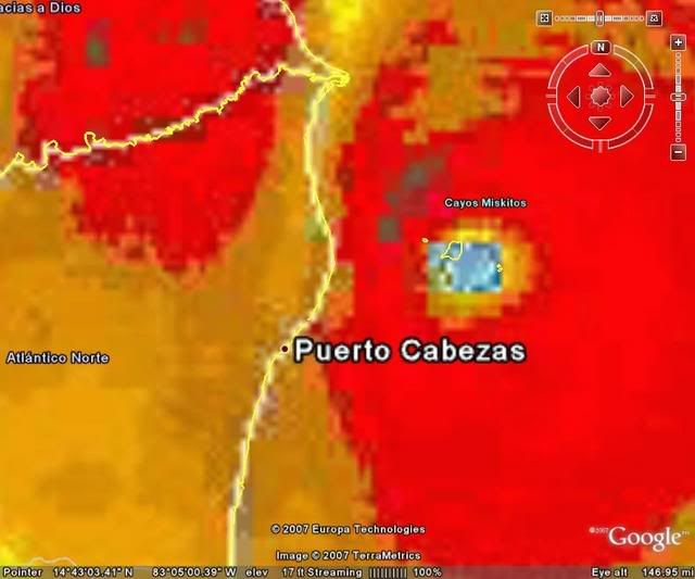
Disclaimer: the following is amateur analysis of landfalling hurricane Felix.. just north of Puerto Cabezas in Nicaragua..
Looks like the south eyewall will pass very close to Puerto Cabezas, appears north eyewall is stronger but with such strong convection it looks any quad could get severe winds. With the history this storm has of causing a NOAA hurricane hunter to withdraw due to turbulence and the continuing strong convection, I think that this storm could bring gusts even higher and cause damage higher than one would expect from a 140-145 kt Cat4/5 borderline hurricane.
Looks like the south eyewall will pass very close to Puerto Cabezas, appears north eyewall is stronger but with such strong convection it looks any quad could get severe winds. With the history this storm has of causing a NOAA hurricane hunter to withdraw due to turbulence and the continuing strong convection, I think that this storm could bring gusts even higher and cause damage higher than one would expect from a 140-145 kt Cat4/5 borderline hurricane.
0 likes
-
windstorm99

- S2K Supporter
- Posts: 1578
- Age: 48
- Joined: Sat May 26, 2007 8:10 am
- Location: Miami, Florida
- Contact:
Re: Hurricane FELIX:Caribbean-Discussions & Imagery 11 PM pag 73
A monster before moving onshore...

0 likes
Who is online
Users browsing this forum: No registered users and 85 guests