
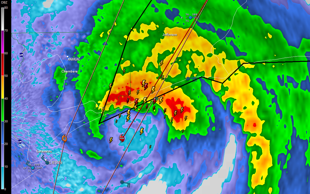
Does anyone have a good radar still image of Humberto right at or just after landfall? Much Thanks.
What a crazy little storm!
Tropical Depression HUMBERTO Discussion & Images
Moderator: S2k Moderators

>>That's pretty close to 30.0N and 90.0W isn't it. BTW your posts are good.
A bit north of there. They adjusted their forecast positions farther south. Still not sure if it will go south of Jackson or not, but it's gonna be close. FWIW, I'm not at 90/30 except for work. I'm more at like 90.5/29.4 at home.
Steve
A bit north of there. They adjusted their forecast positions farther south. Still not sure if it will go south of Jackson or not, but it's gonna be close. FWIW, I'm not at 90/30 except for work. I'm more at like 90.5/29.4 at home.
Steve
0 likes

-
CrazyC83
- Professional-Met

- Posts: 34315
- Joined: Tue Mar 07, 2006 11:57 pm
- Location: Deep South, for the first time!
I'm looking back in the posts and quite a number of us said this could very well become a hurricane (as early as yesterday afternoon people were saying that). The fact that it turned NNE gave the storm precious time over water. Who knows what would have happened if it had another 6-12 hours over water?
0 likes
Re: TS HUMBERTO (Louisiana): Discussion & Images
Check out the last paragraph from the 11 a.m. discussion. Amazing! Surprised no one else has picked up on it:
BASED ON OPERATIONAL ESTIMATES...HUMBERTO STRENGTHENED FROM A 30 KT
DEPRESSION AT 15Z YESTERDAY TO A 75 KT HURRICANE AT 09Z THIS
MORNING...AN INCREASE OF 45 KT IN 18 HOURS. TO PUT THIS
DEVELOPMENT IN PERSPECTIVE...NO TROPICAL CYCLONE IN THE HISTORICAL
RECORD HAS EVER REACHED THIS INTENSITY AT A FASTER RATE NEAR
LANDFALL. IT WOULD BE NICE TO KNOW...SOMEDAY...WHY THIS HAPPENED.
0 likes
-
JtSmarts

- S2K Supporter

- Posts: 1442
- Age: 40
- Joined: Thu Jul 10, 2003 1:29 pm
- Location: Columbia, South Carolina
Re:
CrazyC83 wrote:I'm looking back in the posts and quite a number of us said this could very well become a hurricane (as early as yesterday afternoon people were saying that). The fact that it turned NNE gave the storm precious time over water. Who knows what would have happened if it had another 6-12 hours over water?
Humberto will go down as another one of those "thank god it didn't have more time" storms similar to Katrina (FL), Claudette, Cindy and Gaston. It easily could have been close to a Cat 3 if it had 5-6 more hours considering how rapidly it was developing and how close it was to a Cat 2 at landfall.
0 likes
-
jasons2k

- Storm2k Executive

- Posts: 8290
- Age: 52
- Joined: Wed Jul 06, 2005 12:32 pm
- Location: The Woodlands, TX
Re: TS HUMBERTO (Louisiana): Discussion & Images
Tropics_Dude83 wrote:Check out the last paragraph from the 11 a.m. discussion. Amazing! Surprised no one else has picked up on it:
BASED ON OPERATIONAL ESTIMATES...HUMBERTO STRENGTHENED FROM A 30 KT
DEPRESSION AT 15Z YESTERDAY TO A 75 KT HURRICANE AT 09Z THIS
MORNING...AN INCREASE OF 45 KT IN 18 HOURS. TO PUT THIS
DEVELOPMENT IN PERSPECTIVE...NO TROPICAL CYCLONE IN THE HISTORICAL
RECORD HAS EVER REACHED THIS INTENSITY AT A FASTER RATE NEAR
LANDFALL. IT WOULD BE NICE TO KNOW...SOMEDAY...WHY THIS HAPPENED.
It's been posted 2X already...check more carefully
0 likes
-
HURAKAN

- Professional-Met
- Posts: 46084
- Age: 39
- Joined: Thu May 20, 2004 4:34 pm
- Location: Key West, FL
- Contact:
Re: Re:
JtSmarts wrote:CrazyC83 wrote:I'm looking back in the posts and quite a number of us said this could very well become a hurricane (as early as yesterday afternoon people were saying that). The fact that it turned NNE gave the storm precious time over water. Who knows what would have happened if it had another 6-12 hours over water?
Humberto will go down as another one of those "thank god it didn't have more time" storms similar to Katrina (FL), Claudette, Cindy and Gaston. It easily could have been close to a Cat 3 if it had 5-6 more hours considering how rapidly it was developing and how close it was to a Cat 2 at landfall.
It also applies the phrase, "thank god it didn't pull an Alicia."
0 likes
-
CrazyC83
- Professional-Met
- Posts: 34315
- Joined: Tue Mar 07, 2006 11:57 pm
- Location: Deep South, for the first time!
Re: Re:
HURAKAN wrote:JtSmarts wrote:CrazyC83 wrote:I'm looking back in the posts and quite a number of us said this could very well become a hurricane (as early as yesterday afternoon people were saying that). The fact that it turned NNE gave the storm precious time over water. Who knows what would have happened if it had another 6-12 hours over water?
Humberto will go down as another one of those "thank god it didn't have more time" storms similar to Katrina (FL), Claudette, Cindy and Gaston. It easily could have been close to a Cat 3 if it had 5-6 more hours considering how rapidly it was developing and how close it was to a Cat 2 at landfall.
It also applies the phrase, "thank god it didn't pull an Alicia."
Had he gone straight in at Galveston, he would have still only been a tropical storm...
0 likes
-
CrazyC83
- Professional-Met
- Posts: 34315
- Joined: Tue Mar 07, 2006 11:57 pm
- Location: Deep South, for the first time!
Re: Re:
JtSmarts wrote:CrazyC83 wrote:I'm looking back in the posts and quite a number of us said this could very well become a hurricane (as early as yesterday afternoon people were saying that). The fact that it turned NNE gave the storm precious time over water. Who knows what would have happened if it had another 6-12 hours over water?
Humberto will go down as another one of those "thank god it didn't have more time" storms similar to Katrina (FL), Claudette, Cindy and Gaston. It easily could have been close to a Cat 3 if it had 5-6 more hours considering how rapidly it was developing and how close it was to a Cat 2 at landfall.
Another close call was Jose in 2005 (few mention it) but it rapidly intensified from 30 to 50 kt in the 6-8 hours before landfall and was forming an eyewall...
0 likes
-
vacanechaser

- Category 5

- Posts: 1461
- Joined: Wed Dec 03, 2003 9:34 pm
- Location: Portsmouth, Va
- Contact:
Re:
KWT wrote:I wonder whether the rapid development can also explain the amount of lightning that this system had in it last night. If I remember recon saw a heck of a lot of lightning in the eyewall of Felix when it bombed out.
Wonder if thats a trademark of really explosive systems?
when you get a system that is developing and could be developing quickly, yes you do get lightning... have seen it before in hurricanes and tropical storms... gabrielle had some nice lightning in some of the outer bands as it developed over night saturday.. there is a report i believe on this very subject on the hrd's site.. will see if i can find it and post it...
Jesse V. Bass III
http://www.vastormphoto.com
Hurricane Intercept Research Team
0 likes
-
CrazyC83
- Professional-Met
- Posts: 34315
- Joined: Tue Mar 07, 2006 11:57 pm
- Location: Deep South, for the first time!
Re:
HURAKAN wrote:By the way, when was the last time a hurricane made landfall in the US without any hurricane watches or warnings?
That's a scary scenario for a system like Humberto bad impacting a more populated area.
No hurricane watches or warnings were issued with Cindy.
0 likes
-
HURAKAN
- Professional-Met
- Posts: 46084
- Age: 39
- Joined: Thu May 20, 2004 4:34 pm
- Location: Key West, FL
- Contact:
Re: Re:
CrazyC83 wrote:HURAKAN wrote:By the way, when was the last time a hurricane made landfall in the US without any hurricane watches or warnings?
That's a scary scenario for a system like Humberto bad impacting a more populated area.
No hurricane watches or warnings were issued with Cindy.
But Cindy was declared a hurricane after the post-season. I understand your point.
0 likes
-
jasons2k
- Storm2k Executive
- Posts: 8290
- Age: 52
- Joined: Wed Jul 06, 2005 12:32 pm
- Location: The Woodlands, TX
Re: TS HUMBERTO (Louisiana): Discussion & Images
From Jeff - preliminary damage report:
1 fatality in Bridge City TX
Total power outages : 115,000
Power infrastructure is damaged, but large transmission towers appear to have survived..so outages should be confined to 3-5 days.
First damage assessment teams indicate wind damage is confined to roofing materials and window failures as well as widespread tree fall.
Galveston, Chambers, Jefferson, Orange counties are requesting federal disaster declarations.
Jefferson Co:
73,000 without power.
Widespread minor to moderate wind damage to structures across the county.
Petro-chemical plants in BPT have been knocked offline due to power failures (Valero, Motiva, and Total Petrochemicals)
All critical services are offline (water, sewer, hospitals, gas stations)
City of Port Arthur is 80% without power.
Hampshire area: significant wind damage to houses with trees down and into homes.
Orange County:
Entire county is without power.
Widespread tree fall into structures
Galveston County:
HWY 87 is closed to all traffic
Large powerline transmission towers have collapsed onto HWY 87.
Storm surge and wave action breached parts of HWY 87.
Estimated power restoration to Bolivar is 3-5 days.
Houses have suffered wind damage to roofs and decking at Crystal Beach and High Island.
It is estimated that 500 residents are stranded on Bolivar
0 likes
-
CrazyC83
- Professional-Met
- Posts: 34315
- Joined: Tue Mar 07, 2006 11:57 pm
- Location: Deep South, for the first time!
Re: Re:
HURAKAN wrote:CrazyC83 wrote:HURAKAN wrote:By the way, when was the last time a hurricane made landfall in the US without any hurricane watches or warnings?
That's a scary scenario for a system like Humberto bad impacting a more populated area.
No hurricane watches or warnings were issued with Cindy.
But Cindy was declared a hurricane after the post-season. I understand your point.
Also there WERE hurricane warnings with Humberto, but issued at 12:15 am and only 2 hours before landfall, making them practically useless for most people as they were asleep.
I am looking back and my favorite post was after the 4 pm CDT yesterday, when I thought a Hurricane Watch should be issued.
0 likes


Re: TS HUMBERTO (Louisiana): Discussion & Images
Been hearing about Humberto possibly going back into the GOM and making another landfall. Anyone else heard the same?
0 likes
-
jhamps10
Who is online
Users browsing this forum: No registered users and 12 guests