Hurricane NOEL : Discussions & Images
Moderator: S2k Moderators


Re: Tropical Storm NOEL : Discussions & Images
Latest ASCAT Pass
OSI SAF ASCAT 25-km ascending 2007-10-31 02:30

OSI SAF ASCAT 25-km ascending 2007-10-31 02:30
0 likes

Re: Tropical Storm NOEL : Discussions & Images
By the way, I think if NWS didn't already issue High Wind Watches first on Monday, NHC would of probably issued a TS Watch then. It may been "downgraded" to wind advisory today.
0 likes
Re: Tropical Storm NOEL : Discussions & Images
wxman57 wrote:Cuber wrote:wxman57 wrote:If you look at a detailed map of observations across the Bahamas northward to the Carolinas, you see winds on the west and northwest side of Noel at about 10-15 mph (to about Andros Island). North and northwest of that is the strong high pressure area that's mainly responsible for the winds along the southeast U.S. Coast. It's cool air spilling out off the east coast then flowing south and southwestward (supergradient flow) that is producing the strong winds along the Florida coast. Noel's lower pressure being down near Cuba does help to increase the pressure gradient to the north, but Noel's circulation is not producing the strong winds along the Florida coast.
Thank you. The prompt additional clarification is appreciated.
0 likes
-
HURAKAN

- Professional-Met

- Posts: 46084
- Age: 39
- Joined: Thu May 20, 2004 4:34 pm
- Location: Key West, FL
- Contact:
505
URNT15 KNHC 311207
AF307 0716A NOEL HDOB 20 20071031
115530 2114N 07556W 8120 01864 0064 +155 +145 189032 033 000 005 00
115600 2115N 07557W 8118 01862 0059 +154 +146 188032 033 001 004 00
115630 2115N 07559W 8117 01861 0055 +157 +143 185033 033 002 004 00
115700 2115N 07601W 8118 01857 0053 +159 +141 189034 034 005 004 00
115730 2116N 07603W 8116 01857 0053 +155 +141 189034 034 004 004 00
115800 2116N 07604W 8120 01857 0056 +155 +144 186036 037 002 004 00
115830 2117N 07606W 8116 01859 0050 +161 +132 187036 036 003 004 03
115900 2118N 07608W 8119 01853 0050 +158 +132 189035 036 999 999 03
115930 2118N 07609W 8120 01850 0046 +160 +129 186035 035 999 999 03
120000 2119N 07611W 8119 01847 0042 +159 +133 186036 037 999 999 03
120030 2119N 07613W 8119 01846 0042 +155 +141 189034 035 999 999 03
120100 2120N 07615W 8118 01845 0042 +153 +149 188030 031 999 999 03
120130 2121N 07616W 8118 01846 0043 +150 +147 189031 033 999 999 03
120200 2121N 07618W 8120 01841 0041 +153 +146 189033 033 999 999 03
120230 2122N 07620W 8119 01841 0037 +155 +154 192031 032 999 999 03
120300 2122N 07621W 8117 01849 0040 +159 +148 192030 031 999 999 03
120330 2123N 07623W 8118 01849 0043 +162 +144 192029 030 999 999 03
120400 2124N 07625W 8119 01844 0034 +163 +142 189030 031 999 999 03
120430 2124N 07627W 8175 01790 0041 +163 +152 185030 031 999 999 03
120500 2125N 07628W 8313 01649 9990 +160 +999 182030 030 999 999 05
$$
;
37 knts FL
0 likes
-
bocadude86
- Tropical Depression

- Posts: 52
- Joined: Wed Sep 12, 2007 3:29 pm
- Location: Boca Raton, Fl
Re: Tropical Storm NOEL : Discussions & Images
Evil Jeremy wrote:From the SFL WInd Advisory:
ANY CHANGE IN THE FORECAST TRACK OR INTENSITY OF NOEL COULD PROMPT UPGRADING OR
REPLACING THE ADVISORY WITH A TROPICAL STORM WARNING LATER TODAY
OR TONIGHT SO RESIDENTS ACROSS THE AREA ARE ADVISED TO MONITOR
LATEST STATEMENTS FOR UPDATES AND REMAIN ON THE ALERT.
Why would Noel being stronger then forecast call for a tropical storm warning here?
0 likes
-
ExBailbonds

- Tropical Storm

- Posts: 142
- Joined: Wed Sep 06, 2006 12:03 am
- Location: Homestead,Fl
- Contact:
I think that if people have a look at this water vapor loop of the northwest atlantic You would have a clearer picture of were this storm is going. Turn the the forcast points and ncep fronts on. http://www.ssd.noaa.gov/goes/east/nwatl/loop-wv.html
P/S I will say that our resident pros here have done very well with this very difficult to forcast storm.
P/S I will say that our resident pros here have done very well with this very difficult to forcast storm.
Last edited by ExBailbonds on Wed Oct 31, 2007 7:12 am, edited 1 time in total.
0 likes
-
bocadude86
- Tropical Depression
- Posts: 52
- Joined: Wed Sep 12, 2007 3:29 pm
- Location: Boca Raton, Fl
-
Gustywind

- Category 5

- Posts: 12334
- Joined: Mon Sep 03, 2007 7:29 am
- Location: Baie-Mahault, GUADELOUPE
000
AXNT20 KNHC 311207
TWDAT
TROPICAL WEATHER DISCUSSION
NWS TPC/NATIONAL HURRICANE CENTER MIAMI FL
805 AM EDT WED OCT 31 2007
...SPECIAL FEATURE...
TROPICAL STORM NOEL IS CENTERED NEAR 22.3N 78.2W AT 31/1200 UTC
ALONG THE N COAST OF CUBA NEAR CAYO COCO CUBA OR ABOUT 195 NM
SSW OF NASSAU IN THE BAHAMAS MOVING NNW AT 6 KT. ESTIMATED
MINIMUM CENTRAL PRESSURE IS 1000 MB. MAXIMUM SUSTAINED WIND
SPEED IS 35 KT WITH GUSTS TO 45 KT. SEE THE NHC FORECAST/ ADVISORY UNDER AWIPS/WMO HEADERS MIATCMAT1/ WTNT21 KNHC AND/OR
THE PUBLIC ADVISORY UNDER MIATCPAT1/WTNT31 KNHC FOR MORE
DETAILS. NOEL IS EXPECTED TO EMERGE INTO THE W ATLC LATER TODAY
BUT DUE TO THE CLOSE PROXIMITY OF THE NEIGHBORING ISLANDS ONLY
SOME SLIGHT STRENGTHENING IS EXPECTED BEFORE IT BEGINS ITS MOVE
MORE TO THE NE. UPPER LEVEL DRY SLOT REMAINS JUST TO THE W OF
THE CENTER KEEPING THE ASSOCIATED DEEP CONVECTION TO THE N AND E
OF THE CENTER. SCATTERED/NUMEROUS CONVECTION IS INLAND OVER E
CUBA E OF AND INCLUDING HOLGUIN AND GRANMA PROVIDENCES...AND
ACROSS MOST OF THE BAHAMAS FROM 21N-25N BETWEEN 72W-78W
INCLUDING THE TURKS AND CAICOS. TROPICAL MOISTURE CONTINUES TO
STREAM FROM THE CARIBBEAN E OF NOEL WITH CLUSTERS OF SCATTERED
SHOWERS/ISOLATED THUNDERSTORMS OVER THE CENTRAL CARIBBEAN AND
PORTION OF THE W ATLC S OF 26N BETWEEN 67W-78W. NOEL WILL
CONTINUE TO BE A MAJOR RAIN MAKER TODAY FOR E CUBA AND MOST OF
THE BAHAMA ISLANDS AND COULD CONTINUE TO CAUSE LIFE-THREATENING
FLASH FLOODS AND MUD SLIDES ESPECIALLY OVER MOUNTAINOUS TERRAIN
INCLUDING PORTIONS OF HISPANIOLA.
0 likes


-
HURAKAN
- Professional-Met
- Posts: 46084
- Age: 39
- Joined: Thu May 20, 2004 4:34 pm
- Location: Key West, FL
- Contact:
571
URNT15 KNHC 311217
AF307 0716A NOEL HDOB 21 20071031
120530 2126N 07630W 8414 01539 9990 +164 +999 185028 029 999 999 05
120600 2126N 07632W 8428 01522 9990 +165 +999 185030 031 999 999 05
120630 2127N 07633W 8430 01522 0046 +165 +165 185032 032 999 999 03
120700 2127N 07635W 8428 01524 0042 +165 +165 187034 035 999 999 03
120730 2128N 07637W 8430 01526 0043 +166 +166 188035 036 999 999 03
120800 2128N 07639W 8430 01522 0045 +165 +165 186035 035 999 999 03
120830 2129N 07640W 8428 01521 0040 +165 +165 185035 036 999 999 03
120900 2130N 07642W 8430 01518 0038 +165 +165 185035 036 999 999 03
120930 2130N 07644W 8428 01504 0022 +166 +166 183037 037 999 999 03
121000 2131N 07645W 8428 01496 0023 +166 +166 184038 038 999 999 03
121030 2131N 07647W 8428 01526 0046 +165 +165 184037 037 999 999 03
121100 2132N 07649W 8428 01525 0043 +170 +164 183037 037 020 005 03
121130 2133N 07651W 8430 01516 0037 +169 +165 182039 039 020 005 00
121200 2133N 07652W 8430 01518 0056 +168 +165 183039 039 018 005 00
121230 2134N 07654W 8430 01565 0079 +165 +165 184037 038 019 005 00
121300 2134N 07656W 8428 01539 0060 +169 +164 186039 040 020 005 00
121330 2135N 07658W 8430 01539 0060 +170 +156 186039 040 020 005 00
121400 2136N 07659W 8428 01560 0084 +168 +162 187039 039 019 005 00
121430 2136N 07701W 8430 01567 0088 +165 +165 186039 039 020 005 00
121500 2137N 07703W 8427 01548 0071 +164 +162 186039 040 019 005 00
$$
;
39 knots FL and 40 knots SFMR
0 likes


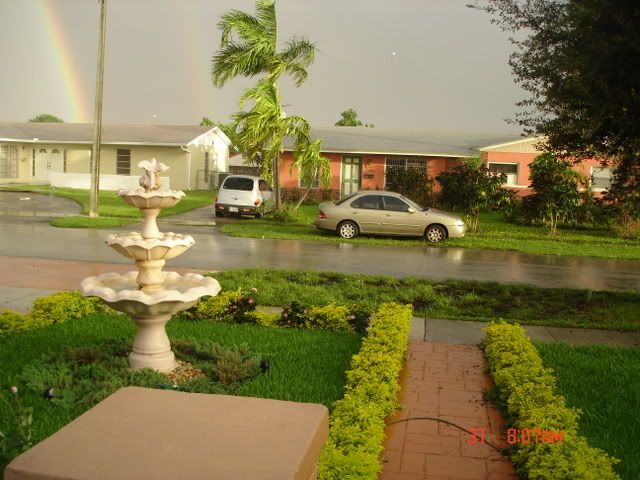
Re: Tropical Storm NOEL : Discussions & Images
Hey Sandy I like the rain bow and the fountain in front of your house.
0 likes
-
ExBailbonds
- Tropical Storm
- Posts: 142
- Joined: Wed Sep 06, 2006 12:03 am
- Location: Homestead,Fl
- Contact:
-
HURAKAN
- Professional-Met
- Posts: 46084
- Age: 39
- Joined: Thu May 20, 2004 4:34 pm
- Location: Key West, FL
- Contact:
627
URNT15 KNHC 311227
AF307 0716A NOEL HDOB 22 20071031
121530 2138N 07704W 8427 01542 0065 +165 +165 183038 039 015 005 00
121600 2139N 07706W 8434 01533 0063 +166 +166 184038 039 007 005 00
121630 2140N 07708W 8426 01492 0022 +161 +161 188038 040 028 002 00
121700 2141N 07709W 8426 01516 0025 +164 +164 194035 036 029 003 00
121730 2141N 07711W 8428 01516 0033 +168 +168 194035 035 025 005 00
121800 2142N 07712W 8427 01518 0034 +169 +169 194036 037 016 005 00
121830 2143N 07714W 8424 01527 0043 +167 +167 191037 038 009 006 00
121900 2144N 07716W 8430 01525 0046 +166 +166 193037 037 013 005 00
121930 2145N 07717W 8432 01524 0047 +166 +166 195035 036 014 007 00
122000 2145N 07719W 8428 01513 0041 +156 +156 194033 034 025 010 00
122030 2146N 07720W 8430 01505 0038 +150 +150 193030 031 019 011 00
122100 2147N 07722W 8431 01513 0030 +167 +167 196030 030 018 007 00
122130 2148N 07724W 8430 01514 0032 +169 +169 197028 028 028 007 00
122200 2149N 07725W 8429 01514 0024 +174 +163 196029 029 021 005 00
122230 2149N 07727W 8428 01514 0026 +175 +165 194029 029 029 002 00
122300 2150N 07728W 8430 01513 0029 +173 +170 194027 027 045 001 00
122330 2151N 07730W 8431 01515 0037 +166 +166 196026 027 110 007 03
122400 2152N 07732W 8427 01527 0040 +170 +170 196025 026 999 999 03
122430 2153N 07733W 8429 01511 0028 +172 +172 194026 026 999 999 03
122500 2153N 07735W 8431 01513 0031 +170 +168 193025 026 999 999 03
$$
;
0 likes
-
HURAKAN
- Professional-Met
- Posts: 46084
- Age: 39
- Joined: Thu May 20, 2004 4:34 pm
- Location: Key West, FL
- Contact:
896
UZNT13 KNHC 311202
XXAA 81124 99210 70743 08014 99007 28440 13023 00058 27837 13024
92746 21808 15033 85477 18841 16527 70120 09626 19030 50584 05550
19528 40756 14150 22013 88999 77999
31313 09608 81134
61616 AF307 0716A NOEL OB 06
62626 SPL 2110N07425W 1143 MBL WND 13525 AEV 00000 DLM WND 18027
006401 WL150 13024 075 =
XXBB 81128 99210 70743 08014 00007 28440 11918 21208 22867 18417
33850 18841 44721 11433 55530 03312 66484 06156 77442 10546 88430
10561 99425 10760 11393 15540
21212 00007 13023 11961 14025 22953 15029 33922 15034 44907 15533
55897 16037 66866 16534 77850 16527 88699 19030 99679 21029 11612
19027 22523 20031 33460 18524 44437 20524 55411 20016 66393 22008
31313 09608 81134
61616 AF307 0716A NOEL OB 06
62626 SPL 2110N07425W 1143 MBL WND 13525 AEV 00000 DLM WND 18027
006401 WL150 13024 075 =
;
0 likes
-
HURAKAN
- Professional-Met
- Posts: 46084
- Age: 39
- Joined: Thu May 20, 2004 4:34 pm
- Location: Key West, FL
- Contact:
438
URNT15 KNHC 311237
AF307 0716A NOEL HDOB 23 20071031
122530 2154N 07736W 8431 01507 0025 +171 +171 194026 027 999 999 03
122600 2155N 07738W 8432 01509 0030 +162 +162 188026 026 999 999 03
122630 2156N 07740W 8431 01504 0026 +164 +164 197022 022 999 999 03
122700 2157N 07741W 8430 01502 0021 +169 +169 204024 024 999 999 03
122730 2157N 07743W 8428 01504 0020 +168 +168 205025 025 999 999 03
122800 2158N 07744W 8430 01497 0013 +170 +169 202026 027 999 999 03
122830 2159N 07746W 8430 01493 0009 +171 +170 201024 025 999 999 03
122900 2200N 07748W 8430 01492 0006 +170 +170 204024 025 999 999 03
122930 2201N 07749W 8430 01488 0013 +168 +168 208024 025 999 999 03
123000 2201N 07751W 8428 01510 0027 +170 +170 208023 024 999 999 03
123030 2202N 07752W 8428 01511 0027 +170 +168 209024 024 999 999 03
123100 2203N 07754W 8431 01521 0031 +173 +167 206023 023 999 999 03
123130 2204N 07755W 8430 01513 0025 +177 +166 208023 023 999 999 03
123200 2205N 07757W 8428 01513 0026 +173 +169 209021 021 999 999 03
123230 2205N 07759W 8428 01502 0013 +177 +167 208021 021 999 999 03
123300 2206N 07800W 8432 01492 0008 +179 +167 211019 020 999 999 03
123330 2207N 07802W 8427 01503 0009 +182 +161 209017 018 999 999 03
123400 2207N 07803W 8431 01498 0009 +185 +157 215019 019 999 999 03
123430 2208N 07805W 8429 01503 0012 +184 +163 224018 018 999 999 03
123500 2209N 07806W 8428 01510 0018 +180 +166 220017 018 999 999 03
$$
;
0 likes
Who is online
Users browsing this forum: No registered users and 32 guests