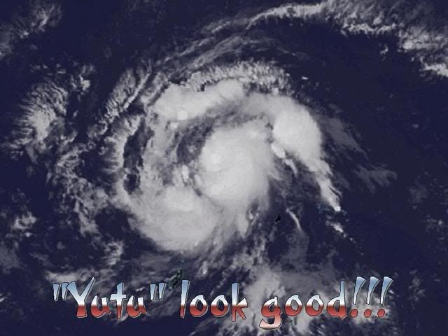
Up to 40kts now:
Issued at 12:00 UTC, 17 May 2007RSMC TROPICAL CYCLONE ADVISORY
NAME TS 0702 YUTU (0702)
ANALYSIS
PSTN 171200UTC 09.8N 137.9E FAIR
MOVE WNW 11KT
PRES 1000HPA
MXWD 040KT
GUST 060KT
30KT 100NM
FORECAST
24HF 181200UTC 11.2N 135.2E 90NM 70%
MOVE NW 08KT
PRES 985HPA
MXWD 050KT
GUST 070KT
48HF 191200UTC 15.1N 133.9E 150NM 70%
MOVE N 10KT
PRES 975HPA
MXWD 060KT
GUST 085KT
72HF 201200UTC 18.2N 134.9E 290NM 70%
MOVE NNE 08KT
PRES 960HPA
MXWD 075KT
GUST 105KT
Typhoon (Yutu) in WPAC
Moderator: S2k Moderators
-
Typhoon Hunter
- WesternPacificWeather.com

- Posts: 1222
- Joined: Wed Oct 11, 2006 11:37 am
- Location: Tokyo
- Contact:
-
Tampa Bay Hurricane

- Category 5

- Posts: 5597
- Age: 38
- Joined: Fri Jul 22, 2005 7:54 pm
- Location: St. Petersburg, FL
-
wxmann_91

- Category 5
- Posts: 8007
- Age: 34
- Joined: Fri Jul 15, 2005 2:49 pm
- Location: Southern California
- Contact:
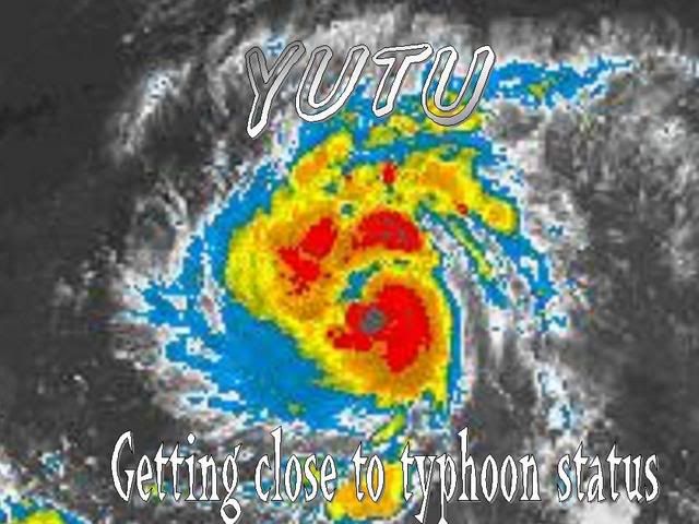
Wow, I was not aware the JMA was going so bullish on it... almost NEVER have I seen JMA forecast such.
There's already an eye-type feature evident on Microwave imagery, and strong upper diffluence; in addition, there is currently low shear and strong dual outflow jets from a monsoonal trough to the south, and polar outflow enhancement from a strong baroclinic system to the north.
What I'm doubting though is the fact that the same system will begin to shear Yutu in about 72 hours. However, it's got that compact, fist look that can precede rapid intensification in developing systems, so it's worth watching.
EDIT: My mistake, I thought JMA forecasted sustained winds of 105 kt, did not see that was gust. Much more realistic now
0 likes


STS 0702 (YUTU)
Issued at 06:00 UTC, 18 May 2007
RSMC TROPICAL CYCLONE ADVISORY
NAME STS 0702 YUTU (0702) UPGRADED FROM TS
ANALYSIS
PSTN 180600UTC 12.1N 134.9E FAIR
MOVE NW 13KT
PRES 990HPA
MXWD 055KT
GUST 080KT
50KT 20NM
30KT 120NM
FORECAST
24HF 190600UTC 16.2N 132.7E 90NM 70%
MOVE N 08KT
PRES 975HPA
MXWD 060KT
GUST 085KT
48HF 200600UTC 19.3N 134.3E 160NM 70%
MOVE N 09KT
PRES 970HPA
MXWD 065KT
GUST 095KT
72HF 210600UTC 22.8N 138.1E 290NM 70%
MOVE NE 12KT
PRES 965HPA
MXWD 070KT
GUST 100KT
0 likes
952
WWPN20 KNES 181516
SATELLITE WEATHER BULLETIN
WEST PACIFIC OCEAN MTSAT IRNIGHT
.
MAY 18 2007 1433Z
.
13.8N 133.2E T5.0/5.0/D2.0/24HRS YUTU (02W)
.
PAST POSITIONS....12.1N 135.2E 18/0233Z VIS/IRDAY
10.0N 137.3E 17/1433Z IRNIGHT
.
ADDL POSITIONS....12.6N 134.0E 18/0803Z TRMM
12.8N 133.8E 18/0911Z SSMI
.
REMARKS....SYSTEM HAS DEVELOPED RAPIDLY OVER THE LAST 12 HOURS
AND IS NOW CHARACTERIZED BY A LG EYE SURROUNDED BY W RESULTING IN
A DT OF 6.0. MET IS 4.5 FOR THIS RAPIDLY DEVELOPING SYSTEM AND
PT IS 5.0. FT BASED ON PT AND CONSTRAINTS.
.
POSITION ACCURATE WITHIN 30 NMI.
.
THE NEXT BULLETIN WILL BE ISSUED BY 18/2200Z.
.
FOR AREAL DISPLAY OF RAINFALL POTENTIAL SEE OUR WEB SITE AT
HTTP://WWW.SSD.NOAA.GOV/PS/TROP/TRAP.HTML
ALL LOWER CASE LETTERS EXCEPT PS/TROP
.
TURK
0 likes


-
P.K.

- Professional-Met

- Posts: 5149
- Joined: Thu Sep 23, 2004 5:57 pm
- Location: Watford, England
- Contact:
Just upgraded to a typhoon.
RSMC TROPICAL CYCLONE ADVISORY
NAME TY 0702 YUTU (0702) UPGRADED FROM STS
ANALYSIS
PSTN 181800UTC 14.3N 133.0E FAIR
MOVE NW 14KT
PRES 980HPA
MXWD 065KT
GUST 095KT
50KT 50NM
30KT 170NM
FORECAST
24HF 191800UTC 17.4N 132.7E 90NM 70%
MOVE N 08KT
PRES 965HPA
MXWD 070KT
GUST 100KT
48HF 201800UTC 20.6N 135.2E 160NM 70%
MOVE NE 10KT
PRES 960HPA
MXWD 075KT
GUST 105KT
72HF 211800UTC 24.5N 138.5E 290NM 70%
MOVE NE 12KT
PRES 975HPA
MXWD 065KT
GUST 095KT =
0 likes


-
wxmann_91
- Category 5
- Posts: 8007
- Age: 34
- Joined: Fri Jul 15, 2005 2:49 pm
- Location: Southern California
- Contact:
I think Yutu has peaked; it will likely weaken from here. It got to Cat 2 strength, not bad, pretty much what was expected. The outflow pattern was really good but the environment surrounding the storm was most likely characterized by significant amounts of dry air which hindered the storm's ability to wrap deep convection around itself for any extended period of time.
0 likes
Who is online
Users browsing this forum: No registered users and 65 guests