Invest 90L SE GOM: Discussions & Images
Moderator: S2k Moderators


Re: Invest 90L SE GOM: Discussions-Analysis & Images
I believe this will all come down to timing. Tx has two fronts prog to come through with the strongest one clearing the area on Friday/Saturday. If 90L hangs out or stalls it may get dragged/pushed out/up with the stronger of the two fronts.
I also saw mention yesterday in the local statements about a possible front hanging up in S GA/N FL. I'm sure that will play into the mix somewhere down the line.
Will be an interesting week to watch the tropics. Lots of bubbles out there.
But first persistance.
Time to leave now. I look forward to reading some good discussions when I get back this afternoon.
0 likes
-
HURAKAN

- Professional-Met

- Posts: 46084
- Age: 39
- Joined: Thu May 20, 2004 4:34 pm
- Location: Key West, FL
- Contact:
Re: Re:
aroughleague1209 wrote:Chacor wrote:09/0645 UTC 23.3N 86.7W T1.0/1.0 90L -- Atlantic Ocean
You mean gulf of mexico
Isn't the GOM in the Atlantic Ocean!?!?!? Just a technicality.
0 likes
-
cycloneye

- Admin

- Posts: 149275
- Age: 69
- Joined: Thu Oct 10, 2002 10:54 am
- Location: San Juan, Puerto Rico
Re: Invest 90L SE GOM: Discussions-Analysis & Images
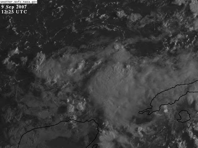
09/1145 UTC 22.8N 88.2W T1.0/1.0 90L -- Atlantic Ocean
0 likes
-
wxman57

- Moderator-Pro Met

- Posts: 23172
- Age: 68
- Joined: Sat Jun 21, 2003 8:06 pm
- Location: Houston, TX (southwest)
Re: Invest 90L SE GOM: Discussions-Analysis & Images
Very slim chance of development, 10-15% at best. Even the Canadian model only develops into into a TS, not a hurricane like every other feature it sees. I'm sure the NHC doesn't give it too much chance of really developing, they just wanted to see where the models took it and when. I'm not too concerned about it, yet. Always have to watch these thunderstorm clusters closely this time of year. Surface analysis shows no significant feature down there, not even a wave.
0 likes

-
HURAKAN
- Professional-Met
- Posts: 46084
- Age: 39
- Joined: Thu May 20, 2004 4:34 pm
- Location: Key West, FL
- Contact:
Re: Re:
HollynLA wrote:HURAKAN wrote:Dr. Steve Lyons said that if anything were to develop it would move towards the panhandle of Florida.
but yet most models move it into Texas? hmmmmm?
I know but that's what he said in the Tropical Update.
0 likes

Re: Re:
HURAKAN wrote:HollynLA wrote:HURAKAN wrote:Dr. Steve Lyons said that if anything were to develop it would move towards the panhandle of Florida.
but yet most models move it into Texas? hmmmmm?
I know but that's what he said in the Tropical Update.
He sure did say that.
0 likes
-
Tampa Bay Hurricane

- Category 5

- Posts: 5597
- Age: 38
- Joined: Fri Jul 22, 2005 7:54 pm
- Location: St. Petersburg, FL
Re: Invest 90L SE GOM: Discussions-Analysis & Images
wxman57 wrote:Very slim chance of development, 10-15% at best. Even the Canadian model only develops into into a TS, not a hurricane like every other feature it sees. I'm sure the NHC doesn't give it too much chance of really developing, they just wanted to see where the models took it and when. I'm not too concerned about it, yet. Always have to watch these thunderstorm clusters closely this time of year. Surface analysis shows no significant feature down there, not even a wave.
and give me some wave/wind action
I hope it maybe becomes a weak TS, I really
hope so, my surfer/stormchaser friends and I are
getting really desperate.
0 likes
-
Starburst

- S2K Supporter

- Posts: 484
- Joined: Sun Aug 28, 2005 11:03 pm
- Location: Beeville, TX
- Contact:
Re:
HURAKAN wrote:Dr. Steve Lyons said that if anything were to develop it would move towards the panhandle of Florida.
Yep he did say that, but I sure seem to think it is moving west
0 likes
-
HURAKAN
- Professional-Met
- Posts: 46084
- Age: 39
- Joined: Thu May 20, 2004 4:34 pm
- Location: Key West, FL
- Contact:
Re: Re:
Starburst wrote:HURAKAN wrote:Dr. Steve Lyons said that if anything were to develop it would move towards the panhandle of Florida.
Yep he did say that, but I sure seem to think it is moving westbut maybe I just need another cup of coffee
Maybe another Opal-like, Earl-like, track WITHOUT their intensities!!!
0 likes
Re: Invest 90L SE GOM: Discussions-Analysis & Images
Don't get me wrong, I do believe Lyons did say that, but I'm wondering why he would pinpoint the panhandle when models show it going to Texas.
0 likes
-
lrak

- S2K Supporter
- Posts: 1770
- Age: 59
- Joined: Thu Jun 21, 2007 2:48 pm
- Location: Corpus Christi, TX
Re: Invest 90L SE GOM: Discussions-Analysis & Images
Texas needs a good swell, and with nothing at the surface no long good East fetch. If we could only get a little lower pressure to kick up the winds across the entire Gulf. One last great ride without a WETSUIT!
Mr. Waxman you sure have been right on the money this year, but you wrong this time "I want my two dollars"
I thought the shrear was going to relax a bit as the blob moved West? Why only the 10-15% Mr. Waxman57? The sheer?
Mr. Waxman you sure have been right on the money this year, but you wrong this time
I thought the shrear was going to relax a bit as the blob moved West? Why only the 10-15% Mr. Waxman57? The sheer?
0 likes
-
HURAKAN
- Professional-Met
- Posts: 46084
- Age: 39
- Joined: Thu May 20, 2004 4:34 pm
- Location: Key West, FL
- Contact:
Re: Invest 90L SE GOM: Discussions-Analysis & Images
HollynLA wrote:Don't get me wrong, I do believe Lyons did say that, but I'm wondering why he would pinpoint the panhandle when models show it going to Texas.
Unfortunately he didn't explain his reasoning.
0 likes
-
Tampa Bay Hurricane
- Category 5
- Posts: 5597
- Age: 38
- Joined: Fri Jul 22, 2005 7:54 pm
- Location: St. Petersburg, FL
Re: Re:
HURAKAN wrote:Starburst wrote:HURAKAN wrote:Dr. Steve Lyons said that if anything were to develop it would move towards the panhandle of Florida.
Yep he did say that, but I sure seem to think it is moving west
Maybe another Opal-like, Earl-like, track WITHOUT their intensities!!!
It would be perfect if it develops but does not
become a hurricane, a weak tropical storm is perfect.
Yes I want this to develop I think it may with the warm
waters but I hope that it does not go above 50 mph but
just that maybe that 50 mph gives
me some good squalls and wave action plus
it has been pretty dry here since early august with little
or no rain....
0 likes
-
Portastorm

- Storm2k Moderator

- Posts: 9954
- Age: 63
- Joined: Fri Jul 11, 2003 9:16 am
- Location: Round Rock, TX
- Contact:
Re: Invest 90L SE GOM: Discussions-Analysis & Images
Like a few others have said, it's all a matter of timing here (that is, IF anything develops). A perusal of Texas NWSFO morning forecast discussions indicates that the cold front predicted to reach far into the state is now predicted to wash out short of the coast. The frontal boundary will be weak at best and more likely diffuse by mid-week. Consequently, there would not be a trough digging deep enough (or strong enough) into the Gulf to carry this disturbance north then northeast, I think.
If 90L does develop but does it slowly ... both the GFS and Euro show a much stronger front by late in the week (and subsequent trough moving west to east across the area) and this could definitely move whatever might be down there toward the NE Gulf.
If 90L does develop but does it slowly ... both the GFS and Euro show a much stronger front by late in the week (and subsequent trough moving west to east across the area) and this could definitely move whatever might be down there toward the NE Gulf.
0 likes
-
mattpetre
- Category 2

- Posts: 510
- Age: 54
- Joined: Mon Sep 19, 2005 3:20 pm
- Location: Missouri City,TX & Galleria
- Contact:
Re: Invest 90L SE GOM: Discussions-Analysis & Images
Posted by me last night:
There's a low level circulation trying to get started in the southern GOM around 87N 23W that I'm predicting will cause an invest by tomorrow afternoon. By the time it starts to look like something of concern it may drift a bit further South and West and from there I think the CMC path is reasonable, but probably a little to far West...
Just my SWAG for the day.
Posted by me today:
Even I am surprised that I was right about the invest thing.... WOW, i really didn't think this would be anything until at least later today if not Monday. However, I will say that I do believe we see some low/mid level turning on satellite, there is an area of lower pressure, and the SST's are high... shear conditions will likely get better again. I believe a minimal hurricane is by no means out of the question by mid week. We shall see.
0 likes
-
tropicsgal05

- Tropical Depression

- Posts: 92
- Joined: Sun Jun 05, 2005 7:25 am
- Location: FT. Walton Beach. Florida
Re: Invest 90L SE GOM: Discussions-Analysis & Images
I heard Dr. Lyons say also that it would come towards the Florida Panhandle but things change and time will tell if it develops
0 likes
Who is online
Users browsing this forum: No registered users and 31 guests