Tropical Depression LORENZO: Discussions & Images
Moderator: S2k Moderators

-
Brent
- S2K Supporter

- Posts: 38729
- Age: 37
- Joined: Sun May 16, 2004 10:30 pm
- Location: Tulsa Oklahoma
- Contact:
Re: INVEST 94L: Western Caribbean: Discussions & Images
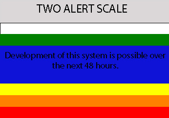
5:30pm TWO:
THE TROPICS HAVE BECOME A LITTLE MORE ACTIVE THIS AFTERNOON WITH
SEVERAL AREAS OF DISTURBED WEATHER. SATELLITE IMAGES AND SURFACE
OBSERVATIONS INDICATE THAT A BROAD AREA OF LOW PRESSURE HAS FORMED
IN THE NORTHWESTERN CARIBBEAN SEA...AND IS ACCOMPANIED BY A LARGE
AREA OF CLOUDINESS AND THUNDERSTORMS. THE LOW IS EXPECTED TO MOVE
NORTHWESTWARD OVER THE YUCATAN PENINSULA TONIGHT. UPPER-LEVEL WINDS
ARE FAVORABLE FOR SLOW DEVELOPMENT OF THIS SYSTEM AFTER IT EMERGES
OVER THE GULF OF MEXICO ON SUNDAY.
0 likes
-
Extremeweatherguy

- Category 5

- Posts: 11095
- Joined: Mon Oct 10, 2005 8:13 pm
- Location: Florida

Re:
Extremeweatherguy wrote:very interesting 5:30 TWO. Seems like the NHC is now a little more bullish on possible development.
Isn't this system supposed to move into the GOM rather quickly? I've heard Monday evening and 72 hours. What kinda time frame are we looking at to be rid of this thing (assuming it develops)
0 likes

Re: Invest 94L Recon Obs
C. 23/1630Z
D. 24.0N 91.0W
The initalized the models at 14z today before the POD as follows:
DISTURBANCE INVEST (AL942007) 20070922 1200 UTC
...00 HRS... ...12 HRS... ...24 HRS. .. ...36 HRS...
070922 1200 070923 0000 070923 1200 070924 0000
LAT LON LAT LON LAT LON LAT LON
BAMS 18.0N 85.5W 19.6N 87.5W 21.1N 89.5W 22.5N 91.0W
BAMD 18.0N 85.5W 19.7N 87.1W 21.4N 88.8W 23.3N 90.5W
BAMM 18.0N 85.5W 19.6N 87.3W 21.0N 89.1W 22.6N 90.8W
LBAR 18.0N 85.5W 19.7N 87.0W 21.9N 88.8W 24.3N 90.6W
SHIP 25KTS 31KTS 39KTS 46KTS
DSHP 25KTS 31KTS 27KTS 37KTS
This system is 48 hours form that position! That POD was made for the low in the middle of the GOM, but may end up flying into 94L.
0 likes

Re: INVEST 94L: Western Caribbean: Discussions & Images
It's interesting that strong TCs sometimes are nearly bone dry with catastrophic winds, while a sheared storm or wandering low can bring devastating rain. I call storms like WXman described "pumpers"
The biggest rain events I've seen seem to be weak TDs or STDs that just pump tropical air in the vicinity of a high/cold front.
When people hear Tropical Storm warnings, they should really think "rain danger" and forget about winds (except tornadoes of course).
The biggest rain events I've seen seem to be weak TDs or STDs that just pump tropical air in the vicinity of a high/cold front.
When people hear Tropical Storm warnings, they should really think "rain danger" and forget about winds (except tornadoes of course).
0 likes


Re: Re:
HollynLA wrote:Isn't this system supposed to move into the GOM rather quickly? I've heard Monday evening and 72 hours. What kinda time frame are we looking at to be rid of this thing (assuming it develops)
It looks like it will emerge in the Gulf of Mexico some time between 9 am and 1 pm on Sunday. It will then have approximately 44-56 hours over the Gulf before it reaches the Upper Texas coast--if it does--hitting some time on Tuesday. If it starts to slow down and turn to the west and south again, however, all bets are off.
0 likes
Re: INVEST 94L: Western Caribbean: Discussions & Images
What's the chance of a trough turn it NE? Is that far enough out that it will be pretty much TX/LA ?
0 likes
Re: INVEST 94L: Western Caribbean: Discussions & Images
Recurve wrote:What's the chance of a trough turn it NE? Is that far enough out that it will be pretty much TX/LA ?
I don't have a direct answer to your question, but the past week, and the past few years have taught us that nothing is certain in the tropics especially with systems that are only invests.
0 likes
-
Extremeweatherguy
- Category 5
- Posts: 11095
- Joined: Mon Oct 10, 2005 8:13 pm
- Location: Florida
I think the chance of this one turning NE is probably pretty small...but as RL3AO just said, anything is possible in the tropics. We will have a better idea come tomorrow and Monday. As of right now though, the highest threat area is Texas and Louisiana with no model currently showing a landfall east of the SW part of Louisiana.
0 likes
-
CYCLONE MIKE
- Category 5
- Posts: 2183
- Joined: Tue Aug 31, 2004 6:04 pm
- Location: Gonzales, LA
Re: INVEST 94L: Western Caribbean: Discussions & Images
Yeah, but lets remember td10, all models were showing sw la to ms and look where it went.. Could the blod in the se gulf continue moving nne and detach from the broad low and let more energy consolidate around the low and help it form?
0 likes
Re: INVEST 94L: Western Caribbean: Discussions & Images
Recurve wrote:When people hear Tropical Storm warnings, they should really think "rain danger" and forget about winds (except tornadoes of course).
Unless the storm decides to behave like Humberto. While not typical, of course, there is always the chance that a TS can blow up quickly when people aren't paying attention. Allison did a similar thing - became a TS when no one was looking. In Allison's case it was a rain event, but for the poor folks in the path of Humberto the wind did a lot of damage.
I think you're generally right that the danger from a TS will be primarily from rain. But you never know what one of these things will decide to do at the last minute, from a slight shift in one direction or the other, to rapid strengthening right before landfall. Always good to be prepared, etc., etc.
Back on topic....my local met said the water temps in the mid-GOM are warm enough to produce significant strengthening. Is that true?
0 likes

Re: INVEST 94L: Western Caribbean: Discussions & Images
jabman98 wrote:Recurve wrote:When people hear Tropical Storm warnings, they should really think "rain danger" and forget about winds (except tornadoes of course).
Unless the storm decides to behave like Humberto. While not typical, of course, there is always the chance that a TS can blow up quickly when people aren't paying attention. Allison did a similar thing - became a TS when no one was looking. In Allison's case it was a rain event, but for the poor folks in the path of Humberto the wind did a lot of damage.
I think you're generally right that the danger from a TS will be primarily from rain. But you never know what one of these things will decide to do at the last minute, from a slight shift in one direction or the other, to rapid strengthening right before landfall. Always good to be prepared, etc., etc.
Back on topic....my local met said the water temps in the mid-GOM are warm enough to produce significant strengthening. Is that true?
sst's are fine....however its the upper air dynamics that will decide what comes of this.....
http://wxmaps.org/pix/hurpot.html#ATL
0 likes
-
marcane_1973

- Category 1

- Posts: 330
- Age: 52
- Joined: Mon Jun 26, 2006 11:01 pm
- Location: N.C.
- Contact:
Re: INVEST 94L: Western Caribbean: Discussions & Images
Latest satellite shows this system is very disorganized and has alot of work to do if it wants to form into a TD. The most impressive feature in the Atlantic is the wave south of the Cape Verde islands.
0 likes
-
Matt-hurricanewatcher
Re: INVEST 94L: Western Caribbean: Discussions & Images
No the most impressive future is 95L. In which already looks like a tropical storm. As for this there is surface obs/buoys that show a possible LLC just off the coast of the Yucatan. But it should be inland in the next 6-8 hours.
0 likes
-
wxman57

- Moderator-Pro Met

- Posts: 23172
- Age: 68
- Joined: Sat Jun 21, 2003 8:06 pm
- Location: Houston, TX (southwest)
Re: Re:
vaffie wrote:HollynLA wrote:Isn't this system supposed to move into the GOM rather quickly? I've heard Monday evening and 72 hours. What kinda time frame are we looking at to be rid of this thing (assuming it develops)
It looks like it will emerge in the Gulf of Mexico some time between 9 am and 1 pm on Sunday. It will then have approximately 44-56 hours over the Gulf before it reaches the Upper Texas coast--if it does--hitting some time on Tuesday. If it starts to slow down and turn to the west and south again, however, all bets are off.
I'd say more like 24 hours from Sunday afternoon before it moves inland. It'll be racing NNW-N across the Gulf, embedded in the strong southerly winds east of the upper trof. Global models have it inland 48 hours from this afternoon/evening. Not a lot of time to organize, but could spin up an LLC before it moves inland Monday afternoon/evening.
0 likes
-
Brent
- S2K Supporter
- Posts: 38729
- Age: 37
- Joined: Sun May 16, 2004 10:30 pm
- Location: Tulsa Oklahoma
- Contact:
Re: INVEST 94L: Western Caribbean: Discussions & Images
I'm not that impressed with this. Looks like another rain event for TX/LA.
0 likes
-
Ed Mahmoud
Re: INVEST 94L: Western Caribbean: Discussions & Images
Brent wrote:I'm not that impressed with this. Looks like another rain event for TX/LA.
Just turned off the sprinkler, first time I watered the lawn all Summer, er, Fall.
0 likes

Re: INVEST 94L: Western Caribbean: Discussions & Images
Brent wrote:I'm not that impressed with this. Looks like another rain event for TX/LA.
Hasn't rained in Houston for about a week. I wouldn't mind a rainy day
0 likes
Who is online
Users browsing this forum: No registered users and 54 guests