OLGA'S remnants : Discussions & Images
Moderator: S2k Moderators
-
Evil Jeremy

- S2K Supporter

- Posts: 5463
- Age: 32
- Joined: Mon Apr 10, 2006 2:10 pm
- Location: Los Angeles, CA
-
wxman57

- Moderator-Pro Met

- Posts: 23172
- Age: 68
- Joined: Sat Jun 21, 2003 8:06 pm
- Location: Houston, TX (southwest)
Re:
Evil Jeremy wrote:If, and if, Olga survives the mountains and shear over the next 3 or so days, which is possible with the season we have had, I take it that Florida would need to begin watching Olga closely?
Nope, a very strong polar jet is building eastward into Florida. By 48 hours, westerly winds across the FL Peninsula will be 50-70 kts. By 72 hours they increase to 80-100 kts. Nothing could survive that.
0 likes
-
Evil Jeremy
- S2K Supporter
- Posts: 5463
- Age: 32
- Joined: Mon Apr 10, 2006 2:10 pm
- Location: Los Angeles, CA

Re: Tropical Storm OLGA in D.R : Discussions & Images
hypothetical
if olga was reforming NW what signs should we be looking for
and WXMAN i know you just want it to go away but one nite next season you gotta join in the "fun" and root for a nice fun fish to track with us.
if olga was reforming NW what signs should we be looking for
and WXMAN i know you just want it to go away but one nite next season you gotta join in the "fun" and root for a nice fun fish to track with us.
0 likes
-
AJC3

- Admin

- Posts: 4153
- Age: 62
- Joined: Tue Aug 31, 2004 7:04 pm
- Location: Ballston Spa, New York
- Contact:
Re: Tropical Storm OLGA in D.R : Discussions & Images
cpdaman wrote:hypothetical
if olga was reforming NW what signs should we be looking for
Well, for one thing, you would be looking for the 40 MPH winds at Puerto Plata, on the north central coast, (MDPP) to somehow magically flop around to a westerly component.
METAR MDPP 120300Z 08035KT 5000 +RA BKN016 OVC070 23/23 Q1010
METAR MDST 120300Z 06020KT 4000 RA BKN012 OVC070 22/22 Q1008
The surface center is clearly passing south of these sites.
0 likes
Re: Tropical Storm OLGA in D.R : Discussions & Images
with no reform
http://www.ssd.noaa.gov/goes/flt/t1/loop-ir2.html
looks like the center is about get chopped up
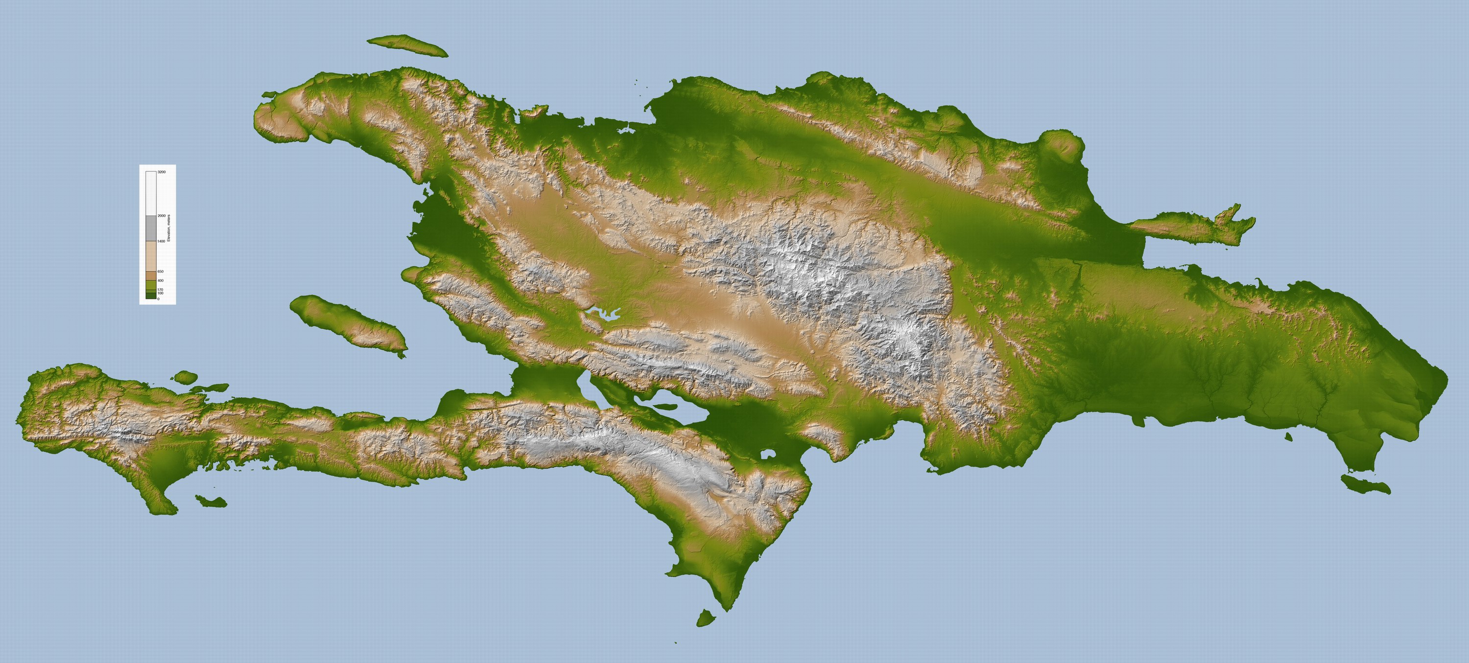
http://upload.wikimedia.org/wikipedia/c ... la_lrg.jpg
by these mountains
http://www.ssd.noaa.gov/goes/flt/t1/loop-ir2.html
looks like the center is about get chopped up
http://upload.wikimedia.org/wikipedia/c ... la_lrg.jpg
by these mountains
0 likes
-
Coredesat
Storm2k Disclaimer: The posts in this forum are NOT official forecasts and should not be used as such. They are just the opinion of the poster and may or may not be backed by sound meteorological data. They are NOT endorsed by any professional institution or storm2k.org. For official information, please refer to the NHC and NWS products.
CTCC Disclaimer: These products are unofficial and are not certified by any Regional Specialized Meteorological Centre, Tropical Cyclone Warning Centre, or any official forecasting agency and may be subject to large errors. Refer to their products for official updates.
-------------
Tropical Storm OLGA (17L)
NOTICE: I was unable to issue forecast 02 due to a technical issue with my computer. Position at 11/1500 was 18.3°N 67.9°W FAIR with intensity of 40 kt, pressure of 1005 hPa.
TIME: 0300 UTC 12 December 2007
FCST: 03
PSTN: 18.8°N 70.5°W POOR (0245Z GOES-10 IR2/IR4 loop)
WIND: 45 kt
PRES: 1004 hPa
MOVE: WNW 11 kt
Olga (17L) has transitioned to tropical based on wind measurements from Air Force reconnaissance aircraft. The maximum winds are closer to the center, but the system has become disrupted by interaction with the mountainous terrain of Hispaniola. Convection has been weakening at a fairly steady rate as the system moves westward to west-northwestward, although the low level circulation is still fairly well-defined on SSMI and SSMI-S 91GHz color imagery. Dvorak estimates are unavailable as the system is over land, but the center is located well to the northwest of its previous position, possibly due to relocation under the convection. Given that the system had strengthened earlier, but looks to have weakened now, the current intensity estimate is held at 45 knots.
The most recent model package seems to be insistent on a west to west-northwest track through the northern Caribbean over the next several days, and that is what this forecast will indicate. There does not seem to be anything in the short term that would affect the steering regime in the deep tropics. As for intensity, I forecast weakening in the previous package, I will forecast it again now, especially given that the system is beginning to become disorganized over land. At its current rate of weakening, there may not be much left of Olga by the time it reemerges over water west of Haiti. I am holding off on complete dissipation within the forecast period because the last couple of GFDL and HWRF intensity runs indicate the system surviving as at least a 30 knot tropical depression for the next 120 hours (and promptly stalling out in the central Caribbean).
12HR FCST: 19.2°N 72.8°W over land
WIND/PRES: 30 kt/1007 hPa
24HR FCST: 19.4°N 74.9°W
WIND/PRES: 30 kt/1008 hPa
36HR FCST: 19.5°N 77.1°W
WIND/PRES: 30 kt/1008 hPa
48HR FCST: 19.6°N 79.4°W
WIND/PRES: 30 kt/1009 hPa
Dissipating as a significant tropical cyclone over water
72HR FCST: 19.8°N 83.5°W
WIND/PRES: 25 kt/1009 hPa
Dissipating as a significant tropical cyclone over water
Next update: N/A
Next forecast: 1500 UTC 13 December 2007
Weaver
0 likes


-
Evil Jeremy
- S2K Supporter
- Posts: 5463
- Age: 32
- Joined: Mon Apr 10, 2006 2:10 pm
- Location: Los Angeles, CA
Please tell me that the ridge is not weakening, because that is what it looks like.
http://www.ssd.noaa.gov/goes/east/watl/loop-wv.html
http://www.ssd.noaa.gov/goes/east/watl/loop-wv.html
0 likes
-
Evil Jeremy
- S2K Supporter
- Posts: 5463
- Age: 32
- Joined: Mon Apr 10, 2006 2:10 pm
- Location: Los Angeles, CA
Re: Tropical Storm OLGA in D.R : Discussions & Images
Those who said "I bet we see a December storm" were right. Is this due to Nina conditions extending the season? We are in the 80's here all week.
We need the rain from this badly. This is yet another Caribbean storm that could have gone bigger if it hadn't hit land.
We need the rain from this badly. This is yet another Caribbean storm that could have gone bigger if it hadn't hit land.
0 likes

Re: Tropical Storm OLGA in D.R : Discussions & Images
I think we'll get rain from this due to the southerly flow out ahead of our weekend cold front. It will be just the leftover moisture though. I wish this was a widespread rain event.
0 likes
Re: Tropical Storm OLGA in D.R : Discussions & Images
A flat west track is odd for this climatological time. I have that same feeling that we'll get brushed by the rain.
0 likes
Re: Tropical Storm OLGA in D.R : Discussions & Images
The last time it rained was from Noel back in November.
0 likes
-
gatorcane

- S2K Supporter
- Posts: 23708
- Age: 48
- Joined: Sun Mar 13, 2005 3:54 pm
- Location: Boca Raton, FL
Re: Tropical Storm OLGA in D.R : Discussions & Images
boca I don't know why you keep saying we need rain. Along the coast of SE Palm Beach County the story is different...in fact it just rained a few hours ago 
0 likes

Re: Tropical Storm OLGA in D.R : Discussions & Images
The last time a storm named Olga formed was in 2001 and it was a late season storm too.
0 likes
doesn't the name OLGA just invoke thoughts of a real brute, some chick that won't go down w/o a fight  nite nite
beautiful summer like nite breezy down by the water
still can't wait for that cold front to plow thru sat nite
p.s it would make sense that olga formed late in the year, not the kinda letter we'll see in july
beautiful summer like nite breezy down by the water
still can't wait for that cold front to plow thru sat nite
p.s it would make sense that olga formed late in the year, not the kinda letter we'll see in july
0 likes
-
Derek Ortt
I said it is still subtropical for 2 reasons
1. I was about to leave for the SF Airport to fly back to Miami and didn't really want to be bothered by a change (I am at the apt now)
2. I did not want to change the recommended warnings from Gale and Storm to TS. Far too much confusion (besides, I like Gale and Storm better than TS anyways). If this is surviving once I get back to Miami and is at storm strength, I will change the classification.
0 likes
Who is online
Users browsing this forum: No registered users and 63 guests