Tropical Depression LORENZO: Discussions & Images

Moderator: S2k Moderators

Message
Author
User avatar
Ptarmigan
Category 5
Category 5
Posts: 5273
Joined: Wed Aug 16, 2006 9:06 pm

Re: INVEST 94L: Western Caribbean: Discussions & Images

#81 Postby Ptarmigan » Sat Sep 22, 2007 6:47 pm

wxman57 wrote:Just looking at the pattern of squalls, it reminds me very much of a "storm" that moved into Houston about 6 years ago. Anyone remember Alison? Alison formed a weak LLC that was sheared and exposed to the west of a massive area of squalls that extended from the upper TX coast all the way to the Yucatan. It didn't produce any wind when it came ashore (just TS force winds offshore) but it dropped 6-12" of rain on its first pass through Houston. This time, though, the remnant low should only make one pass through the area. Watch the MPEG below and pause it near the point when Alison's center is on the TX coast. Look at the squalls extending across the Gulf toward the Yucatan.

You can see the upper high on the east side, as indicated by the good outflow pattern in the east semicircle. But there's clearly a deep upper trof to the west. Exactly the pattern that's developing in the Gulf over the next 2 days.

ftp://eclipse.ncdc.noaa.gov/pub/isccp/b1/hurr/mpg/2001NAALL.mpg


I remember Allison well. Different situation in this case though. Allison was not even forecasted to develop. It was just a ULL to hit Louisiana.
0 likes   

User avatar
Extremeweatherguy
Category 5
Category 5
Posts: 11095
Joined: Mon Oct 10, 2005 8:13 pm
Location: Houston, TX

#82 Postby Extremeweatherguy » Sat Sep 22, 2007 6:51 pm

GFDL has now run for this system...it takes it NW and then turns it more WNW into south Texas.

Image

As for intensity: The SHIPS model..which assumes a slower motion..brings the system up to 66 knots by 96 hours. However, if it moves faster (like Wxman57 is predicting), then it would not have enough time to gain that much strength. The SHIPS model does still bring this up to 49 knots within 48 hours though, so a strong TS isn't out of the question. Assuming the SHIPS is a bit too high though, I would say 40-45 knots as landfall is a good bet if this does indeed develop. We will need to watch the speed and direction of this system very closely however. If it decides to move slower or take a longer route over water, then it may have the potential to get a bit stronger.
0 likes   

User avatar
Yankeegirl
Category 5
Category 5
Posts: 3417
Age: 48
Joined: Sun May 23, 2004 11:59 pm
Location: Cy-Fair, Northwest Houston
Contact:

Re: INVEST 94L: Western Caribbean: Discussions & Images

#83 Postby Yankeegirl » Sat Sep 22, 2007 7:21 pm

I dont like the LBAR.....But we do need some rain...
0 likes   

User avatar
HURAKAN
Professional-Met
Professional-Met
Posts: 46086
Age: 37
Joined: Thu May 20, 2004 4:34 pm
Location: Key West, FL
Contact:

#84 Postby HURAKAN » Sat Sep 22, 2007 7:21 pm

TWD 805:


A CARIBBEAN SEA TROPICAL WAVE IS ALONG 78W SOUTH OF 20N MOVING
WEST 15 KT. AN UPPER LEVEL LOW IS LOCATED E OF THE WAVE AXIS
NEAR 15N72W MASKING THE LOW LEVEL WAVE CURVATURE. ISOLATED
MODERATE CONVECTION IS WITHIN 60 NM OF THE AXIS. SCATTERED
MODERATE CONVECTION IS ALSO OVER E CUBA FROM 19N-21N BETWEEN
75W-77W.

THE CARIBBEAN SEA...
A TROPICAL WAVE IS ALONG 78W. SEE ABOVE. A BROAD AREA OF LOW
PRESSURE IS OVER THE YUCATAN PENINSULA NEAR 18N88W MOVING NW.
SURFACE LOW MAY DEVELOP OVER THE NEXT 24 HOURS. WIDELY
SCATTERED MODERATE CONVECTION IS FROM 15N-21N BETWEEN 85W-89W.
SCATTERED MODERATE TO ISOLATED STRONG CONVECTION IS FURTHER E
OVER CUBA FROM 21N-23N BETWEEN 78W-83W. SIMILAR CONVECTION IS
INLAND OVER N VENEZUELA FROM 6N-11N BETWEEN 68W-72W. SURFACE
TRADES ARE RELATIVELY LIGHT OVER THE CARIBBEAN SEA. IN THE
UPPER LEVELS... AN UPPER LEVEL HIGH IS OVER THE NW CARIBBEAN
NEAR 19N84W. AN UPPER LEVEL LOW IS OVER THE CENTRAL CARIBBEAN
NEAR 15N72W. EXPECT CONTINUED CONVECTION OVER THE W CARIBBEAN
AND CENTRAL AMERICA W OF 80W DURING THE NEXT 24 HOURS.
0 likes   

Smurfwicked
Tropical Storm
Tropical Storm
Posts: 160
Age: 39
Joined: Mon Sep 03, 2007 7:47 pm
Location: SETX

Re: INVEST 94L: Western Caribbean: Discussions & Images

#85 Postby Smurfwicked » Sat Sep 22, 2007 7:40 pm

From what I've seen models really have a drastic ( and I believe a more precise ) change once the storm develops... As far as the water temps goes, its not much of a difference in when Humberto went thru it.. And from what I've seen ( and I'm no expert ) you can't rule out anything thats in the gulf.
0 likes   

User avatar
cycloneye
Admin
Admin
Posts: 139756
Age: 67
Joined: Thu Oct 10, 2002 10:54 am
Location: San Juan, Puerto Rico

Re: INVEST 94L: Western Caribbean: Discussions & Images

#86 Postby cycloneye » Sat Sep 22, 2007 7:43 pm

Brent wrote:I'm not that impressed with this. Looks like another rain event for TX/LA.


The low pressure South of Cape Verde islands may develop well before 94L.
0 likes   

Ed Mahmoud

Re: INVEST 94L: Western Caribbean: Discussions & Images

#87 Postby Ed Mahmoud » Sat Sep 22, 2007 7:47 pm

cycloneye wrote:
Brent wrote:I'm not that impressed with this. Looks like another rain event for TX/LA.


The low pressure South of Cape Verde islands may develop well before 94L.


Maybe, but I'd bet a thousand quatloos no storm becoming a TC East of 50ºW this late in the year won't recurve out to sea well before the Lesser Antilles.
0 likes   

User avatar
Ptarmigan
Category 5
Category 5
Posts: 5273
Joined: Wed Aug 16, 2006 9:06 pm

Re: INVEST 94L: Western Caribbean: Discussions & Images

#88 Postby Ptarmigan » Sat Sep 22, 2007 8:11 pm

cycloneye wrote:
The low pressure South of Cape Verde islands may develop well before 94L.


That low south of CV should get an invest. One computer model has it developing into something tropical and heading towards Florida and GOM.
0 likes   

User avatar
ConvergenceZone
Category 5
Category 5
Posts: 4833
Joined: Fri Jul 29, 2005 1:40 am
Location: Northern California

Re: INVEST 94L: Western Caribbean: Discussions & Images

#89 Postby ConvergenceZone » Sat Sep 22, 2007 8:34 pm

Wow, it seems like everything that has a threat of developing either won't be a threat to land or will just end up as a tropical storm hitting land....I guess that's normal as we go into October, as conditions get a bit more unsettled with much more shear and unfavorable conditions....
0 likes   

User avatar
ConvergenceZone
Category 5
Category 5
Posts: 4833
Joined: Fri Jul 29, 2005 1:40 am
Location: Northern California

Re: INVEST 94L: Western Caribbean: Discussions & Images

#90 Postby ConvergenceZone » Sat Sep 22, 2007 8:36 pm

Ptarmigan wrote:
cycloneye wrote:
The low pressure South of Cape Verde islands may develop well before 94L.


That low south of CV should get an invest. One computer model has it developing into something tropical and heading towards Florida and GOM.


That's the only one I'm not quite sure about. Perhaps it will be the one that actually develops into something other than a tropical storm, but we've got a long time to watch this one to see what may happen....
0 likes   

User avatar
Starburst
S2K Supporter
S2K Supporter
Posts: 484
Joined: Sun Aug 28, 2005 11:03 pm
Location: Beeville, TX
Contact:

Re: INVEST 94L: Western Caribbean: Discussions & Images

#91 Postby Starburst » Sat Sep 22, 2007 8:38 pm

I see most discuss this area going into upper texas/LA but why are the models not showing this they all point to lower Texas near Mexico event.

Image
0 likes   

User avatar
Steve
S2K Supporter
S2K Supporter
Posts: 8611
Joined: Sat Apr 05, 2003 11:41 pm
Location: Not a state-caster

#92 Postby Steve » Sat Sep 22, 2007 8:39 pm

>>Maybe, but I'd bet a thousand quatloos no storm becoming a TC East of 50ºW this late in the year won't recurve out to sea well before the Lesser Antilles.

I'd take a double negative bet anyday. I'll PM you my paypal address. 8-)

Of this year's close-in systems, 94l might have the most moisture to work with so far. The environment looks juiced. I am sure some of #10's moisture and some of Ingrid are up in there. If it had time, I'd be a lot more worried about potential. I know some of the models want to drop it back toward the lower TX Coast or even into the BoC (eh.... maybe?) but that seems less likely than a low(?) quickly up to the TX Coast. {FWIW, the ECMWF and some of the GFS runs (particularly the ensembles) were pretty good with TD #10's ultimate track (a couple of degrees too far south).}

Looks like the FL Peninsula's getting some good rain out of this so far. http://www.goes.noaa.gov/HURRLOOPS/gulfir.html
0 likes   

User avatar
Tampa Bay Hurricane
Category 5
Category 5
Posts: 5596
Age: 36
Joined: Fri Jul 22, 2005 7:54 pm
Location: St. Petersburg, FL

#93 Postby Tampa Bay Hurricane » Sat Sep 22, 2007 8:40 pm

moisture with this streaming to its north so areas
north of the track get the heaviest rain/weather.
0 likes   

Ed Mahmoud

Re:

#94 Postby Ed Mahmoud » Sat Sep 22, 2007 9:01 pm

Steve wrote:>>Maybe, but I'd bet a thousand quatloos no storm becoming a TC East of 50ºW this late in the year won't recurve out to sea well before the Lesser Antilles.

I'd take a double negative bet anyday. I'll PM you my paypal address. 8-)

Of this year's close-in systems, 94l might have the most moisture to work with so far. The environment looks juiced. I am sure some of #10's moisture and some of Ingrid are up in there. If it had time, I'd be a lot more worried about potential. I know some of the models want to drop it back toward the lower TX Coast or even into the BoC (eh.... maybe?) but that seems less likely than a low(?) quickly up to the TX Coast. {FWIW, the ECMWF and some of the GFS runs (particularly the ensembles) were pretty good with TD #10's ultimate track (a couple of degrees too far south).}

Looks like the FL Peninsula's getting some good rain out of this so far. http://www.goes.noaa.gov/HURRLOOPS/gulfir.html


Um, I think you know what I meant...
0 likes   

Brent
S2K Supporter
S2K Supporter
Posts: 37146
Age: 35
Joined: Sun May 16, 2004 10:30 pm
Location: Tulsa Oklahoma
Contact:

Re: INVEST 94L: Western Caribbean: Discussions & Images

#95 Postby Brent » Sat Sep 22, 2007 9:28 pm

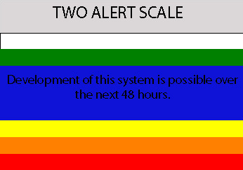
10:30pm TWO:

THE BROAD AREA OF LOW PRESSURE OVER THE NORTHWESTERN CARIBBEAN SEA
AND THE YUCATAN PENINSULA HAS CHANGED LITTLE IN ORGANIZATION DURING
THE PAST FEW HOURS...AND CONTINUES TO BE ACCOMPANIED BY A LARGE
AREA OF CLOUDINESS AND THUNDERSTORMS. UPPER-LEVEL WINDS
ARE FAVORABLE FOR SOME DEVELOPMENT WHEN THE LOW EMERGES
OVER THE GULF OF MEXICO WITHIN THE NEXT 24 HOURS.
0 likes   

RL3AO
Moderator-Pro Met
Moderator-Pro Met
Posts: 16308
Joined: Thu Jun 14, 2007 10:03 pm
Location: NC

#96 Postby RL3AO » Sat Sep 22, 2007 9:29 pm

Image
0 likes   

User avatar
hurricanetrack
HurricaneTrack.com
HurricaneTrack.com
Posts: 1776
Joined: Tue Dec 02, 2003 10:46 pm
Location: Wilmington, NC
Contact:

Re: INVEST 94L: Western Caribbean: Discussions & Images

#97 Postby hurricanetrack » Sat Sep 22, 2007 9:30 pm

ConvergenceZone wrote:Wow, it seems like everything that has a threat of developing either won't be a threat to land or will just end up as a tropical storm hitting land....I guess that's normal as we go into October, as conditions get a bit more unsettled with much more shear and unfavorable conditions....


We can't get much more shear and unfavorable conditions than what we just went through here at the peak of the hurricane season. That was (and still is) quite bad for a hurricane season promoted to be such an active one. Perhaps the pattern is about to change and we will see a 15-25 day period of favorable conditions across a broader area.
0 likes   

User avatar
HollynLA
S2K Supporter
S2K Supporter
Posts: 836
Joined: Sat Aug 28, 2004 10:36 pm
Location: South Louisiana

Re: INVEST 94L: Western Caribbean: Discussions & Images

#98 Postby HollynLA » Sat Sep 22, 2007 9:40 pm

Starburst wrote:I see most discuss this area going into upper texas/LA but why are the models not showing this they all point to lower Texas near Mexico event.

Image


Yeah, I've wondered the same thing. Leave Louisiana out of this unless something changes. I don't think this system will amount to much anyway since it won't have enough time.
0 likes   

jaxfladude
Category 5
Category 5
Posts: 1246
Joined: Wed Aug 24, 2005 9:36 pm
Location: Jacksonville, Fla

Re: INVEST 94L: Yucatan / GOM: Discussions & Images

#99 Postby jaxfladude » Sat Sep 22, 2007 9:43 pm

Is not great the season is now on the decline....??? :D
0 likes   

User avatar
HollynLA
S2K Supporter
S2K Supporter
Posts: 836
Joined: Sat Aug 28, 2004 10:36 pm
Location: South Louisiana

Re: INVEST 94L: Yucatan / GOM: Discussions & Images

#100 Postby HollynLA » Sat Sep 22, 2007 9:47 pm

jaxfladude wrote:Is not great the season is now on the decline....??? :D


Well, it should be on the decline, but it doesn't seem to be working out that way :grr:
0 likes   


Return to “2007”

Who is online

Users browsing this forum: No registered users and 2 guests