Invest 99L:Off E Coast-Discussions

Moderator: S2k Moderators

Message
Author
User avatar
coriolis
Retired Staff
Retired Staff
Posts: 8314
Joined: Wed Feb 05, 2003 10:58 pm
Location: Muncy, PA

Re:

#981 Postby coriolis » Wed Sep 05, 2007 6:11 pm

cycloneye wrote:Dont worrie anymore about bad things here. :)


Mildred is gone, thanks to Luis.
0 likes   

User avatar
cycloneye
Admin
Admin
Posts: 145366
Age: 68
Joined: Thu Oct 10, 2002 10:54 am
Location: San Juan, Puerto Rico

Re: Invest 99L,Off U.S.E.Coast: Discussions-Analysis & Imagery

#982 Postby cycloneye » Wed Sep 05, 2007 6:18 pm

Wthrman13 wrote:
ConvergenceZone wrote:Thanx for the heads up! I hope they get that trash off this board. I'm at work and thank god I didn't open that link...


I did open the link because I wasn't paying attention (I really should have known better, but sometimes things just slip), and I thank God that my officemate wasn't looking over at the time! :oops:

Of course, the poster is probably laughing their rear off right now...


I guess that person is out of here. :) Ok lets go to the topic in hand.
0 likes   

PhillyWX
Category 1
Category 1
Posts: 494
Joined: Tue Aug 30, 2005 8:54 am
Location: Philly
Contact:

Re: Re:

#983 Postby PhillyWX » Wed Sep 05, 2007 6:23 pm

Wthrman13 wrote:It never fails to amaze me (and I'm not just singling you out here) how people will follow every single short-term trend of a system. I've seen these threads go from, "Oh my! This thing is clearly tropical, why won't the NHC upgrade it!?" to "It's dead Jim, stick a fork in it", etc. etc. at the drop of a hat.

Clearly the system is not developing right now. Earlier it looked like it was beginning to take on more tropical characteristics, but the UL trough has been hanging tough to it's immediate NW. However, there is very good reason to suspect that this will change over the next day or so. I would caution people to just take a deep breath and not hammer on every single short term trend and extrapolate it in an unwarranted manner. If you notice, most of the pro mets on this board are very conservative when it comes to forecasting trends of tropical systems. There is a reason for this, and it's simply that short term trends in tropical systems can change very quickly, and simple extrapolation just does not work most of the time. I humbly suggest that more people follow this philosophy.


I remember this happening to with every single wobble that Dean or Felix took to the north. When either storm wobbled it was "OMG it's a threat to (insert your US location of choice here) now...here's the northward turn that the GFDL has been calling for!" With any event in weather, you have to look at the trend over several hours if not a day or so.

I'm willing to give this 24-36 more hours before I write it off. The shear has persisted longer than I expected but until the storm has no chance to develop (and it still has a good chance) we can't get all fixated on what is happening at this very second.
0 likes   

User avatar
brunota2003
S2K Supporter
S2K Supporter
Posts: 9476
Age: 34
Joined: Sat Jul 30, 2005 9:56 pm
Location: Stanton, KY...formerly Havelock, NC
Contact:

#984 Postby brunota2003 » Wed Sep 05, 2007 6:26 pm

D-Max is just a few hours away, right? Ought to make things interesting and un-"dead"ish again.
0 likes   

TheShrimper
Category 2
Category 2
Posts: 516
Joined: Sun Aug 01, 2004 5:05 pm

Re: Invest 99L,Off U.S.E.Coast: Discussions-Analysis & Imagery

#985 Postby TheShrimper » Wed Sep 05, 2007 6:27 pm

Luis, I hope for the boards sake you are right. But she is rather cunning and hard headed. If she posts again, you have my word, I will personally see that she doesn't do so again. What happens on Pine Island, stays on Pine Island, the long standing rule. I do not like seeing myself on the net. I will take care of this matter. TheShrimper. End of discussion.
0 likes   

User avatar
WindRunner
Category 5
Category 5
Posts: 5806
Age: 34
Joined: Fri Jul 29, 2005 8:07 pm
Location: Warrenton, VA, but Albany, NY for school
Contact:

#986 Postby WindRunner » Wed Sep 05, 2007 6:32 pm

If I may, some other good reasons why the NHC did not upgrade . . . other than the marginal reports from the recon flight . . .

1. AMSU data.
Image

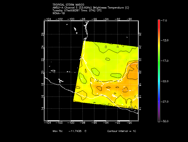
The above AMSU overpass from 1742z today shows that the system is still cold-core at the mid-levels (the map above shows the 550hPa level). Other maps of higher altitudes show a continuing, though less significant, cold core (both 350hPa and 200hPa). However, when compared to the passes from this morning, yesterday evening, and yesterday morning, the system's core is slowly warming with the 550hPa temperature gradient slowly weakening. At higher levels, the cold core has strengthened over the same time period which, while certainly not an end-all in determining the tropical nature of a system, is certainly not one of the better things to see.
(To see all images, view here courtesy of CIMSS.)

2. Structure.
I'm sure you have all been watching this aspect, but it is a highly sheared system which is forecast to move into a better environment over the next 48 hours . . . hence, if it survives this, it will develop and be named in time to issue official warnings as necessary. If it doesn't survive the current conditions, then we won't be naming a highly questionable system and providing a false alarm to the coastal areas in the southeast. While the overall change in structure today has been fairly little, this does show its potentcy and potential for the future . . . however, it did not and does not bode well for development tonight.

3. Phase-space diagrams
GFDL: http://moe.met.fsu.edu/cyclonephase/gfd ... 512/2.html
HWRF: http://moe.met.fsu.edu/cyclonephase/hwr ... 512/4.html
GFS: http://moe.met.fsu.edu/cyclonephase/gfs ... 12/16.html
NAM: http://moe.met.fsu.edu/cyclonephase/nam ... 512/2.html
CMC: http://moe.met.fsu.edu/cyclonephase/cmc ... 12/20.html

All show a borderline to weakly warm core cyclone at present time, yet all show some amount of deepening and an increase in the core temperature. Some show little development with this relatively brief tropical transition (i.e. GFS), other show significantly more deepening with a similar transition (HWRF, GFDL), and others show a respectable amount of deepening along with a significant tropical transition (NAM, CMC). Regardelss, all show it becoming a better candidate for upgrading in the future, so why rush things? We all know how the NHC works on the conservative side when it comes to upgrading systems, but this would be a stretch by any play of the imagination and data at this point, hence there should be no surprise as to the lack of an upgrade at 5pm or at any time until the data significantly changes.
0 likes   

Cyclone1
Category 5
Category 5
Posts: 2739
Age: 33
Joined: Tue Jun 12, 2007 12:03 pm
Location: Florida

Re: Invest 99L,Off U.S.E.Coast: Discussions-Analysis & Imagery

#987 Postby Cyclone1 » Wed Sep 05, 2007 6:32 pm

TheShrimper wrote:Luis, I hope for the boards sake you are right. But she is rather cunning and hard headed. If she posts again, you have my word, I will personally see that she doesn't do so again. What happens on Pine Island, stays on Pine Island, the long standing rule. I do not like seeing myself on the net. I will take care of this matter. TheShrimper. End of discussion.


If she posts again, she may just [ img]URL[/img ] it instead of linking it.

Or maybe I just gave her that idea...
0 likes   

User avatar
Tampa Bay Hurricane
Category 5
Category 5
Posts: 5597
Age: 37
Joined: Fri Jul 22, 2005 7:54 pm
Location: St. Petersburg, FL

#988 Postby Tampa Bay Hurricane » Wed Sep 05, 2007 6:33 pm

99l will become gabrielle and will get strong over the
gulf stream.
0 likes   

User avatar
hial2
S2K Supporter
S2K Supporter
Posts: 809
Joined: Fri Oct 10, 2003 9:20 pm
Location: Indian trail N.C.

Re: Invest 99L,Off U.S.E.Coast: Discussions-Analysis & Imagery

#989 Postby hial2 » Wed Sep 05, 2007 6:39 pm

Cyclone1 wrote:
TheShrimper wrote:Luis, I hope for the boards sake you are right. But she is rather cunning and hard headed. If she posts again, you have my word, I will personally see that she doesn't do so again. What happens on Pine Island, stays on Pine Island, the long standing rule. I do not like seeing myself on the net. I will take care of this matter. TheShrimper. End of discussion.


If she posts again, she may just [ img]URL[/img ] it instead of linking it.

Or maybe I just gave her that idea...


For those of us that missed this,what happened?? Did someone unleash some sort of virus in an attachement??
0 likes   

Cyclone1
Category 5
Category 5
Posts: 2739
Age: 33
Joined: Tue Jun 12, 2007 12:03 pm
Location: Florida

Re: Invest 99L,Off U.S.E.Coast: Discussions-Analysis & Imagery

#990 Postby Cyclone1 » Wed Sep 05, 2007 6:42 pm

hial2 wrote:
Cyclone1 wrote:
TheShrimper wrote:Luis, I hope for the boards sake you are right. But she is rather cunning and hard headed. If she posts again, you have my word, I will personally see that she doesn't do so again. What happens on Pine Island, stays on Pine Island, the long standing rule. I do not like seeing myself on the net. I will take care of this matter. TheShrimper. End of discussion.


If she posts again, she may just [ img]URL[/img ] it instead of linking it.

Or maybe I just gave her that idea...


For those of us that missed this,what happened?? Did someone unleash some sort of virus in an attachement??


stuff.
0 likes   

User avatar
cycloneye
Admin
Admin
Posts: 145366
Age: 68
Joined: Thu Oct 10, 2002 10:54 am
Location: San Juan, Puerto Rico

Re: Invest 99L,Off U.S.E.Coast: Discussions-Analysis & Imagery

#991 Postby cycloneye » Wed Sep 05, 2007 6:43 pm

:uarrow: I think the theme is 99L.
0 likes   

Cyclone1
Category 5
Category 5
Posts: 2739
Age: 33
Joined: Tue Jun 12, 2007 12:03 pm
Location: Florida

Re: Invest 99L,Off U.S.E.Coast: Discussions-Analysis & Imagery

#992 Postby Cyclone1 » Wed Sep 05, 2007 6:45 pm

cycloneye wrote::uarrow: I think the theme is 99L.

Yeah, I was just answering a question. Back on topic, right.
0 likes   

fasterdisaster
Category 5
Category 5
Posts: 1868
Joined: Mon Sep 19, 2005 4:41 pm
Location: Miami, Florida

#993 Postby fasterdisaster » Wed Sep 05, 2007 6:46 pm

WR, it may be true that this storm is subtropical, but so? The NHC should have at the VERY(and I mean VERY) least have done a Subtropical Depression Advisory.
0 likes   

User avatar
ronjon
Category 5
Category 5
Posts: 4822
Joined: Fri Aug 19, 2005 5:17 pm
Location: Hernando Beach, FL

Re: Invest 99L,Off U.S.E.Coast: Discussions-Analysis & Imagery

#994 Postby ronjon » Wed Sep 05, 2007 6:47 pm

System looks to have stalled or drifting west - it certainly isn't jugging east anymore - I place the center at 29.5N-70.5W. Shear has already dropped off to its west so if the trend persists - and that's what the models are saying - it would gradually become better organized over the next 24 hrs and may actually rapidly deepen when shear drops below 10 kts.

http://www.ssd.noaa.gov/goes/flt/t3/loop-ir2.html
0 likes   

User avatar
cycloneye
Admin
Admin
Posts: 145366
Age: 68
Joined: Thu Oct 10, 2002 10:54 am
Location: San Juan, Puerto Rico

Re: Invest 99L,Off U.S.E.Coast: Discussions-Analysis & Imagery

#995 Postby cycloneye » Wed Sep 05, 2007 6:48 pm

Speaking of 99L.if anyone noticed,two models in the 18z run GFS and GFDL are a little more east than in past runs.That may be a trend towards less threat to the East Coast,as long the low continues to drift more ENE.
0 likes   

User avatar
wxman57
Moderator-Pro Met
Moderator-Pro Met
Posts: 22979
Age: 67
Joined: Sat Jun 21, 2003 8:06 pm
Location: Houston, TX (southwest)

Re:

#996 Postby wxman57 » Wed Sep 05, 2007 6:48 pm

Derek Ortt wrote:as I said, we can look forward to a full day of "it's dead" posts

None of the models even had this intensifying until late tomorrow and Friday


Exactly what I was thinking, Derek, as I read through pages 46-49 after coming home. The real development threat isn't until Friday and Saturday when shear relaxes.
0 likes   

User avatar
punkyg
Category 2
Category 2
Posts: 770
Joined: Mon Apr 23, 2007 7:37 pm
Location: sanford florida

#997 Postby punkyg » Wed Sep 05, 2007 6:48 pm

Right now i think this system won't develop until atleast tomorrow night cause of it poor appearance.
0 likes   

Coredesat

Re:

#998 Postby Coredesat » Wed Sep 05, 2007 6:57 pm

WindRunner wrote:If I may, some other good reasons why the NHC did not upgrade . . . other than the marginal reports from the recon flight . . .


Excellent discussion, although it doesn't seem to have reached people. This is not even a subtropical system yet until that cold core is gone; a weak low-level warm core is not enough.
0 likes   

User avatar
deltadog03
Professional-Met
Professional-Met
Posts: 3580
Joined: Tue Jul 05, 2005 6:16 pm
Location: Macon, GA

#999 Postby deltadog03 » Wed Sep 05, 2007 7:12 pm

You know whats funny is that some say this is slacking and might not develop. Well, I think derek and wxman and maybe others, said that this is not suppose to develop until tom. or friday. Its funny to think that most models show this shear actually turning around and really providing an outflow channel/ ridge over the top. So, what I am saying is that, when this gets goinging it could do so in a BIG hurry!
0 likes   

User avatar
webke
S2K Supporter
S2K Supporter
Posts: 290
Age: 69
Joined: Sun Sep 05, 2004 12:39 pm
Location: North Myrtle Beach SC

Re: Re:

#1000 Postby webke » Wed Sep 05, 2007 7:20 pm

wxman57 wrote:
Derek Ortt wrote:as I said, we can look forward to a full day of "it's dead" posts

None of the models even had this intensifying until late tomorrow and Friday


Exactly what I was thinking, Derek, as I read through pages 46-49 after coming home. The real development threat isn't until Friday and Saturday when shear relaxes.


Lets give the Met's a benefit of a doubt, I can and I will as this system could have an impact on where I live. As the Met's say now it is time to have patience and wait.
0 likes   


Return to “2007”

Who is online

Users browsing this forum: No registered users and 14 guests