

ATL: PALOMA - Tropical Depression - Discussion
Moderator: S2k Moderators
-
Derek Ortt
-
wxman57

- Moderator-Pro Met

- Posts: 23172
- Age: 68
- Joined: Sat Jun 21, 2003 8:06 pm
- Location: Houston, TX (southwest)
Re:
Derek Ortt wrote:I'm not sure there is a TD yet. I do not see a well-defined center on satellite and recon so far is not that impressive
Probably will need a pressure of 1003-1000mb before this becomes a TD
Question is - would the NHC downgrade a depression to a remnant low if it looked like this with convection over the center and 20-30 kt winds around it? Surface obs show a well-defined low center. And it is increasing in organization. I can't see the NHC not calling this Seventeen in the next few hours.
0 likes


-
gatorcane

- S2K Supporter

- Posts: 23708
- Age: 48
- Joined: Sun Mar 13, 2005 3:54 pm
- Location: Boca Raton, FL
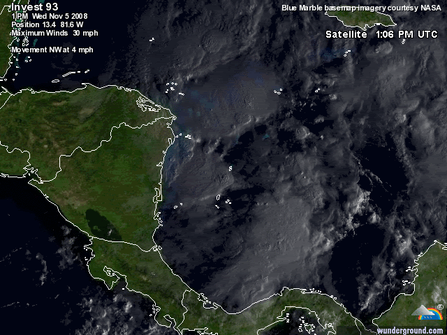
There is about 0 shear over 93L at the moment, maybe some light SW shear but virtually none. A large anticyclone continues to build right on top of 93L as shown by the symmetric "fanning" of the high cloud tops around the center.
It shows November can produce some nasty systems:

It shows November can produce some nasty systems:
Last edited by gatorcane on Wed Nov 05, 2008 3:18 pm, edited 1 time in total.
0 likes
-
wxman57
- Moderator-Pro Met
- Posts: 23172
- Age: 68
- Joined: Sat Jun 21, 2003 8:06 pm
- Location: Houston, TX (southwest)
Re: ATL: Invest 93L - TWO "TD may be forming"
Model guidance now says "Seventeen" vs. "Invest".
0 likes
-
Blown Away

- S2K Supporter
- Posts: 10253
- Joined: Wed May 26, 2004 6:17 am
Re: ATL: Invest 93L - TWO "TD may be forming"
So what happens to 93L if it misses the trough coming down this weekend?
0 likes
-
cycloneye

- Admin

- Posts: 149275
- Age: 69
- Joined: Thu Oct 10, 2002 10:54 am
- Location: San Juan, Puerto Rico
ATL: Invest 93L -invest_RENUMBER_al932008_al172008.ren
We have TD 17:
invest_RENUMBER_al932008_al172008.ren
invest_RENUMBER_al932008_al172008.ren
0 likes
-
cycloneye
- Admin
- Posts: 149275
- Age: 69
- Joined: Thu Oct 10, 2002 10:54 am
- Location: San Juan, Puerto Rico
Re: ATL: Invest 93L -invest_RENUMBER_al932008_al172008.ren
AL, 17, 2008110518, , BEST, 0, 137N, 816W, 25, 1004, TD,
0 likes
-
wxman57
- Moderator-Pro Met
- Posts: 23172
- Age: 68
- Joined: Sat Jun 21, 2003 8:06 pm
- Location: Houston, TX (southwest)
Re: ATL: Invest 93L - TWO "TD may be forming"
Blown_away wrote:So what happens to 93L if it misses the trough coming down this weekend?
This thread gets a lot longer.
0 likes
Re: ATL: Invest 93L -invest_RENUMBER_al932008_al172008.ren
Convection symmetry suggests strengthening.
0 likes
-
gatorcane
- S2K Supporter
- Posts: 23708
- Age: 48
- Joined: Sun Mar 13, 2005 3:54 pm
- Location: Boca Raton, FL
Looks like NHC is respecting the models that want to stall/slow TD 17:
5:00PM EST Discussion snippet:
E.G. MITCH OR WILMA...AND THE MODELS CAN
BE TOO QUICK TO EJECT THESE SYSTEMS OUT OF THE CARIBBEAN. WE'RE
GOING TO LEAN TOWARD THE SLOWER GUIDANCE AT THIS TIME...AND THE NHC
FORECAST IS A BIT BEHIND THE DYNAMICAL MODEL CONSENSUS
5:00PM EST Discussion snippet:
E.G. MITCH OR WILMA...AND THE MODELS CAN
BE TOO QUICK TO EJECT THESE SYSTEMS OUT OF THE CARIBBEAN. WE'RE
GOING TO LEAN TOWARD THE SLOWER GUIDANCE AT THIS TIME...AND THE NHC
FORECAST IS A BIT BEHIND THE DYNAMICAL MODEL CONSENSUS
0 likes
-
Blown Away
- S2K Supporter
- Posts: 10253
- Joined: Wed May 26, 2004 6:17 am
Re: ATL: Invest 93L - TWO "TD may be forming"
wxman57 wrote:Blown_away wrote:So what happens to 93L if it misses the trough coming down this weekend?
This thread gets a lot longer.
Thanks, I needed a good afternoon laugh!!
0 likes

Re: ATL: Invest 93L - TWO "TD may be forming"
Blown_away wrote:So what happens to 93L if it misses the trough coming down this weekend?
what are the chances of this?
0 likes
-
Derek Ortt
Who is online
Users browsing this forum: No registered users and 25 guests