ATL: Invest 97L in Central Atlantic
Moderator: S2k Moderators
-
cheezyWXguy

- Category 5

- Posts: 6281
- Joined: Mon Feb 13, 2006 12:29 am
- Location: Dallas, TX
Re: Ex 97L in East Atlantic
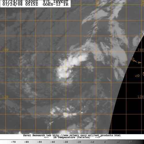
My God I cant believe its coming back...convection appears to be on the increase, and the storm appears to still be moving wsw. This could get interesting about 2-3 days from now.
0 likes


Re: Ex 97L in East Atlantic
njweather wrote:Does anyone know where this system is centered (if it has one)?
The entire system seems to be moving steadily WSW, and if it continues, will be well below 15N.
Earliest pass
http://manati.orbit.nesdis.noaa.gov/dat ... Bas124.png
Latest pass but still pretty old.
http://manati.orbit.nesdis.noaa.gov/dat ... Bds124.png
Looks a little better organized on the later pass.
0 likes
Re: Ex 97L in East Atlantic
tailgater wrote:njweather wrote:Does anyone know where this system is centered (if it has one)?
The entire system seems to be moving steadily WSW, and if it continues, will be well below 15N.
Earliest pass
http://manati.orbit.nesdis.noaa.gov/dat ... Bas124.png
Latest pass but still pretty old.
http://manati.orbit.nesdis.noaa.gov/dat ... Bds124.png
Looks a little better organized on the later pass.
The earlier pass is a little unclear.
Based on those images, how south do you think it has moved?
0 likes
-
HurricaneHunter914
- Category 5
- Posts: 4439
- Age: 32
- Joined: Fri Mar 10, 2006 7:36 pm
- Location: College Station, TX
Re:
curtadams wrote:Nogaps and UKM think it will turn into an open wave tomorrow. GFS thinks it'll turn into a remnant low and die. None see any revelopment. So the models are pretty pessimistic.
After Dolly, I'm kinda hoping we have a nice long lull, till August. Those models can be as pessimistic as they want.
0 likes

Its still got a good circlation and its still firing convection. Models aren't al lthat good, lets remember several turned Bertha into an open wave when it was a cat-3!
Once it reaches warmer waters around 40W then we should see convection flare up more and more, its just got to survive till then.
Once it reaches warmer waters around 40W then we should see convection flare up more and more, its just got to survive till then.
0 likes
-
HURAKAN

- Professional-Met

- Posts: 46084
- Age: 39
- Joined: Thu May 20, 2004 4:34 pm
- Location: Key West, FL
- Contact:
TROPICAL WEATHER OUTLOOK
NWS TPC/NATIONAL HURRICANE CENTER MIAMI FL
200 AM EDT THU JUL 24 2008
FOR THE NORTH ATLANTIC...CARIBBEAN SEA AND THE GULF OF MEXICO...
THE NATIONAL HURRICANE CENTER IS ISSUING ADVISORIES ON TROPICAL
STORM DOLLY...CENTERED INLAND ABOUT 75 MILES NORTHWEST OF
BROWNSVILLE TEXAS.
A BROAD AREA OF LOW PRESSURE...ASSOCIATED WITH A LARGE
WESTWARD-MOVING TROPICAL WAVE...IS LOCATED OVER THE TROPICAL
EASTERN ATLANTIC ABOUT 600 MILES WEST OF THE CAPE VERDE
ISLANDS. SIGNIFICANT DEVELOPMENT OF THIS SYSTEM IS NOT EXPECTED
DURING THE NEXT COUPLE OF DAYS.
ELSEWHERE...TROPICAL CYCLONE FORMATION IS NOT EXPECTED DURING THE
NEXT 48 HOURS.
$$
FORECASTER KNABB
0 likes
Re: Ex 97L in East Atlantic
I'm not entirely sure why this would be an "ex" invest. Circulation is still there. We've seen far worse invests. They jumped the gun on it while it was still in Africa, and now they are jumping the gun on it predicting its demise, IMO.
0 likes
-
Blown Away

- S2K Supporter

- Posts: 10253
- Joined: Wed May 26, 2004 6:17 am
Re: Ex 97L in East Atlantic
Ex 97L's circulation still looks good. Shooting west across the Atlantic near 15N. IMO, if 97L stays at or below 15N after reaching 50W then it will be a potential player for the islands. Maybe we will have 98L forming just to the SE of ex 97L today.
http://www.ssd.noaa.gov/PS/TROP/DATA/RT ... -loop.html
http://www.ssd.noaa.gov/PS/TROP/DATA/RT ... -loop.html
0 likes
-
HURAKAN
- Professional-Met
- Posts: 46084
- Age: 39
- Joined: Thu May 20, 2004 4:34 pm
- Location: Key West, FL
- Contact:

Very circulation still present.
Loop: http://www.nrlmry.navy.mil/tc-bin/tc_ho ... PE=Instant
Quite an impressive little circulation considering the environmental factors around.
0 likes
-
DESTRUCTION5

- Category 5
- Posts: 4430
- Age: 44
- Joined: Wed Sep 03, 2003 11:25 am
- Location: Stuart, FL
-
Ed Mahmoud
Re: Ex 97L in East Atlantic
Bastardi says MJO phase now rather unfavorable for development in the Atlantic currently. He notes Indian Ocean and WestPac are the hot spots for development now.
To quote just a small snippet of JB so as not to violate my pay-per-view terms of service:
To quote just a small snippet of JB so as not to violate my pay-per-view terms of service:
It also means that in the tropics we have a major SEOTA... Subsidence Event Of The Age.
0 likes
-
Rincon
- S2K Supporter
- Posts: 19
- Joined: Tue May 20, 2008 1:39 pm
- Location: Rincon, Puerto Rico
- Contact:
Re: Ex 97L in East Atlantic
Just saw 97L back on NRL.. Maybe an error or it is back???? Not sure 
0 likes


Re: Ex 97L in East Atlantic
Yep, 97L on NRL. Looks like this invest is back from the grave.
It actually would have been better if it had simply developed right out of the gate since it would have almost certainly gone fishing. If it can fire and sustain some convection over that circulation, it could not only develop, but threaten land as well.
It actually would have been better if it had simply developed right out of the gate since it would have almost certainly gone fishing. If it can fire and sustain some convection over that circulation, it could not only develop, but threaten land as well.
0 likes
Re: Ex 97L in East Atlantic
What this does will tell you a lot about the tropical conditions in the Atlantic.
0 likes

-
HouTXmetro

- Category 5
- Posts: 3949
- Joined: Sun Jun 13, 2004 6:00 pm
- Location: District of Columbia, USA
Who is online
Users browsing this forum: No registered users and 49 guests