Australian Government Bureau of Meteorology
Northern Territory
Darwin Regional Forecasting Centre
PRIORITY
Media: The Standard Emergency Warning Signal should NOT be used with this
warning.
TROPICAL CYCLONE WATCH
TROPICAL CYCLONE ADVICE NUMBER 8
Issued by the BUREAU OF METEOROLOGY, DARWIN
at 10:50 am CST [10:20 am WDT] Friday 29 February 2008
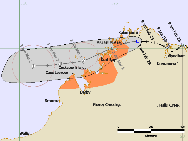
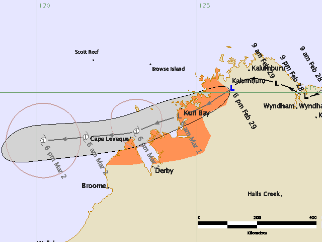
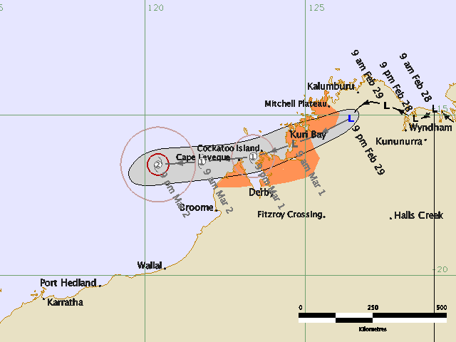
A Cyclone WATCH is current for coastal and island communities from Cape Leveque
to Mitchell Plateau in Western Australia.
At 9:30 am CST [9:00 am WDT] a Tropical Low was estimated to be 105 kilometres
east southeast of Kalumburu and 180 kilometres northwest of Kununurra and moving
west northwest at 9 kilometres per hour.
The tropical low is expected to move to the west across the north Kimberley
region today. The low is not expected to develop into a TROPICAL CYCLONE in the
Joseph Bonaparte Gulf, but may develop once it moves off the west Kimberley
coast on Saturday night or Sunday. GALES are not expected in coastal areas
within the next 24 hours, however gales could develop later.
Details of Tropical Low at 9:30 am CST [9:00 am WDT]:
.Centre located near...... 14.7 degrees South 127.5 degrees East
.Location accuracy........ within 37 kilometres
.Recent movement.......... towards the west northwest at 9 kilometres per hour
.Wind gusts near centre... 85 kilometres per hour
.Severity category........ below cyclone intensity
.Central pressure......... 1002 hectoPascals
The next advice will be issued by 4:30 pm WDT Friday 29 February.
This advice is available on telephone NT-1300 659 211 and WA-1300 659 210
DARWIN Tropical Cyclone Warning Centre