cycloneye wrote:Gustywind wrote:Any models, plots on this Invest?
Not yet but soon,the Tropical model guidance will come out.
Ok tkanks my friend,
Moderator: S2k Moderators


Tampa Bay Hurricane wrote:NOT OFFICIAL:
Caribbean islands should watch this closely. It may
undergo slow development, so some
windy/rainy conditions to the islands in 3-5 days.


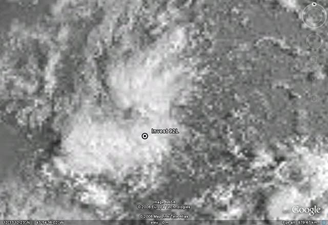
Hurakan, the center indicated in your pic is not at 41.3W. In fact, there's little or no convection at that postion, I did a double-take at the satellite loop. But I guess they basing the position on the scatterometer pass this morning.HURAKAN wrote:
caribepr wrote:Glued eyes...even more so since I am supposed to be taking the puddle jumper to SJ airport on Thursday...
cycloneye wrote:caribepr wrote:Glued eyes...even more so since I am supposed to be taking the puddle jumper to SJ airport on Thursday...
Mj,I think you may have to leave your property very secured as you travel to the U.S.


BatzVI wrote:Just a question.....is there anything that would cause this one to gain latitude? I don't understand the pressure maps, etc. too well....It seems IMHO, that the southern islands would be at more of a risk than the northern islands....thanks for help on this one...
Users browsing this forum: No registered users and 27 guests