ATL: Invest 97L in Central Atlantic
Moderator: S2k Moderators


Re: Ex 97L in East Atlantic
tailgater wrote:RL3AO wrote:Tropical waves don't recurve (at least I've never seen one). It will continue to move west until it develops, hits the East coast, or hits the GOM coast.
A HIGH AMPLITUDE TROPICAL WAVE IS ALONG 35W/36W S OF 23N MOVING
W NEAR 20 KT. VIS SATELLITE IMAGERY INDICATES A BROAD CYCLONIC
CIRCULATION AND A 1010 MB LOW ALONG THE WAVE AXIS NEAR 14N.
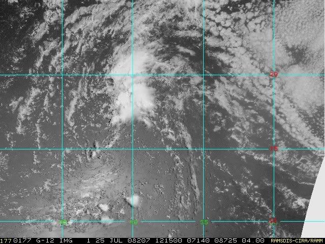
Latest Quickscat
http://manati.orbit.nesdis.noaa.gov/dat ... Bds112.png
Based on that quickscat it looks more like 13N.
0 likes


Re: Ex 97L in East Atlantic
blp wrote:tailgater wrote:RL3AO wrote:Tropical waves don't recurve (at least I've never seen one). It will continue to move west until it develops, hits the East coast, or hits the GOM coast.
A HIGH AMPLITUDE TROPICAL WAVE IS ALONG 35W/36W S OF 23N MOVING
W NEAR 20 KT. VIS SATELLITE IMAGERY INDICATES A BROAD CYCLONIC
CIRCULATION AND A 1010 MB LOW ALONG THE WAVE AXIS NEAR 14N.
Latest Quickscat
http://manati.orbit.nesdis.noaa.gov/dat ... Bds112.png
Based on that quickscat it looks more like 13N.
yeah and if zoom in on the Sat loop it looks 15N
http://www.ssd.noaa.gov/goes/east/catl/loop-rb.html
Ramsdis has a floater on it.
http://hadar.cira.colostate.edu/ramsdis ... at1_0.html
0 likes
-
stevetampa33614
Re: Ex 97L in East Atlantic
imo thats a very strong wide reach low. Look at how far the effects of it are. If it did develop it would be a fairly large storm circumfrence wise.
Anyway, a bit of convection firing on it tonight. Im just not so sure, doesnt look all too impressive. Maybe if it headed into the Carib or around the bahamas. I wouldnt worry too much about. Dont think anything else is going to happen till august.
Anyway, a bit of convection firing on it tonight. Im just not so sure, doesnt look all too impressive. Maybe if it headed into the Carib or around the bahamas. I wouldnt worry too much about. Dont think anything else is going to happen till august.
0 likes
-
SapphireSea
- Category 1

- Posts: 430
- Joined: Wed Aug 24, 2005 12:13 pm
- Location: Miami, FL
Re: Ex 97L in East Atlantic
Looks like there is going to be some increasing shear ahead of the system according to shear tendency maps, that convection that is also firing up tonight looks like its shear induced as well, from the looks of the sat, it's SW shear that is also evident in shear maps.
0 likes
Re: Ex 97L in East Atlantic
00Z GFS seems stronger has the main vorticity North of 20N in 24 hours. Unless the low relocates North I can't see this jump from 14N to that far North in such a short time.
850MB
http://www.nco.ncep.noaa.gov/pmb/nwprod ... v_024l.gif
48 hr the vorticity tightens up and is at 26N
http://www.nco.ncep.noaa.gov/pmb/nwprod ... v_048l.gif
850MB
http://www.nco.ncep.noaa.gov/pmb/nwprod ... v_024l.gif
48 hr the vorticity tightens up and is at 26N
http://www.nco.ncep.noaa.gov/pmb/nwprod ... v_048l.gif
0 likes
-
stevetampa33614
Re: Ex 97L in East Atlantic
blp wrote:00Z GFS seems stronger has the main vorticity North of 20N in 24 hours. Unless the low relocates North I can't see this jump from 14N to that far North in such a short time.
850MB
http://www.nco.ncep.noaa.gov/pmb/nwprod ... v_024l.gif
48 hr the vorticity tightens up and is at 26N
http://www.nco.ncep.noaa.gov/pmb/nwprod ... v_048l.gif
Ya tending to agree with that sentiment. Its going to keep heading due west for awhile.
0 likes

Re: Ex 97L in East Atlantic
Most of the models (with UKMET as the exception) have been forecasting NW movement for quite some time. In reality, however, it's been moving steadily WSW.
I suppose we'll know who's right in 24 hrs...
I suppose we'll know who's right in 24 hrs...
0 likes
AN ATLANTIC OCEAN TROPICAL WAVE IS ALONG 23N36W 20N37W
15N38W 7N38W MOVING WEST ABOUT 15 KT. A 1012 MB LOW PRESSURE
CENTER IS ALONG THE WAVE NEAR 14.5N. AN UPPER LEVEL TROUGH IS
ALONG 29N39W 23N43W. A SECOND TROUGH IS ALONG 16N43W 10N47W.
STRONG SHOWERS AND THUNDERSTORMS FROM 17N TO 18N BETWEEN 38W
AND 39W. ISOLATED MODERATE SHOWERS ARE ELSEWHERE FROM 14N
TO 21N BETWEEN 38W AND 42W.
0 likes
Re: Ex 97L in East Atlantic
The buoy at 15 N 38 W nicely showed the passage of the low to the south of it with a wind shift http://www.ndbc.noaa.gov/station_page.php?station=13008
0 likes
-
Matt-hurricanewatcher
Re: Ex 97L in East Atlantic
20+ if shear over the system now. You can see the convection screaming to the northeast. If this thing gets lucky it could get west of the shear in another 24 hours. I only expect slow development...
On the other hand it does seem to have a broad "LLC".
On the other hand it does seem to have a broad "LLC".
0 likes
-
Matt-hurricanewatcher
Re: Ex 97L in East Atlantic
The Atlantic is looking very unfavorable for late July. The ULL appears to be moving westward with it based on water vapor, so maybe not much chance of development. Also you have dry air. Anyways nothing else to watch or any thing that has a chance to develop for the next 24-36 hours.
We might see a very boring period for about 2 weeks.
We might see a very boring period for about 2 weeks.
0 likes


Re: Ex 97L in East Atlantic
Matt-hurricanewatcher wrote:The Atlantic is looking very unfavorable for late July. The ULL appears to be moving westward with it based on water vapor, so maybe not much chance of development. Also you have dry air. Anyways nothing else to watch or any thing that has a chance to develop for the next 24-36 hours.
We might see a very boring period for about 2 weeks.
Some call it boring, some call it a semi-relaxing lull Two, two, two times in one!!
0 likes
-
gatorcane

- S2K Supporter

- Posts: 23708
- Age: 48
- Joined: Sun Mar 13, 2005 3:54 pm
- Location: Boca Raton, FL
Re: Ex 97L in East Atlantic
perk wrote:It looks like old 97L is beginning to generate some convection.
Indeed because it has hit warmer SSTs at around 40W, convection is firing right on time as I thought (see higher up on this thread from a day or so ago where I discuss the 40W longitude significance).
I'm surprised the NHC just dropped this thing completely from their discussions. Ironically enough as soon as they did it fires up convection and is close to looking invest worthy to me.
0 likes
-
gatorcane
- S2K Supporter
- Posts: 23708
- Age: 48
- Joined: Sun Mar 13, 2005 3:54 pm
- Location: Boca Raton, FL
BTW look how nice the Upper-Level environment looks out ahead of ex-97L. Assuming it can make it through this pocket of moderate shear and SAL it is currently fighting, it has *alot* of green grass ahead of it.
Note also how you can tell its almost August --- look how the upper-level winds are continuing to relax across the entire Atlantic with the usual TUTT draped across the Caribbean.

Note also how you can tell its almost August --- look how the upper-level winds are continuing to relax across the entire Atlantic with the usual TUTT draped across the Caribbean.
0 likes
-
stevetampa33614
Re: Ex 97L in East Atlantic
aww look. its just out there chillin 
Not expecting much till August. Gonna take a break for awhile. See you all.
Not expecting much till August. Gonna take a break for awhile. See you all.
0 likes
-
cycloneye

- Admin

- Posts: 149275
- Age: 69
- Joined: Thu Oct 10, 2002 10:54 am
- Location: San Juan, Puerto Rico
Re: Ex 97L in Central Atlantic
Well guys,97L is alive again as ATCF released a best track text:
AL, 97, 2008072512, , BEST, 0, 185N, 410W, 25, 1010, DB, 34, NEQ, 0, 0, 0, 0, 1012, 120, 25, 0, 0,
The thread is moved back to active storms forum.
AL, 97, 2008072512, , BEST, 0, 185N, 410W, 25, 1010, DB, 34, NEQ, 0, 0, 0, 0, 1012, 120, 25, 0, 0,
The thread is moved back to active storms forum.
0 likes
Who is online
Users browsing this forum: No registered users and 21 guests