ATL GUSTAV: Tropical Depression - Discussion
Moderator: S2k Moderators

Re: ATL: Hurricane Gustav in Central Caribbean Sea
For any of you that are the least bit interested, we are getting some rather nasty weather here on Provo, Turks & Caicos Islands.......
0 likes


Re:
Derek Ortt wrote:unfortunately a couple of bursts have just went up in the eyewall over Haiti
likely torrential rain and severe mudslides occurring there
not what I wanted to see Derek, but indeed can see those bursts very nicely on the high resolution imagery in that eastern eyewall, just got to hope its not too extreme.
vbhoutex, yep there willbe some further weakening but don't think the inner core will be all that badly disrupted unless it spends a good 6-12hrs longer than expected inland, could be out over water again in 6hrs.
0 likes
-
weatherguru18
Re: ATL: Hurricane Gustav in Central Caribbean Sea
Matt-hurricanewatcher wrote:Now 50 people that are being reported dead because of Fay is a bad and a sad thing, but why having had Fay move right through DR/Hati for over a day caused a "low" for Hati/DR number of deaths, but your expecting this to be much more deadly. I understand that the ground is now moist and ready to come down, but what makes this storm more deadly then Fay besides that?
I know this isn't the right thread, but since it was brought up, does anybody think that Fay will be retired...becoming only the second T.S. ever to be retired (behind Allison)?
0 likes
-
TCmet
- Professional-Met

- Posts: 106
- Age: 45
- Joined: Sat Jul 14, 2007 4:00 pm
- Location: New York, NY
- Contact:
Re:
Derek Ortt wrote:unfortunately a couple of bursts have just went up in the eyewall over Haiti
likely torrential rain and severe mudslides occurring there
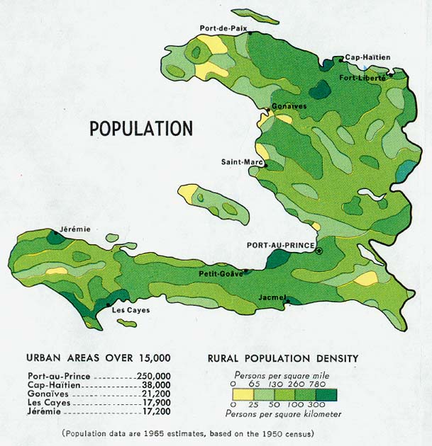
unfortunately, also, this is one of the highest areas of population density in the country (as of 1970 at least) - very near port-au-prince. the combination of high population density and mountains normally equals slums - especially on the outskirts of the capital. my research has shown this to be one of the best indicators of high mortality in hurricanes. send out your prayers and positive energy.
Last edited by TCmet on Tue Aug 26, 2008 3:02 pm, edited 2 times in total.
0 likes
-
jlauderdal
- S2K Supporter

- Posts: 7240
- Joined: Wed May 19, 2004 5:46 am
- Location: NE Fort Lauderdale
- Contact:
Re: Re:
TCmet wrote:jlauderdal wrote:Dean4Storms wrote:Have the levees been rebuilt since Katrina?? I saw a documentary
they are building a stronger levee???
There is nothing they can do with a Cat 4 or 5.
rain is the issue with levees not wind folks
rain and surge. mostly surge.[/quote]
rain for lake Okeechobee, right?
0 likes
-
Derek Ortt
Re: ATL: Hurricane Gustav in Central Caribbean Sea
Matt-hurricanewatcher wrote:Now 50 people that are being reported dead because of Fay is a bad and a sad thing, but why having had Fay move right through DR/Hati for over a day caused a "low" for Hati/DR number of deaths, but your expecting this to be much more deadly. I understand that the ground is now moist and ready to come down, but what makes this storm more deadly then Fay besides that?
already saturated ground for starters. Remember in Olga the DR had to make the decision to kill about 40 people via releasing water from a damn, to save about 4,000 that would have died had it have collapsed
Also, this came straight into Haiti as a much stronger system. Far greater rain rates for Haiti can be expected
0 likes
Yeah thats a big difference Derek, this is a hurricane, Fay was just about a TS at this time, plus the ground is already very wet from Fay.
Just hope no one has to make that call this time round Derek!
As has been said it hit a fairly dense part of the island, the Ne eyewall was probably giving 90-95mph gusts in that region near landfall I'd guess as well?
Just hope no one has to make that call this time round Derek!
As has been said it hit a fairly dense part of the island, the Ne eyewall was probably giving 90-95mph gusts in that region near landfall I'd guess as well?
0 likes

-
Over my head

- Tropical Depression

- Posts: 86
- Joined: Sat Aug 18, 2007 7:52 pm
- Location: Southeast Texas
Re: ATL: Hurricane Gustav in Central Caribbean Sea
greels wrote:For any of you that are the least bit interested, we are getting some rather nasty weather here on Provo, Turks & Caicos Islands.......
I imagine it's pretty wild there!
0 likes
-
ColdFusion

- S2K Supporter
- Posts: 452
- Joined: Wed Feb 13, 2008 3:46 pm
- Location: Addison, TX
Judging by where the eye came ashore, and where it "could be" now (it's obscured), the eye seems like it should be more than halfway across land already, though I kinda see more of a west component now:
http://hadar.cira.colostate.edu/ramsdis ... ive_0.html
http://hadar.cira.colostate.edu/ramsdis ... ive_0.html
0 likes
Hardly surprising NOLA news companies have already latched onto Gustav given model tracks loosely suggest a threat possibly and after Katrina any loose threat will get attention.
Agua, yep this part of the world is very poor and is getting hammered by a hurricane right now on already wet ground.
Agua, yep this part of the world is very poor and is getting hammered by a hurricane right now on already wet ground.
0 likes
-
TCmet
- Professional-Met
- Posts: 106
- Age: 45
- Joined: Sat Jul 14, 2007 4:00 pm
- Location: New York, NY
- Contact:
Re:
KWT wrote:Yeah thats a big difference Derek, this is a hurricane, Fay was just about a TS at this time, plus the ground is already very wet from Fay.
Just hope no one has to make that call this time round Derek!
As has been said it hit a fairly dense part of the island, the Ne eyewall was probably giving 90-95mph gusts in that region near landfall I'd guess as well?
rain and slides will be the biggest threat. but wind will knock down trees... in mitch (honduras 1998) huge temporary dams/lakes spontaneously formed because of felled trees clogging up rivers - which added to the flooding.
0 likes
-
Derek Ortt
Re: Re:
TCmet wrote:KWT wrote:Yeah thats a big difference Derek, this is a hurricane, Fay was just about a TS at this time, plus the ground is already very wet from Fay.
Just hope no one has to make that call this time round Derek!
As has been said it hit a fairly dense part of the island, the Ne eyewall was probably giving 90-95mph gusts in that region near landfall I'd guess as well?
rain and slides will be the biggest threat. but wind will knock down trees... in mitch (honduras 1998) huge temporary dams/lakes spontaneously formed because of felled trees clogging up rivers - which added to the flooding.
I don't believe there are many trees to knock down in Haiti. Most were either cut down or burned
The winds may do a number on the shanty towns though in Haiti
0 likes
I have to admit the high reoslution imagery does rather suggest the westerly motion is kicking in now, not seeing it gaining all that much latitude right now, maybe down to 285-280 now in terms of direction which should keep it over land for possibly another 12hrs...inner core should weaken quite decently but being such a small system over condusive waters its bound to ramp up pretty quickly. May well be down to TS status when it reaches water again if it is heading more west now.
Derek, yeah gusts must be close to cat-2 upon landfall of Gustav, never good in the slums.
Derek, yeah gusts must be close to cat-2 upon landfall of Gustav, never good in the slums.
0 likes
-
ColdFusion
- S2K Supporter
- Posts: 452
- Joined: Wed Feb 13, 2008 3:46 pm
- Location: Addison, TX
Re: ATL: Hurricane Gustav over SW Haiti
Any bets being placed on the next NHC advisory? Track shift anyone?
My thinking is that there will be little if any change in the track @ the 5 PM.
My thinking is that there will be little if any change in the track @ the 5 PM.
0 likes
-
Texas Snowman

- Storm2k Moderator

- Posts: 6197
- Joined: Fri Jan 25, 2008 11:29 am
- Location: Denison, Texas
Re: ATL: Hurricane Gustav over SW Haiti
Couple of interesting links dealing with historical tracks of storms in a position where Gus is right now.
http://blogs.chron.com/sciguy/archives/ ... 41471.html - Big Map of Tracks
http://blogs.chron.com/sciguy/archives/ ... ry_te.html - Houston Chronicle's Sci-Guy Discussing Historical Tracks
I'm kind of thinking that given models, motion trends, etc. that NOLA might end up being on the eastern side of the eventual landfall cone and that the Houston/Galveston area might be the bulls-eye.
As for 5 p.m. change, perhaps a little more to the left, but not much.
0 likes


-
Tampa_God

- Category 1

- Posts: 333
- Age: 36
- Joined: Wed May 31, 2006 7:27 pm
- Location: New Port Richey/Trinity, FL
Re:
KWT wrote:I have to admit the high reoslution imagery does rather suggest the westerly motion is kicking in now, not seeing it gaining all that much latitude right now, maybe down to 285-280 now in terms of direction which should keep it over land for possibly another 12hrs...inner core should weaken quite decently but being such a small system over condusive waters its bound to ramp up pretty quickly. May well be down to TS status when it reaches water again if it is heading more west now.
Derek, yeah gusts must be close to cat-2 upon landfall of Gustav, never good in the slums.
I don't think we will see that much of weakening. I would estimate that the storm might lose 10 mph, the most. It still has a lot of moisture and even with the mountains, Gustav won't feel that much of a affect. But I do see a more west to west northwest track right now.
I don't see them changing the track at all.
0 likes
Who is online
Users browsing this forum: No registered users and 16 guests