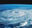
ATL: Invest 97L in Central Atlantic

Moderator: S2k Moderators

Message
Author
User avatar
Thunder44
Category 5
Category 5
Posts: 5922
Age: 44
Joined: Mon Jun 09, 2003 7:53 pm
Location: New York City

Re: ATL: Invest 97L in Central Atlantic

#301 Postby Thunder44 » Fri Jul 25, 2008 11:09 am

Blown_away wrote:
gatorcane wrote:I believe there is low center trying to form on the 17N lattitude (southern edge of the convection). Does anybody else agree with that assessment?


I agree, in the area of 16.5-17N/ 42-43W.
http://www.ssd.noaa.gov/goes/east/tatl/loop-vis.html


Look at closer loop. I see a LLC centered near 14.5N 43W, moving westward. It's very elongated from SSW to NNE and it well south of that convection. It looks there is some shear out of the SSE over the system. I don't see another center forming further north.
Last edited by Thunder44 on Fri Jul 25, 2008 11:10 am, edited 1 time in total.
0 likes   

User avatar
Just Joshing You
Category 2
Category 2
Posts: 512
Joined: Sat Nov 03, 2007 10:29 am
Location: Nova Scotia

Re: ATL: Invest 97L in Central Atlantic

#302 Postby Just Joshing You » Fri Jul 25, 2008 11:10 am

97L is looking pretty good and chances for development are increasing imo.
0 likes   

User avatar
cycloneye
Admin
Admin
Posts: 145271
Age: 68
Joined: Thu Oct 10, 2002 10:54 am
Location: San Juan, Puerto Rico

Re: ATL: Invest 97L in Central Atlantic

#303 Postby cycloneye » Fri Jul 25, 2008 11:13 am

The latest:

Image
0 likes   

User avatar
HURAKAN
Professional-Met
Professional-Met
Posts: 46086
Age: 38
Joined: Thu May 20, 2004 4:34 pm
Location: Key West, FL
Contact:

#304 Postby HURAKAN » Fri Jul 25, 2008 11:16 am

LOOKS impressive considering the dry air and time of the day.
0 likes   

User avatar
Blown Away
S2K Supporter
S2K Supporter
Posts: 10145
Joined: Wed May 26, 2004 6:17 am

Re: ATL: Invest 97L in Central Atlantic

#305 Postby Blown Away » Fri Jul 25, 2008 11:16 am

Thunder44 wrote:
Blown_away wrote:
gatorcane wrote:I believe there is low center trying to form on the 17N lattitude (southern edge of the convection). Does anybody else agree with that assessment?


I agree, in the area of 16.5-17N/ 42-43W.
http://www.ssd.noaa.gov/goes/east/tatl/loop-vis.html


Look at closer loop. I see a LLC centered near 14.5N 43W, moving westward. It's very elongated from SSW to NNE and it well south of that convection. It looks there is some shear out of the SSE over the system. I don't see another center forming further north.


It does appear there is a slight rotation just below 15N/43W, the last frame especially. Good eye. :wink:
0 likes   

User avatar
catastrophic
Tropical Low
Tropical Low
Posts: 35
Joined: Wed Jul 23, 2008 1:50 pm
Location: palm bay FL

#306 Postby catastrophic » Fri Jul 25, 2008 11:49 am

the convextion is still building to the north of the circulation
[img]Image[/img]
0 likes   

User avatar
wzrgirl1
S2K Supporter
S2K Supporter
Posts: 1325
Joined: Sat Sep 04, 2004 6:44 am
Location: Pembroke Pines, Florida

Re: ATL: Invest 97L in Central Atlantic

#307 Postby wzrgirl1 » Fri Jul 25, 2008 11:55 am

My concern is down the road it pulling a jeanne (i think that was the storm)....where it did a loop and came back and hit the east coast of florida...i wonder if the synoptics down the road favor that scenario or not...
0 likes   

User avatar
HURAKAN
Professional-Met
Professional-Met
Posts: 46086
Age: 38
Joined: Thu May 20, 2004 4:34 pm
Location: Key West, FL
Contact:

#308 Postby HURAKAN » Fri Jul 25, 2008 11:57 am

Image

Image
0 likes   

User avatar
Just Joshing You
Category 2
Category 2
Posts: 512
Joined: Sat Nov 03, 2007 10:29 am
Location: Nova Scotia

#309 Postby Just Joshing You » Fri Jul 25, 2008 11:59 am

Looks like it has a broad LLC, also looks like its tightening. Depression soon?
0 likes   

HurricaneHunter914
Category 5
Category 5
Posts: 4439
Age: 31
Joined: Fri Mar 10, 2006 7:36 pm
Location: College Station, TX

#310 Postby HurricaneHunter914 » Fri Jul 25, 2008 12:04 pm

Looks like an impressive little fellow given the conditions. Could become a depression, with shear staying at least marginally favorable and SST's increasing as it moves westward. I'd expect another mention by the 8pm TWO, the NHC might want to wait to see if this persists.
0 likes   

Ed Mahmoud

Re:

#311 Postby Ed Mahmoud » Fri Jul 25, 2008 12:05 pm

extradited wrote:Looks like it has a broad LLC, also looks like its tightening. Depression soon?


Except for the shear and dry air, maybe.

Image

Image

The Southern circulation, has much better shear conditions. But is a little light on ,ow level convergence.

Image
0 likes   

User avatar
GCANE
S2K Supporter
S2K Supporter
Posts: 11490
Joined: Mon Oct 22, 2007 8:03 am

Re: ATL: Invest 97L in Central Atlantic

#312 Postby GCANE » Fri Jul 25, 2008 12:15 pm

Buoy 41041 at 14.4N 46W is showing winds out of the NE. That suggests to me that the center of the surface-circulation is to the south-east of it.

http://seaboard.ndbc.noaa.gov/station_p ... tion=41041
0 likes   

User avatar
gatorcane
S2K Supporter
S2K Supporter
Posts: 23691
Age: 47
Joined: Sun Mar 13, 2005 3:54 pm
Location: Boca Raton, FL

Re: ATL: Invest 97L in Central Atlantic

#313 Postby gatorcane » Fri Jul 25, 2008 12:25 pm

So I'm curious what the NHC is going to say about this feature for the 2pm EST TWO....?

Looks to be gradually organizing albeit shear and dry air should keep "development, if any, to be slow to occur."
0 likes   

User avatar
gatorcane
S2K Supporter
S2K Supporter
Posts: 23691
Age: 47
Joined: Sun Mar 13, 2005 3:54 pm
Location: Boca Raton, FL

#314 Postby gatorcane » Fri Jul 25, 2008 12:27 pm

Sticks out like a soar thumb in the central Atlantic:

Image
0 likes   

User avatar
wzrgirl1
S2K Supporter
S2K Supporter
Posts: 1325
Joined: Sat Sep 04, 2004 6:44 am
Location: Pembroke Pines, Florida

Re: ATL: Invest 97L in Central Atlantic

#315 Postby wzrgirl1 » Fri Jul 25, 2008 12:29 pm

what do you all think about the loop scenario I suggested above?
0 likes   

User avatar
vbhoutex
Storm2k Executive
Storm2k Executive
Posts: 29112
Age: 73
Joined: Wed Oct 09, 2002 11:31 pm
Location: Cypress, TX
Contact:

Re: ATL: Invest 97L in Central Atlantic

#316 Postby vbhoutex » Fri Jul 25, 2008 12:31 pm

I've looked at a couple of different sat loops on this one and I still only see a broad circulation. There may be a few mini vortices within that broad circulation from time to time but I didn't see one while I was looking. Possibly the increasing convection will spark something, but imo it has a long ways to go to what I classify as a LLCC.
0 likes   

User avatar
gatorcane
S2K Supporter
S2K Supporter
Posts: 23691
Age: 47
Joined: Sun Mar 13, 2005 3:54 pm
Location: Boca Raton, FL

Re: ATL: Invest 97L in Central Atlantic

#317 Postby gatorcane » Fri Jul 25, 2008 12:34 pm

wzrgirl1 wrote:what do you all think about the loop scenario I suggested above?


A loop could happen if a system gets pulled N by a weakness (e.g. from a short-wave trough) but the trough does not completely catch the system and a ridge builds in from the NW behind the trough pushing the system west again.

I see no evidence of such a situation with 97L and even so its so long out (like 7-10 days) and so many IFs (like will 97L even develop) that I haven't thought much about it. Are you seeing something with the long-range synoptics that may suggest a loop?
Last edited by gatorcane on Fri Jul 25, 2008 12:36 pm, edited 3 times in total.
0 likes   

User avatar
GCANE
S2K Supporter
S2K Supporter
Posts: 11490
Joined: Mon Oct 22, 2007 8:03 am

Re: ATL: Invest 97L in Central Atlantic

#318 Postby GCANE » Fri Jul 25, 2008 12:34 pm

I think I see why there is a discepency between the position of the surface-low and where the convection is firing.

CIMSS seems to show circulation up to the 500mb geo-potential height. At that altitude, it is centered at 18N. That is where condensation of the air-parcels are occuring.

The air-parcels are lifted from and near the surface at around 12N; but move in a generally north direction as they circulate around the center. The center moves north with altitude. The air-parcels finally condense around 500mb.
0 likes   

User avatar
cycloneye
Admin
Admin
Posts: 145271
Age: 68
Joined: Thu Oct 10, 2002 10:54 am
Location: San Juan, Puerto Rico

Re: ATL: Invest 97L in Central Atlantic

#319 Postby cycloneye » Fri Jul 25, 2008 12:37 pm

ABNT20 KNHC 251736
TWOAT
TROPICAL WEATHER OUTLOOK
NWS TPC/NATIONAL HURRICANE CENTER MIAMI FL
200 PM EDT FRI JUL 25 2008

FOR THE NORTH ATLANTIC...CARIBBEAN SEA AND THE GULF OF MEXICO...

THE HYDROMETEOROLOGICAL PREDICTION CENTER IS ISSUING ADVISORIES ON
TROPICAL DEPRESSION DOLLY...LOCATED INLAND NEAR THE TEXAS-MEXICO
BORDER ABOUT 25 MILES SOUTH OF PRESIDIO TEXAS.

A STRONG TROPICAL WAVE OVER THE CENTRAL ATLANTIC OCEAN ABOUT 1300
MILES EAST OF THE LEEWARD ISLANDS IS PRODUCING DISORGANIZED SHOWERS
AND THUNDERSTORMS. ALTHOUGH UPPER-LEVEL WINDS ARE CURRENTLY NOT
FAVORABLE FOR DEVELOPMENT...THE WAVE MAY MOVE INTO AN ENVIRONMENT
MORE CONDUCIVE FOR ORGANIZATION IN A COUPLE OF DAYS. THE SYSTEM IS
EXPECTED TO MOVE TO THE WEST-NORTHWEST OR NORTHWEST AT 15 TO 20 MPH
DURING THE NEXT DAY OR TWO.

ELSEWHERE...TROPICAL CYCLONE FORMATION IS NOT EXPECTED DURING THE
NEXT 48 HOURS.

$$
FORECASTER BLAKE

0 likes   

User avatar
gatorcane
S2K Supporter
S2K Supporter
Posts: 23691
Age: 47
Joined: Sun Mar 13, 2005 3:54 pm
Location: Boca Raton, FL

#320 Postby gatorcane » Fri Jul 25, 2008 12:39 pm

Personal Forecast Disclaimer:
The posts in this forum are NOT official forecast and should not be used as such. They are just the opinion of the poster and may or may not be backed by sound meteorological data. They are NOT endorsed by any professional institution or storm2k.org. For official information, please refer to the NHC and NWS products.


:uarrow: Indeed the NHC outlook is what I thought they would say. Upper-level environment is not good now but will be in a couple of days but notice they are suggesting a NW movement by then...

97L does have fish written all over it. I'm sticking with my W to WNW movement for about 3-5 days followed by a gradual NW bend and gradual development. Should comfortably miss the NE Leewards by several hundred miles (like at least 300-400) to the NE and bend East of Bermuda. A 99% chance of fish :D
Last edited by gatorcane on Fri Jul 25, 2008 12:41 pm, edited 2 times in total.
0 likes   


Return to “2008”

Who is online

Users browsing this forum: No registered users and 8 guests