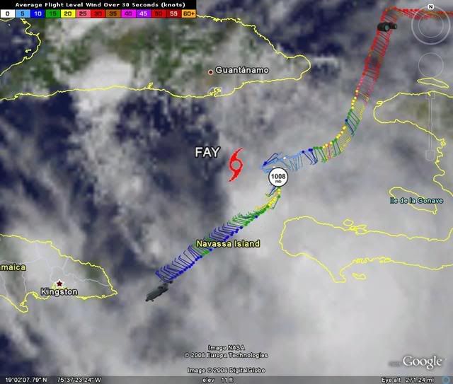
GreenSky wrote:SO CAN ANY OF THE PRO METS ANSWER THE FOLLOWING QUESTIONS...
1) Should Fay be downgraded to a depression right now?
Probably, but the recon hasn't finished its mission yet, so we'll see.
2) Is it safe to say Fay is officially dead if so, and chances of redeveloping and establishing a LLC are remote because of land interaction with mountainous terrain in Cuba?
No, it's not dead, officially or otherwise. It still has an LLC: it never dissipated. Whether it dissipates in the near future or not depends on its near-term track over Cuba. If it stays south of Cuba for a while before turning north, it will likely reintensify, not dissipate.
3) The Southeast Coast of Florida (exception Key West) is looking safer?
Not really, depends on the track across Cuba, which is uncertain right now. On the current NHC track, SE FL would still feel effects.
4) At most, Fay will only be a tropical storm?
Too early to say. I certainly wouldn't confidently assert that.
5) Fay will most likely hit the panhandle of Florida because of the continuous due west motion?
No, but a panhandle landfall is still possible. The bottom line is, there is still considerable spread in the forecast model tracks. You are asking for more precision than anyone can give right now.
I know there are a lot of questions, but if any of you pro mets could answer these I would be more than happy.
Most of my previous questions have been ignored...due to the high volume of posts.
No problem. It's difficult to keep up with all the posts.