Arthur's remnents near the BOC
Moderator: S2k Moderators
-
MGC

- S2K Supporter

- Posts: 5940
- Joined: Sun Mar 23, 2003 9:05 pm
- Location: Pass Christian MS, or what is left.
Re: Tropical Depression Arthur in Yucatan Penninsula
Considering how this season has started out, I'd say there is a remote possibility. Perhaps if the MLC can survive and then move out over the BOC and work its way back down to the surface. Very long shot at this time. Of course, Hurricane Ivan kinda did that........MGC
0 likes
-
jaxfladude
- Category 5

- Posts: 1249
- Joined: Wed Aug 24, 2005 9:36 pm
- Location: Jacksonville, Fla

-
Thundercloud
- Tropical Low

- Posts: 16
- Joined: Wed May 28, 2008 8:48 pm


-
Extremeweatherguy

- Category 5
- Posts: 11095
- Joined: Mon Oct 10, 2005 8:13 pm
- Location: Florida
-
wxman57

- Moderator-Pro Met

- Posts: 23172
- Age: 68
- Joined: Sat Jun 21, 2003 8:06 pm
- Location: Houston, TX (southwest)
Re: Tropical Depression Arthur in Yucatan Penninsula
Time to put a fork in Arthur. Might be a shot of some redevelopment from its remnants in the East Pac, but for all practical purposes...

0 likes

-
lrak

- S2K Supporter
- Posts: 1770
- Age: 59
- Joined: Thu Jun 21, 2007 2:48 pm
- Location: Corpus Christi, TX
Re: Tropical Depression Arthur in Yucatan Penninsula
http://weather.noaa.gov/weather/current/MMTG.html
http://weather.noaa.gov/weather/current/MMCP.html
got a nice East West flow still...isn't that impressive or unusual for being over land so long? Also pressures are kinda low.
http://weather.noaa.gov/weather/current/MMCP.html
got a nice East West flow still...isn't that impressive or unusual for being over land so long? Also pressures are kinda low.
0 likes
-
CrazyC83
- Professional-Met

- Posts: 34315
- Joined: Tue Mar 07, 2006 11:57 pm
- Location: Deep South, for the first time!
The big question is at what point they will determine it became a TD or TS before landfall. Looking back seeing the structure, I would say it was a tropical storm at 1200Z yesterday (the first Arthur advisory was at 1700Z), but not sure about before then. Maybe a tropical depression at 0600Z.
0 likes
-
srainhoutx

- S2K Supporter
- Posts: 6919
- Age: 68
- Joined: Sun Jan 14, 2007 11:34 am
- Location: Haywood County, NC
- Contact:
Re: Tropical Depression Arthur in Yucatan Penninsula
wxman57 wrote:Time to put a fork in Arthur. Might be a shot of some redevelopment from its remnants in the East Pac, but for all practical purposes...

welcome back wxman57
0 likes
-
HURAKAN

- Professional-Met
- Posts: 46084
- Age: 39
- Joined: Thu May 20, 2004 4:34 pm
- Location: Key West, FL
- Contact:
761
WTNT21 KNHC 020236
TCMAT1
TROPICAL DEPRESSION ARTHUR FORECAST/ADVISORY NUMBER 7
NWS TPC/NATIONAL HURRICANE CENTER MIAMI FL AL012008
0300 UTC MON JUN 02 2008
TROPICAL DEPRESSION CENTER LOCATED NEAR 17.4N 91.3W AT 02/0300Z
POSITION ACCURATE WITHIN 60 NM
PRESENT MOVEMENT TOWARD THE SOUTHWEST OR 235 DEGREES AT 5 KT
ESTIMATED MINIMUM CENTRAL PRESSURE 1006 MB
MAX SUSTAINED WINDS 25 KT WITH GUSTS TO 35 KT.
WINDS AND SEAS VARY GREATLY IN EACH QUADRANT. RADII IN NAUTICAL
MILES ARE THE LARGEST RADII EXPECTED ANYWHERE IN THAT QUADRANT.
REPEAT...CENTER LOCATED NEAR 17.4N 91.3W AT 02/0300Z
AT 02/0000Z CENTER WAS LOCATED NEAR 17.5N 91.1W
FORECAST VALID 02/1200Z...DISSIPATED
THIS IS THE LAST FORECAST/ADVISORY ISSUED BY THE NATIONAL HURRICANE
CENTER ON THIS SYSTEM
$$
FORECASTER KNABB
0 likes
-
HURAKAN
- Professional-Met
- Posts: 46084
- Age: 39
- Joined: Thu May 20, 2004 4:34 pm
- Location: Key West, FL
- Contact:
341
WTNT31 KNHC 020241
TCPAT1
BULLETIN
TROPICAL DEPRESSION ARTHUR ADVISORY NUMBER 7
NWS TPC/NATIONAL HURRICANE CENTER MIAMI FL AL012008
1000 PM CDT SUN JUN 01 2008
...ARTHUR DISSIPATING BUT POTENTIAL FOR HEAVY RAINS CONTINUES...
AT 1000 PM CDT...0300Z...THE CENTER OF DISSIPATING TROPICAL
DEPRESSION ARTHUR WAS LOCATED INLAND NEAR LATITUDE 17.4
NORTH...LONGITUDE 91.3 WEST...OR NEAR THE NORTHWESTERN BORDER
BETWEEN GUATEMALA AND MEXICO ABOUT 95 MILES...150 KM...
SOUTH-SOUTHEAST OF CIUDAD DEL CARMEN MEXICO.
THE DISSIPATING DEPRESSION IS MOVING TOWARD THE SOUTHWEST AT ABOUT 6
MPH...10 KM/HR. THE REMNANTS OF ARTHUR ARE EXPECTED TO CONTINUE
MOVING VERY SLOWLY SOUTHWESTWARD AND REMAIN OVER SOUTHEASTERN
MEXICO AND NORTHERN CENTRAL AMERICA DURING THE NEXT DAY OR TWO.
MAXIMUM SUSTAINED WINDS ARE NEAR 30 MPH...45 KM/HR...WITH HIGHER
GUSTS. ARTHUR IS DISSIPATING INLAND OVER SOUTHEASTERN MEXICO.
ESTIMATED MINIMUM CENTRAL PRESSURE IS 1006 MB...29.71 INCHES.
ARTHUR AND ITS REMNANTS ARE EXPECTED TO PRODUCE TOTAL RAIN
ACCUMULATIONS OF 5 TO 10 INCHES OVER PORTIONS OF BELIZE...
GUATEMALA...AND SOUTHEASTERN MEXICO WITH ISOLATED AMOUNTS UP TO 15
INCHES. THESE RAINS COULD CAUSE LIFE-THREATENING FLASH FLOODS AND
MUD SLIDES...ESPECIALLY IN MOUNTAINOUS TERRAIN.
REPEATING THE 1000 PM CDT POSITION...17.4 N...91.3 W. MOVEMENT
TOWARD...SOUTHWEST NEAR 6 MPH. MAXIMUM SUSTAINED WINDS...30 MPH.
MINIMUM CENTRAL PRESSURE...1006 MB.
THIS IS THE LAST PUBLIC ADVISORY ISSUED BY THE NATIONAL HURRICANE
CENTER ON THIS SYSTEM. FOR INFORMATION SPECIFIC TO YOUR
AREA...PLEASE CONSULT PRODUCTS ISSUED BY YOUR LOCAL WEATHER OFFICE.
$$
FORECASTER KNABB
0 likes
-
CrazyC83
- Professional-Met
- Posts: 34315
- Joined: Tue Mar 07, 2006 11:57 pm
- Location: Deep South, for the first time!
Re: Tropical Depression Arthur in Yucatan Penninsula
Goodbye Arthur and have fun trying to revive yourself! Otherwise...don't let the  crash on you Arthur! See ya in 2014!
crash on you Arthur! See ya in 2014!
0 likes
-
HURAKAN
- Professional-Met
- Posts: 46084
- Age: 39
- Joined: Thu May 20, 2004 4:34 pm
- Location: Key West, FL
- Contact:
268
WTNT41 KNHC 020244
TCDAT1
TROPICAL DEPRESSION ARTHUR DISCUSSION NUMBER 7
NWS TPC/NATIONAL HURRICANE CENTER MIAMI FL AL012008
1100 PM EDT SUN JUN 01 2008
FOR MANY HOURS ARTHUR HAS NOT BEEN PRODUCING SUFFICIENT ORGANIZED
DEEP CONVECTION REQUISITE OF A TROPICAL CYCLONE. IN ADDITION...THE
SURFACE CIRCULATION HAS BEEN ENCOUNTERING MORE RUGGED TERRAIN WHILE
PROCEEDING SLOWLY SOUTHWESTWARD...AND IT HAS BECOME POORLY DEFINED
AND ELONGATED AND MIGHT NOT EVEN BE CLOSED. THEREFORE...THIS WILL
BE THE LAST NHC ADVISORY ON THIS SYSTEM. THIS CHANGE IN STATUS...
HOWEVER...DOES NOT MEAN THAT THE RAINFALL AND FLOODING HAZARD HAS
ENDED. SINCE THE CLOSED CIRCULATION APPEARS TO BE DISSIPATING...NO
FORECAST POINTS ARE PROVIDED...BUT THE REMNANTS ARE EXPECTED TO
CONTINUE MOVING VERY SLOWLY SOUTHWESTWARD DURING THE NEXT COUPLE OF
DAYS. THE REMNANTS OF ARTHUR ARE ALSO EMBEDDED WITHIN A LARGER AND
NEARLY STATIONARY AREA OF LOW- TO MID-LEVEL CYCLONIC FLOW....SO
HEAVY RAINS COULD PERSIST OVER PORTIONS OF SOUTHEASTERN MEXICO AND
NORTHERN CENTRAL AMERICA FOR THE NEXT COUPLE OF DAYS AND PERHAPS
LONGER. FOR INFORMATION SPECIFIC TO YOUR AREA...PLEASE CONSULT
PRODUCTS ISSUED BY YOUR LOCAL WEATHER OFFICE.
FORECAST POSITIONS AND MAX WINDS
INITIAL 02/0300Z 17.4N 91.3W 25 KT...DISSIPATING
12HR VT 02/1200Z...DISSIPATED
$$
FORECASTER KNABB
0 likes
-
JonathanBelles
- Professional-Met
- Posts: 11430
- Age: 35
- Joined: Sat Dec 24, 2005 9:00 pm
- Location: School: Florida State University (Tallahassee, FL) Home: St. Petersburg, Florida
- Contact:
Re: Tropical Depression Arthur in Yucatan Penninsula
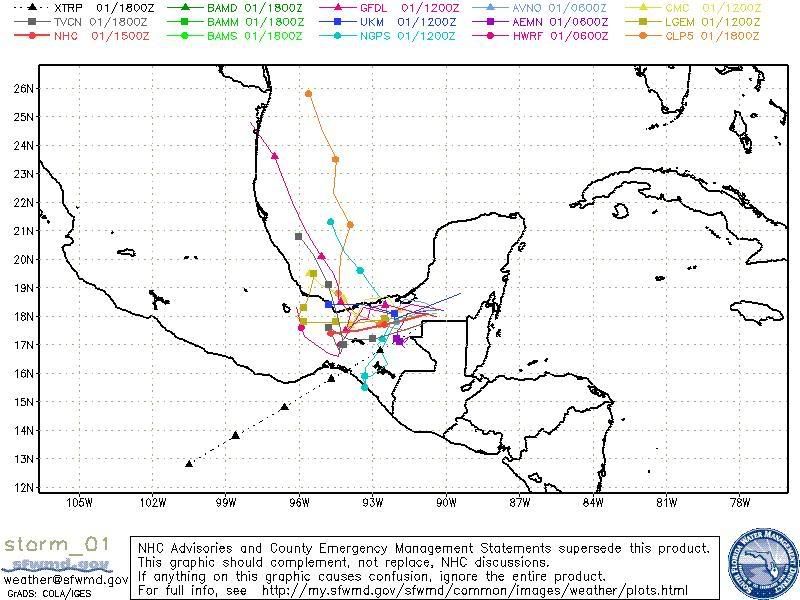
One of the good things about this new product is that it shows the exact path of the system:

0 likes
-
Category 5

- Category 5
- Posts: 10074
- Age: 36
- Joined: Sun Feb 11, 2007 10:00 pm
- Location: New Brunswick, NJ
- Contact:
Re: Arthur dissipates over Mexico/Guatemala border
You know just a thought. If this can make its way back over to the epac then it's entirely possible that this could be Alma/Arthur/Boris. I believe such an event has only happened once before (Hattie/Simone/Igna 1961)
Last edited by Category 5 on Sun Jun 01, 2008 9:53 pm, edited 2 times in total.
0 likes

-
Category 5
- Category 5
- Posts: 10074
- Age: 36
- Joined: Sun Feb 11, 2007 10:00 pm
- Location: New Brunswick, NJ
- Contact:
Re:
StormspinnerD2 wrote:It's been mentioned already, refer to the EPAC TWO.
I just read that.
0 likes
Who is online
Users browsing this forum: No registered users and 81 guests