
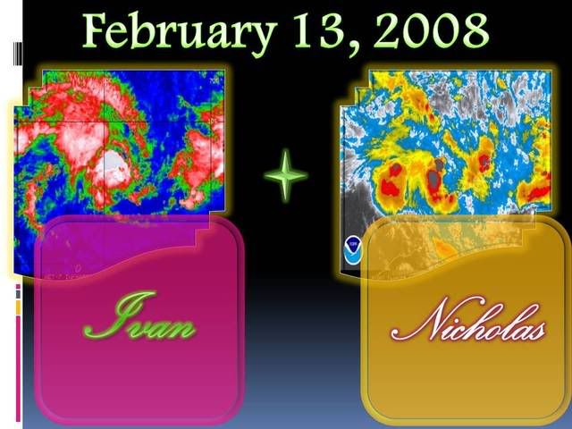
NW Australia: Tropical Cyclone Nicholas (19S)
Moderator: S2k Moderators
-
Coredesat
-
Coredesat
IDW24200
Australian Government Bureau of Meteorology
Western Australia
Media: The Standard Emergency Warning Signal should NOT be used with this
warning.
PRIORITY
TROPICAL CYCLONE ADVICE NUMBER 12
Issued at 3:45 am WDT on Wednesday, 13 February 2008
BY THE BUREAU OF METEOROLOGY
TROPICAL CYCLONE WARNING CENTRE PERTH
A Cyclone WATCH continues for a developing tropical low for coastal areas from
Pardoo to Kalumburu.
At 3:00 am WDT a tropical low was estimated to be
375 kilometres north northwest of Broome and
610 kilometres north northeast of Port Hedland and
was near stationary.
The low has intensified overnight and may develop into a tropical cyclone later
today. Gales are not expected in coastal areas today, however, gales could
develop in coastal areas between Pardoo and Kalumburu Wednesday night or on
Thursday.
Details of tropical low at 3:00 am WDT:
Centre located near...... 15.1 degrees South 120.4 degrees East
Location accuracy........ within 55 kilometres
Recent movement.......... near stationary
Wind gusts near centre... 85 kilometres per hour
Severity category........ below cyclone intensity
Central pressure......... 988 hectoPascals
FESA-State Emergency Service advises that there are no community alerts at
present. Communities between Pardoo and Kalumburu should listen for the next
advice.
The next advice will be issued by 10:00 am WDT Wednesday 13 February.
Cyclone advices and State Emergency Service Community Alerts are available by
dialling 1300 659 210
A map showing the track of the cyclone is available at:
http://www.bom.gov.au/weather/cyclone
0 likes
-
Coredesat


-
Crostorm

- Category 5

- Posts: 2060
- Age: 51
- Joined: Mon Dec 25, 2006 3:51 pm
- Location: Croatia-Europe
- Contact:
Re: 98S. INVEST: Low Kury Bay (TC 19S)
IDW24200
Australian Government Bureau of Meteorology
Western Australia
Media: The Standard Emergency Warning Signal should NOT be used with this
warning.
PRIORITY
TROPICAL CYCLONE ADVICE NUMBER 13
Issued at 9:55 am WDT on Wednesday, 13 February 2008
BY THE BUREAU OF METEOROLOGY
TROPICAL CYCLONE WARNING CENTRE PERTH
A Cyclone WATCH continues for a developing tropical low for coastal areas from
Pardoo to Kuri Bay. The cyclone WATCH from Kuri Bay to Kalumburu is cancelled.
At 9:00 am WDT Tropical Cyclone Nicholas, was estimated to be
430 kilometres northwest of Broome and
620 kilometres north northeast of Port Hedland and
moving west northwest at 6 kilometres per hour.
The system has intensified overnight and reached cyclone intensity this morning.
Further intensification is expected and Nicholas is likely to become a severe
tropical cyclone in the coming days. Nicholas is expected to show slow movement
over the next day or so before moving towards the coast.
Gales are not expected in coastal areas today, however, it is possible gales
could develop in coastal areas between Pardoo and Kuri Bay later on Thursday or
on Friday. Pilbara residents are advised that although the Pilbara coast west of
Pardoo is not under threat in the next 48 hours, it is at risk of severe cyclone
impact over the weekend.
Details of Tropical Cyclone Nicholas at 9:00 am WDT:
Centre located near...... 14.9 degrees South 119.8 degrees East
Location accuracy........ within 55 kilometres
Recent movement.......... towards the west northwest at 6 kilometres per hour
Wind gusts near centre... 100 kilometres per hour
Severity category........ 1
Central pressure......... 980 hectoPascals
FESA-State Emergency Service advises that there are no community alerts at
present. Communities between Pardoo and Kuri Bay should listen for the next
advice.
The next advice will be issued by 4:00 pm WDT Wednesday 13 February.
Cyclone advices and State Emergency Service Community Alerts are available by
dialling 1300 659 210
A map showing the track of the cyclone is available at:
http://www.bom.gov.au/weather/cyclone
0 likes
-
HURAKAN

- Professional-Met

- Posts: 46084
- Age: 39
- Joined: Thu May 20, 2004 4:34 pm
- Location: Key West, FL
- Contact:
Australian Government Bureau of Meteorology
Western Australia
Media: The Standard Emergency Warning Signal should NOT be used with this
warning.
PRIORITY
TROPICAL CYCLONE ADVICE NUMBER 13
Issued at 9:55 am WDT on Wednesday, 13 February 2008
BY THE BUREAU OF METEOROLOGY
TROPICAL CYCLONE WARNING CENTRE PERTH
A Cyclone WATCH continues for a developing tropical low for coastal areas from
Pardoo to Kuri Bay. The cyclone WATCH from Kuri Bay to Kalumburu is cancelled.
At 9:00 am WDT Tropical Cyclone Nicholas, was estimated to be
430 kilometres northwest of Broome and
620 kilometres north northeast of Port Hedland and
moving west northwest at 6 kilometres per hour.
The system has intensified overnight and reached cyclone intensity this morning.
Further intensification is expected and Nicholas is likely to become a severe
tropical cyclone in the coming days. Nicholas is expected to show slow movement
over the next day or so before moving towards the coast.
Gales are not expected in coastal areas today, however, it is possible gales
could develop in coastal areas between Pardoo and Kuri Bay later on Thursday or
on Friday. Pilbara residents are advised that although the Pilbara coast west of
Pardoo is not under threat in the next 48 hours, it is at risk of severe cyclone
impact over the weekend.
Details of Tropical Cyclone Nicholas at 9:00 am WDT:
Centre located near...... 14.9 degrees South 119.8 degrees East
Location accuracy........ within 55 kilometres
Recent movement.......... towards the west northwest at 6 kilometres per hour
Wind gusts near centre... 100 kilometres per hour
Severity category........ 1
Central pressure......... 980 hectoPascals
FESA-State Emergency Service advises that there are no community alerts at
present. Communities between Pardoo and Kuri Bay should listen for the next
advice.
The next advice will be issued by 4:00 pm WDT Wednesday 13 February.
Cyclone advices and State Emergency Service Community Alerts are available by
dialling 1300 659 210
A map showing the track of the cyclone is available at:
http://www.bom.gov.au/weather/cyclone
0 likes


-
Coredesat
Check out that forecast for Nicholas. Forecast to deepen to 910 hPa within 72 hours.
AXAU02 APRF 130103
IDW27700
TROPICAL CYCLONE TECHNICAL BULLETIN: AUSTRALIA - WESTERN REGION
Issued by PERTH TROPICAL CYCLONE WARNING CENTRE
at: 0103 UTC 13/02/2008
Name: Nicholas
Data At: 0000 UTC
Latitude: 14.9S
Longitude: 119.8E
Location Accuracy: within 30 nm [55 km]
Movement Towards: west northwest [289 deg]
Speed of Movement: 3 knots [6 km/h]
Maximum 10-Minute Wind: 40 knots [75 km/h]
Maximum 3-Second Wind Gust: 55 knots [100 km/h]
Central Pressure: 980 hPa
Radius of 34-knot winds NE quadrant: 80 nm [150 km]
Radius of 34-knot winds SE quadrant: 80 nm [150 km]
Radius of 34-knot winds SW quadrant: 80 nm [150 km]
Radius of 34-knot winds NW quadrant: 80 nm [150 km]
Radius of 48-knot winds NE quadrant:
Radius of 48-knot winds SE quadrant:
Radius of 48-knot winds SW quadrant:
Radius of 48-knot winds NW quadrant:
Radius of 64-knot winds:
Radius of Maximum Winds:
Dvorak Intensity Code: T3.0/3.0/D1.5/24HRS
Pressure of outermost isobar: 996 hPa
Radius of outermost closed isobar: 120 nm [220 km]
Storm Depth: Deep
FORECAST DATA
Date/Time : Location : Loc. Accuracy: Max Wind : Central Pressure
[UTC] : degrees : nm [km]: knots[km/h]: hPa
+12: 13/1200: 15.2S 120.0E: 050 [095]: 050 [095]: 972
+24: 14/0000: 15.5S 119.6E: 070 [130]: 055 [100]: 964
+36: 14/1200: 15.6S 119.5E: 090 [165]: 070 [130]: 954
+48: 15/0000: 15.6S 119.4E: 120 [220]: 085 [155]: 936
+60: 15/1200: 16.2S 119.0E: 140 [260]: 095 [175]: 924
+72: 16/0000: 16.9S 118.9E: 160 [295]: 105 [195]: 910
REMARKS:
The 1841Z TRMM pass confirms continued intensification with the LLCC only
slightly displaced from deep convection that is showing increasing curvature.
The IR however does not show significant curved banding with a CDO obscuring the
LLCC. Given that the development has not been consistent with use of a shear
pattern no DT was obtained and the FT is based on MET/PAT, with support from the
microwave.
Shear conditions are forecast to vary between slightly unfavourable to very
favourable over the next three days. Given the high level of oceanic heat
content in the area it may take some time before mixing makes SSTs unfavourable
and so continued development at an average to above average rate is forecast.
Model consensus indicates weak steering over the next two days with a signficant
ridge to the south strengthening a little toward the weekend. With further
intensification the development of the peripheral ridge may become the dominant
steering mechanism leading to southerly motion after a day or so of being near
stationary.
==
The next bulletin for this system will be issued by: 13/0700 UTC by Perth TCWC.
0 likes
-
Crostorm
- Category 5
- Posts: 2060
- Age: 51
- Joined: Mon Dec 25, 2006 3:51 pm
- Location: Croatia-Europe
- Contact:
Re: W.Australia-Tropical Cyclone Nicholas (19S)
UW - CIMSS
ADVANCED DVORAK TECHNIQUE
ADT-Version 7.2.1
Tropical Cyclone Intensity Algorithm
----- Current Analysis -----
Date : 13 FEB 2008 Time : 033000 UTC
Lat : 15:05:00 S Lon : 120:45:14 E
CI# /Pressure/ Vmax
2.9 / 992.2mb/ 43.0kt
6hr-Avg T# 3hr-Avg T# Adj T# Raw T#
2.9 2.9 3.2 3.4
Latitude bias adjustment to MSLP : +0.0mb
Center Temp : -45.9C Cloud Region Temp : -53.9C
Scene Type : CURVED BAND with 0.71 ARC in LT GRAY
Positioning Method : FORECAST INTERPOLATION
Ocean Basin : INDIAN
Dvorak CI > MSLP Conversion Used : PACIFIC
Tno/CI Rules : Constraint Limits : 0.7T/6hr
Weakening Flag : OFF
Rapid Dissipation Flag : OFF
0 likes
-
HURAKAN
- Professional-Met
- Posts: 46084
- Age: 39
- Joined: Thu May 20, 2004 4:34 pm
- Location: Key West, FL
- Contact:
HIGH SEAS WEATHER WARNING FOR METAREA 10 ISSUED BY THE
AUSTRALIAN BUREAU OF METEOROLOGY TROPICAL CYCLONE WARNING
CENTRE PERTH AT 0104UTC 13 FEBRUARY 2008
STORM FORCE WIND WARNING FOR THE WESTERN AREA
Please be aware, wind gusts can be a further 40 percent stronger than the
averages given here, and maximum waves may be up to twice the height.
SITUATION
At 0000 UTC Tropical Cyclone Nicholas was centred within 30 nautical miles of
latitude fourteen decimal nine south [14.9S]
longitude one hundred and nineteen decimal eight east [119.8E]
Recent movement : west northwest at 3 knots
Maximum winds : 40 knots
Central pressure: 980 hPa
AREA AFFECTED
Within 90 nautical miles of the centre.
FORECAST
Maximum winds to 40 knots near the centre increasing to 55 knots by 0000 UTC 14
February with very rough seas and moderate to heavy swell.
Winds within 35 nautical miles increasing to above 47 knots with very rough seas
and moderate to heavy swell by 1200 UTC 13 February.
Winds above 34 knots within 80 nautical miles of the centre increasing to within
90 nautical miles of the centre by 1200 UTC 13 February with rough to very rough
seas and moderate swell.
Forecast positions
At 1200 UTC 13 February: Within 50 nautical miles of 15.2 south 120.0 east
Central pressure 972 hPa.
Winds to 50 knots near centre.
At 0000 UTC 14 February: Within 70 nautical miles of 15.5 south 119.6 east
Central pressure 964 hPa.
Winds to 55 knots near centre.
REMARKS
All ships in the area please send weather reports every three hours.
Regular weather observing ships use normal channels.
Other ships please use either email to tcwcwa@bom.gov.au or fax to +61892632261
or satellite to SAC 1241 through Land Earth Station Perth 312.
Next warning will be issued by 0700 UTC 13 February 2008.
WEATHER PERTH
0 likes
-
Crostorm
- Category 5
- Posts: 2060
- Age: 51
- Joined: Mon Dec 25, 2006 3:51 pm
- Location: Croatia-Europe
- Contact:
Re: W.Australia-Tropical Cyclone Nicholas (19S)
Australian Government Bureau of Meteorology
Western Australia
Media: The Standard Emergency Warning Signal should NOT be used with this
warning.
TOP PRIORITY FOR IMMEDIATE BROADCAST
TROPICAL CYCLONE ADVICE NUMBER 14
Issued at 3:50 pm WDT on Wednesday, 13 February 2008
BY THE BUREAU OF METEOROLOGY
TROPICAL CYCLONE WARNING CENTRE PERTH
A Cyclone WARNING has been declared for coastal areas from Kuri Bay to
Bidyadanga.
A Cyclone WATCH continues for coastal areas from Bidyadanga to Pardoo.
At 3:00 pm WDT Tropical Cyclone Nicholas, was estimated to be
425 kilometres north northwest of Broome and
700 kilometres north northeast of Port Hedland and
moving east northeast at 8 kilometres per hour.
Nicholas has shown no signs of intensification during the day but in the longer
term it is still likely to intensify. Nicholas is currently heading towards the
east northeast, however, it is forecast to take a more southerly movement.
Gales are not expected in coastal areas this afternoon or tonight, however, it
is possible gales could develop in coastal areas between Kuri Bay and Pardoo
later on Thursday or on Friday. Pilbara residents are advised that although the
Pilbara coast west of Pardoo is not under threat in the next 48 hours, there is
still a risk in that area over the weekend.
Details of Tropical Cyclone Nicholas at 3:00 pm WDT:
Centre located near...... 14.4 degrees South 120.8 degrees East
Location accuracy........ within 55 kilometres
Recent movement.......... towards the east northeast at 8 kilometres per hour
Wind gusts near centre... 100 kilometres per hour
Severity category........ 1
Central pressure......... 980 hectoPascals
FESA-State Emergency Service advises that there are no community alerts at
present. Communities between Pardoo and Kuri Bay should listen for the next
advice.
The next advice will be issued by 7:00 pm WDT Wednesday 13 February.
Cyclone advices and State Emergency Service Community Alerts are available by
dialling 1300 659 210

A map showing the track of the cyclone is available at:
http://www.bom.gov.au/weather/cyclone
Western Australia
Media: The Standard Emergency Warning Signal should NOT be used with this
warning.
TOP PRIORITY FOR IMMEDIATE BROADCAST
TROPICAL CYCLONE ADVICE NUMBER 14
Issued at 3:50 pm WDT on Wednesday, 13 February 2008
BY THE BUREAU OF METEOROLOGY
TROPICAL CYCLONE WARNING CENTRE PERTH
A Cyclone WARNING has been declared for coastal areas from Kuri Bay to
Bidyadanga.
A Cyclone WATCH continues for coastal areas from Bidyadanga to Pardoo.
At 3:00 pm WDT Tropical Cyclone Nicholas, was estimated to be
425 kilometres north northwest of Broome and
700 kilometres north northeast of Port Hedland and
moving east northeast at 8 kilometres per hour.
Nicholas has shown no signs of intensification during the day but in the longer
term it is still likely to intensify. Nicholas is currently heading towards the
east northeast, however, it is forecast to take a more southerly movement.
Gales are not expected in coastal areas this afternoon or tonight, however, it
is possible gales could develop in coastal areas between Kuri Bay and Pardoo
later on Thursday or on Friday. Pilbara residents are advised that although the
Pilbara coast west of Pardoo is not under threat in the next 48 hours, there is
still a risk in that area over the weekend.
Details of Tropical Cyclone Nicholas at 3:00 pm WDT:
Centre located near...... 14.4 degrees South 120.8 degrees East
Location accuracy........ within 55 kilometres
Recent movement.......... towards the east northeast at 8 kilometres per hour
Wind gusts near centre... 100 kilometres per hour
Severity category........ 1
Central pressure......... 980 hectoPascals
FESA-State Emergency Service advises that there are no community alerts at
present. Communities between Pardoo and Kuri Bay should listen for the next
advice.
The next advice will be issued by 7:00 pm WDT Wednesday 13 February.
Cyclone advices and State Emergency Service Community Alerts are available by
dialling 1300 659 210
A map showing the track of the cyclone is available at:
http://www.bom.gov.au/weather/cyclone
0 likes

-
Coredesat
AXAU02 APRF 130702
IDW27700
TROPICAL CYCLONE TECHNICAL BULLETIN: AUSTRALIA - WESTERN REGION
Issued by PERTH TROPICAL CYCLONE WARNING CENTRE
at: 0702 UTC 13/02/2008
Name: Nicholas
Data At: 0600 UTC
Latitude: 14.4S
Longitude: 120.8E
Location Accuracy: within 30 nm [55 km]
Movement Towards: east northeast [063 deg]
Speed of Movement: 4 knots [8 km/h]
Maximum 10-Minute Wind: 40 knots [75 km/h]
Maximum 3-Second Wind Gust: 55 knots [100 km/h]
Central Pressure: 980 hPa
Radius of 34-knot winds NE quadrant: 90 nm [165 km]
Radius of 34-knot winds SE quadrant: 90 nm [165 km]
Radius of 34-knot winds SW quadrant: 90 nm [165 km]
Radius of 34-knot winds NW quadrant: 90 nm [165 km]
Radius of 48-knot winds NE quadrant:
Radius of 48-knot winds SE quadrant:
Radius of 48-knot winds SW quadrant:
Radius of 48-knot winds NW quadrant:
Radius of 64-knot winds:
Radius of Maximum Winds: 15 nm [28 km]
Dvorak Intensity Code: T2.5/3.0/D1.0/24HRS
Pressure of outermost isobar: 996 hPa
Radius of outermost closed isobar: 120 nm [220 km]
Storm Depth: Deep
FORECAST DATA
Date/Time : Location : Loc. Accuracy: Max Wind : Central Pressure
[UTC] : degrees : nm [km]: knots[km/h]: hPa
+12: 13/1800: 14.8S 121.0E: 050 [095]: 050 [095]: 972
+24: 14/0600: 15.4S 121.0E: 070 [130]: 055 [100]: 964
+36: 14/1800: 15.8S 120.9E: 090 [165]: 070 [130]: 954
+48: 15/0600: 16.3S 121.0E: 130 [240]: 085 [155]: 936
+60: 15/1800: 16.9S 120.9E: 160 [295]: 095 [175]: 924
+72: 16/0600: 17.9S 120.7E: 190 [350]: 105 [195]: 910
REMARKS:
The system has weakened during the day, with the separation between the LLCC and
deep convection increasing. The LLCC is now visible on the eastern side of the
CDO. FT was 2.5 based on a VIS shear pattern analysis averaged over 3 hours. The
CI is kept at 3.0.
The LLCC is now further north where shear conditions are less favourable. A
southerly track should become established in the longer term although a few
models do show the system translating SE, which is quite possible if it remains
a weak system. The consensus of model guidance is for more southerly motion with
variation between SSE to SSW being dependant on the strength both of
mid-latitude features and the peripheral ridge.
==
The next bulletin for this system will be issued by: 13/1300 UTC by Perth TCWC.
0 likes
-
HURAKAN
- Professional-Met
- Posts: 46084
- Age: 39
- Joined: Thu May 20, 2004 4:34 pm
- Location: Key West, FL
- Contact:
Australian Government Bureau of Meteorology
Western Australia
Media: The Standard Emergency Warning Signal should NOT be used with this
warning.
TOP PRIORITY FOR IMMEDIATE BROADCAST
TROPICAL CYCLONE ADVICE NUMBER 15
Issued at 6:55 pm WDT on Wednesday, 13 February 2008
BY THE BUREAU OF METEOROLOGY
TROPICAL CYCLONE WARNING CENTRE PERTH
A Cyclone WARNING is current for coastal areas from Bidyadanga to Kuri Bay.
A Cyclone WATCH continues for coastal areas from Pardoo to Bidyadanga.
At 6:00 pm WDT Tropical Cyclone Nicholas, was estimated to be
420 kilometres north northwest of Broome and
700 kilometres north northeast of Port Hedland and
moving east northeast at 6 kilometres per hour.
Nicholas has shown no signs of intensification during the day but in the longer
term it is still likely to intensify. Nicholas is likely to be slow moving over
the next 48 hours and in the longer term it is forecast to take a more southerly
track.
Gales are not expected in coastal areas overnight, however, it is possible gales
could develop in coastal areas between Kuri Bay and Bidyadanga later on
Thursday or Friday and may extend further south and west to Pardoo during
Friday. Pilbara residents are advised that although the Pilbara coast west of
Pardoo is not under threat in the next 48 hours, there is still a risk in that
area over the weekend.
Details of Tropical Cyclone Nicholas at 6:00 pm WDT:
Centre located near...... 14.4 degrees South 120.9 degrees East
Location accuracy........ within 55 kilometres
Recent movement.......... towards the east northeast at 6 kilometres per hour
Wind gusts near centre... 100 kilometres per hour
Severity category........ 1
Central pressure......... 980 hectoPascals
FESA-State Emergency Service advises of the following community alerts:
BLUE ALERT: People in or near the communities between Kuri Bay and Bidyadanga,
including Cockatoo Island, Koolan Island, Derby, Cape Leveque, One Arm Point,
Djarindjin, Lombadina, Beagle Bay, Broome and Bidyadanga should commence taking
precautions.
Communities between Pardoo and Bidyadanga should listen for the next advice.
The next advice will be issued by 10:00 pm WDT Wednesday 13 February.
Cyclone advices and State Emergency Service Community Alerts are available by
dialling 1300 659 210
A map showing the track of the cyclone is available at:
http://www.bom.gov.au/weather/cyclone
0 likes
-
Coredesat
Forecast has been scaled back a good amount.
AXAU02 APRF 131241
IDW27700
TROPICAL CYCLONE TECHNICAL BULLETIN: AUSTRALIA - WESTERN REGION
Issued by PERTH TROPICAL CYCLONE WARNING CENTRE
at: 1241 UTC 13/02/2008
Name: Nicholas
Data At: 1200 UTC
Latitude: 14.9S
Longitude: 121.3E
Location Accuracy: within 30 nm [55 km]
Movement Towards: southeast [125 deg]
Speed of Movement: 4 knots [7 km/h]
Maximum 10-Minute Wind: 40 knots [75 km/h]
Maximum 3-Second Wind Gust: 55 knots [100 km/h]
Central Pressure: 980 hPa
Radius of 34-knot winds NE quadrant: 70 nm [130 km]
Radius of 34-knot winds SE quadrant: 70 nm [130 km]
Radius of 34-knot winds SW quadrant: 90 nm [165 km]
Radius of 34-knot winds NW quadrant: 90 nm [165 km]
Radius of 48-knot winds NE quadrant:
Radius of 48-knot winds SE quadrant:
Radius of 48-knot winds SW quadrant:
Radius of 48-knot winds NW quadrant:
Radius of 64-knot winds:
Radius of Maximum Winds: 15 nm [28 km]
Dvorak Intensity Code: T2.5/3.0+/W0.5/12HRS
Pressure of outermost isobar: 998 hPa
Radius of outermost closed isobar: 140 nm [260 km]
Storm Depth: Deep
FORECAST DATA
Date/Time : Location : Loc. Accuracy: Max Wind : Central Pressure
[UTC] : degrees : nm [km]: knots[km/h]: hPa
+12: 14/0000: 15.3S 121.5E: 050 [095]: 045 [085]: 978
+24: 14/1200: 15.7S 121.6E: 075 [140]: 050 [095]: 974
+36: 15/0000: 16.0S 121.4E: 095 [175]: 060 [110]: 964
+48: 15/1200: 16.7S 121.5E: 115 [215]: 065 [120]: 960
+60: 16/0000: 17.4S 121.3E: 140 [260]: 075 [140]: 952
+72: 16/1200: 18.5S 121.1E: 160 [295]: 090 [165]: 932
REMARKS:
The system weakened during the day and the LLCC remains separated to the east of
the deep convection on microwave imagery.
FT was 2.5/3.0 based on a VIS and IR shear pattern analysis averaged over 3
hours.
The CI is kept at 3.0.
With the more favourable environment we expect the system to undergo
reintensification.
The LLCC has moved on a more southeasterly track over the last 6 hours with
model consensus showing a more southerly path towards the coastline in the next
48 to 72 hours.
==
The next bulletin for this system will be issued by: 13/1900 UTC by Perth TCWC.
0 likes
-
Coredesat


-
HURAKAN
- Professional-Met
- Posts: 46084
- Age: 39
- Joined: Thu May 20, 2004 4:34 pm
- Location: Key West, FL
- Contact:
Australian Government Bureau of Meteorology
Western Australia
Media: The Standard Emergency Warning Signal should NOT be used with this
warning.
TOP PRIORITY FOR IMMEDIATE BROADCAST
TROPICAL CYCLONE ADVICE NUMBER 17
Issued at 1:00 am WDT on Thursday, 14 February 2008
BY THE BUREAU OF METEOROLOGY
TROPICAL CYCLONE WARNING CENTRE PERTH
A Cyclone WARNING is current for coastal areas from Bidyadanga to Kuri Bay.
A Cyclone WATCH is current for coastal areas from Pardoo to Bidyadanga.
At 12:00 am WDT Tropical Cyclone Nicholas, was estimated to be
330 kilometres north northwest of Broome and
650 kilometres north northeast of Port Hedland and
moving south southeast at 7 kilometres per hour.
Although Nicholas has not intensified in the last 12 hours it is expected to
resume development in the next 48 hours as it moves slowly southwards.
Gales are not expected in coastal areas on Thursday morning, however, gales may
develop in coastal areas between Kuri Bay and Bidyadanga later on Thursday or
Friday and may extend further south and west to Pardoo during Friday. Pilbara
residents are advised that although the Pilbara coast west of Pardoo is not
under threat in the next 48 hours, there is still a risk in that area over the
weekend.
Details of Tropical Cyclone Nicholas at 12:00 am WDT:
Centre located near...... 15.1 degrees South 121.4 degrees East
Location accuracy........ within 46 kilometres
Recent movement.......... towards the south southeast at 7 kilometres per hour
Wind gusts near centre... 100 kilometres per hour
Severity category........ 1
Central pressure......... 980 hectoPascals
FESA-State Emergency Service advises of the following community alerts:
BLUE ALERT: People in or near the communities between Kuri Bay and Bidyadanga,
including Cockatoo Island, Koolan Island, Derby, Cape Leveque, One Arm Point,
Djarindjin, Lombadina, Beagle Bay, Broome and Bidyadanga should commence taking
precautions.
Communities between Pardoo and Bidyadanga should listen for the next advice.
The next advice will be issued by 4:00 am WDT Thursday 14 February.
Cyclone advices and State Emergency Service Community Alerts are available by
dialing 1300 659 210
0 likes
-
Squarethecircle
- Category 5
- Posts: 2165
- Joined: Fri Oct 19, 2007 4:00 pm
- Location: Fairfax, VA
Who is online
Users browsing this forum: No registered users and 11 guests