
TROPICAL WEATHER OUTLOOK
NWS TPC/NATIONAL HURRICANE CENTER MIAMI FL
200 PM EDT MON AUG 18 2008
FOR THE NORTH ATLANTIC...CARIBBEAN SEA AND THE GULF OF MEXICO...
THE NATIONAL HURRICANE CENTER IS ISSUING ADVISORIES ON TROPICAL
STORM FAY...CENTERED ABOUT 20 MILES SOUTHEAST OF KEY WEST FLORIDA.
A LOW PRESSURE AREA PRODUCING SCATTERED SHOWERS AND THUNDERSTORMS IS
LOCATED ABOUT 725 MILES WEST-SOUTHWEST OF THE CAPE VERDE ISLANDS.
THIS SYSTEM HAS CONTINUED TO BECOME BETTER ORGANIZED TODAY AND
ADDITIONAL DEVELOPMENT IS POSSIBLE DURING THE NEXT 48 HOURS AS
IT MOVES WESTWARD OR WEST-NORTHWESTWARD AT ABOUT 15 MPH.
ELSEWHERE...TROPICAL CYCLONE FORMATION IS NOT EXPECTED DURING THE
NEXT 48 HOURS.
$$
FORECASTER STEWART/BEVEN
ATL GUSTAV: Tropical Depression - Discussion
Moderator: S2k Moderators


-
cycloneye

- Admin

- Posts: 148831
- Age: 69
- Joined: Thu Oct 10, 2002 10:54 am
- Location: San Juan, Puerto Rico
Re: ATL: Invest 94L WSW of CV Islands=2 PM EDT TWO,Orange
From 2 PM Discussion:
TROPICAL WAVE IN THE E TROPICAL ATLC IS ALONG 34W/35W S OF 17N
MOVING W NEAR 7-10 KT. A 1010 MB LOW IS ANALYZED ALONG THE WAVE
AXIS NEAR 13N. THIS WAVE REMAINS EMBEDDED AS A SMALL PERTURBATION
WITHIN THE ITCZ. A BROAD AREA OF DEEP LAYERED MOISTURE IS
OBSERVED ON THE MIMIC-TPW PRODUCT FROM CIMSS. CLUSTERS OF
SCATTERED MODERATE CONVECTION ARE FROM 11N-14N BETWEEN 33W-39W.
0 likes

-
cycloneye
- Admin
- Posts: 148831
- Age: 69
- Joined: Thu Oct 10, 2002 10:54 am
- Location: San Juan, Puerto Rico
Re: ATL: Invest 94L WSW of CV Islands=2 PM EDT TWO,Orange
First T Numbers for 94L after the too weak classification this morning.
18/1745 UTC 12.9N 35.0W T1.0/1.0 94L -- Atlantic Ocean
http://www.ssd.noaa.gov/PS/TROP/positions.html
18/1745 UTC 12.9N 35.0W T1.0/1.0 94L -- Atlantic Ocean
http://www.ssd.noaa.gov/PS/TROP/positions.html
0 likes


-
cycloneye
- Admin
- Posts: 148831
- Age: 69
- Joined: Thu Oct 10, 2002 10:54 am
- Location: San Juan, Puerto Rico
Re: ATL: Invest 94L WSW of CV Islands=2 PM EDT TWO,Orange
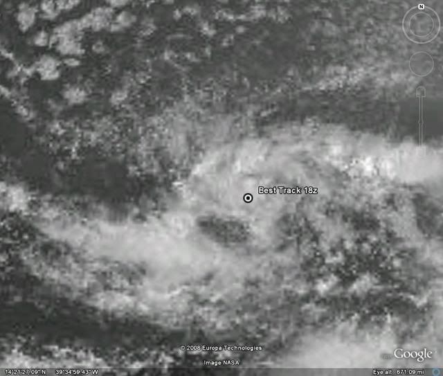
18:00 UTC Best track:
AL, 94, 2008081818, , BEST, 0, 129N, 352W, 25, 1009, DB, 34, NEQ, 0, 0, 0, 0,
AL, 94, 2008081818, , BEST, 0, 129N, 352W, 25, 1009, DB, 34, NEQ, 0, 0, 0, 0,
0 likes


-
cheezyWXguy

- Category 5

- Posts: 6262
- Joined: Mon Feb 13, 2006 12:29 am
- Location: Dallas, TX
Re: ATL: Invest 94L WSW of CV Islands=2 PM EDT TWO,Orange
Lots of convection getting ready to pop. Expect a much more convective system overnight into tomorrow. dots are popping up all over the circulation. We might actually have one storm this year that behaves like a normal tropical cyclone.
heres the loop:
http://www.ssd.noaa.gov/goes/flt/t2/loop-rgb.html
heres the loop:
http://www.ssd.noaa.gov/goes/flt/t2/loop-rgb.html
0 likes

-
cheezyWXguy
- Category 5
- Posts: 6262
- Joined: Mon Feb 13, 2006 12:29 am
- Location: Dallas, TX
Re:
Derek Ortt wrote:looks like a TD already
Do you see evidence yet of a llc? I cant tell as of now, but if you can find some evidence I will easily believe you.
0 likes
-
cycloneye
- Admin
- Posts: 148831
- Age: 69
- Joined: Thu Oct 10, 2002 10:54 am
- Location: San Juan, Puerto Rico
Re:
KWT wrote:Yep Derek I mentioned the same thing ealrier but the NHC of course won't upgrade this, bet if this was where Fay was it'd be upgraded...
But KWT,in past seasons NHC has upgraded systems in the East Atlantic at the same time there is something in the GOM or off the East coast of U.S.
0 likes
Who is online
Users browsing this forum: No registered users and 38 guests