
Arthur's remnents near the BOC
Moderator: S2k Moderators
-
srainhoutx

- S2K Supporter

- Posts: 6919
- Age: 68
- Joined: Sun Jan 14, 2007 11:34 am
- Location: Haywood County, NC
- Contact:
Re: Arthur's remnents near the BOC
Just to lighten things up abit, here's a snipet from HPC today concerning areas of interest...
TROPICAL DISCUSSION - INTERNATIONAL DESKS
NWS HYDROMETEOROLOGICAL PREDICTION CENTER CAMP SPRINGS MD
237 PM EDT MON JUN 02 2008
DISCUSSION FROM JUN 02/0000 UTC. AN ELONGATED UPPER TROUGH OVER
THE SOUTHERN GULF OF MEXICO/SOUTHERN MEXICO SEPARATES TWO RIDGES.
THE WESTERNMOST CENTERS ON A CLOSED HIGH OVER MEXICO NEAR 24N
105W...AND IT ENVELOPS AREA NORTH OF 20N AND WEST OF 95W. THE
MODELS AGREE ON A BROAD TROUGH PATTERN TO GRADUALLY ESTABLISH
ACROSS THE WESTERN/CENTRAL USA... WHICH WILL PUSH AGAINST THE
RIDGE OVER MEXICO. IN THIS PROCESS...THE RIDGE IS TO GRADUALLY
WEAKEN/COLLAPSE THROUGH 60-72 HRS. THE OTHER RIDGE EXTENDS ACROSS
CENTRAL AMERICA-WESTERN/SOUTHERN CARIBBEAN. THIS RIDGE IS TO
INITIALLY CENTER ON A HIGH NEAR CABO GRACIAS A DIOS...AND THROUGH
48 HRS THE HIGH WILL RELOCATE TO SOUTHERN GUATEMALA/CHIAPAS IN
SOUTHERN MEXICO...WHERE IT WILL THEN PERSIST THROUGH 72 HRS.
AT 850/500 HPA...A BROAD CYCLONIC CIRCULATION ENVELOPS SOUTHERN
MEXICO-CENTRAL AMERICA...WITH TWO CLOSED LOWS ANCHORING THIS
FEATURE...BOTH EVIDENT AT 850 AND 700 HPA. ONE OF THE LOWS CENTERS
OVER CAMPECHE/CHIAPAS...WHILE THE OTHER LIES SOUTH OF THE GULF OF
TEHUANTEPEC OVER THE EASTERN PACIFIC. THE BROAD CYCLONIC
CIRCULATION WILL PERSIST NEARLY UNCHANGED THROUGH 30-36 HRS. BUT
AFTER 42/48 HRS IS TO RAPIDLY WEAKEN. BY 72 HRS ALL THAT REMAINS
IS A NARROW TROUGH WITH AXIS FROM CENTRAL MEXICO TO SOUTHERN
HONDURAS/NICARAGUA. AS THE LOW LEVEL TROUGH PATTERN EVOLVES...AND
AS THE UPPER RIDGE OVER MEXICO WEAKENS...WE FORESEE A GRADUAL
DECREASE IN CONVECTION ACROSS SOUTHERN MEXICO-NORTHERN CENTRAL
AMERICA. MOST INTENSE TO DEVELOP DURING THE NEXT 36-48 HRS. OVER
BELIZE-YUCATAN TO TABASCO...WE EXPECT RAINFALL AMOUNTS OF
20-35MM/DAY AND MAXIMA OF 75-125MM THROUGH 36 HRS...WITH MAXIMA OF
35-70MM AT 36-60 HRS. BY 60-84 HRS EXPECT RAINFALL AMOUNTS OF
15-25MM/DAY WITH MAXIMA OF 30-60MM. MOST ACTIVE CONVECTION...
HOWEVER...IS EXPECTED FROM SOUTHERN CHIAPAS TO SOUTHERN
GUATEMALA-EL SALVADOR...WHERE THE BROAD CYCLONIC CIRCULATION WILL
SUSTAIN A SOUTHWESTERLY FLOW THAT IS TO CONVERGE ON THE
CONTINENTAL DIVIDE. IN THIS REGION WE EXPECT RAINFALL AMOUNTS OF
20-35MM/DAY AND MAXIMA OF 100-150MM THROUGH 36 HRS. AT 36-60 HRS
EXPECT MAXIMA OF 75-125MM...AND THROUGH 72-84 HRS MAXIMA WILL
DECREASE TO 30-60MM.
http://www.hpc.ncep.noaa.gov/discussions/fxca20.html
0 likes

Re: Arthur's remnents near the BOC
Chacor wrote:tailgater wrote:ARTHUR ARTHUR ARTHUR It might redevelop, it might get over open water, it might not get over open water, it might drive you crazy ARTHUR ARTHUR ARTHUR
. THE REMNANTS OF ARTHUR CONTINUE TO PRODUCE WIDESPREAD CLOUDINESS AND
LOCALIZED HEAVY RAINS OVER PORTIONS OF BELIZE...GUATEMALA...AND
SOUTHEASTERN MEXICO. REDEVELOPMENT OF THIS SYSTEM IS NOT
EXPECTED DURING THE NEXT COUPLE OF DAYS AS IT MOVES SLOWLY
WESTWARD...BUT ASSOCIATED HEAVY RAINS COULD CAUSE LIFE-THREATENING
FLASH FLOODS AND MUD SLIDES...ESPECIALLY IN MOUNTAINOUS
TERRAIN.
I'll highlight a different bit of that:
THE REMNANTS OF ARTHUR CONTINUE TO PRODUCE WIDESPREAD CLOUDINESS AND
LOCALIZED HEAVY RAINS OVER PORTIONS OF BELIZE...GUATEMALA...AND
SOUTHEASTERN MEXICO. REDEVELOPMENT OF THIS SYSTEM IS NOT
EXPECTED DURING THE NEXT COUPLE OF DAYS AS IT MOVES SLOWLY
WESTWARD...BUT ASSOCIATED HEAVY RAINS COULD CAUSE LIFE-THREATENING
FLASH FLOODS AND MUD SLIDES...ESPECIALLY IN MOUNTAINOUS
TERRAIN.
It doesn't say "ARTHUR CONTINUES TO PRODUCE..."
There's also no need to be a right ****.
Remnants of who
0 likes
-
gatorcane

- S2K Supporter
- Posts: 23708
- Age: 48
- Joined: Sun Mar 13, 2005 3:54 pm
- Location: Boca Raton, FL
Re: Arthur's remnents near the BOC
there is a serious trough digging all the way down into Southern California that is moving quickly ESE and will sweep through the southern plains through the GOM towards the end of this week. If the REMNANTS (lol) of Arthur regenerate in the southern BOC, I think there is a chance it would get swept up by this trough and pulled north:
0 likes
Re: Arthur's remnents near the BOC
[quote="Matt-hurricanewatcher"]LLC moving into the BOC at this moment. The center is near 18.8 north/92.2 west and moving west-northwest to northwest at near 290 degree's. Also this LLC is near the west side of the convection that is blowing up currently. So I expect this to slowly redevelop, even in the face of some moderate shear. In yes this will be Arthur.
A couple of obs from near the REMAINS of Arthur
http://weather.noaa.gov/weather/current/MMCE.html
http://weather.noaa.gov/weather/current/MMVA.html
West winds at Villahermosa, 7 knots, probably aren't gonna upgrade. tehe
A couple of obs from near the REMAINS of Arthur
http://weather.noaa.gov/weather/current/MMCE.html
http://weather.noaa.gov/weather/current/MMVA.html
West winds at Villahermosa, 7 knots, probably aren't gonna upgrade. tehe
0 likes
-
Matt-hurricanewatcher
Re: Arthur's remnents near the BOC
tailgater wrote:Matt-hurricanewatcher wrote:LLC moving into the BOC at this moment. The center is near 18.8 north/92.2 west and moving west-northwest to northwest at near 290 degree's. Also this LLC is near the west side of the convection that is blowing up currently. So I expect this to slowly redevelop, even in the face of some moderate shear. In yes this will be Arthur.
A couple of obs from near the REMAINS of Arthur
http://weather.noaa.gov/weather/current/MMCE.html
Based on those obs it appears that Arthur has developed a weak west wind. In is likely still "just" inland or on the coast near 18.3/92.3. The westly wind is near 18.0/92.3 or so, while the eastly is near 18.4/91.5. So anyways it is close, but not as of yet made it over water.
http://weather.noaa.gov/weather/current/MMVA.html
West winds at Villahermosa, 7 knots, probably aren't gonna upgrade. tehe
0 likes

-
Category 5

- Category 5

- Posts: 10074
- Age: 36
- Joined: Sun Feb 11, 2007 10:00 pm
- Location: New Brunswick, NJ
- Contact:
Re: Arthur's remnents near the BOC
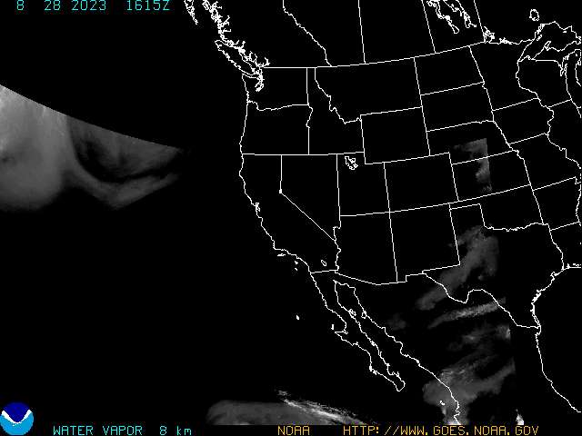
Am I the only one seeing this?

It's bone dry in the BOC. Sheer isn't exactly friendly either.
It's bone dry in the BOC. Sheer isn't exactly friendly either.
0 likes

Re: Arthur's remnents near the BOC
Category 5 wrote:Am I the only one seeing this?
It's bone dry in the BOC. Sheer isn't exactly friendly either.
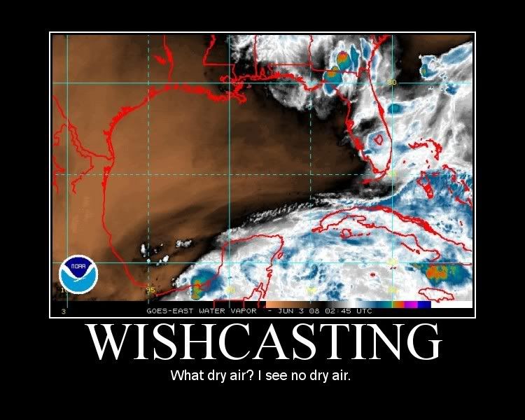
Nope, I posted the NRL WV image one page ago. Roundly ignored, of course.
0 likes
-
Category 5
- Category 5
- Posts: 10074
- Age: 36
- Joined: Sun Feb 11, 2007 10:00 pm
- Location: New Brunswick, NJ
- Contact:
Re: Arthur's remnents near the BOC
Chacor wrote:Nope, I posted the NRL WV image one page ago. Roundly ignored, of course.
0 likes
-
StormspinnerD2
Re: Arthur's remnents near the BOC
Chacor wrote:Category 5 wrote:Am I the only one seeing this?
It's bone dry in the BOC. Sheer isn't exactly friendly either.
Nope, I posted the NRL WV image one page ago. Roundly ignored, of course.
I pointed it out, too. Conditions just do not favour development in the Bay of Campeche at this time, even if the centre does get back over water and even despite its current appearance. Even if conditions were different, at its current pace it'd have at most 4-6 hours over water.
Last edited by StormspinnerD2 on Mon Jun 02, 2008 10:46 pm, edited 1 time in total.
0 likes
-
Matt-hurricanewatcher
Re: Arthur's remnents near the BOC
I know theres dry air. But its not impossible for development even with dry air...I'm not saying this will become anything more then maybe a weak Bret like tropical storm.
0 likes
-
Category 5
- Category 5
- Posts: 10074
- Age: 36
- Joined: Sun Feb 11, 2007 10:00 pm
- Location: New Brunswick, NJ
- Contact:
Re: Arthur's remnents near the BOC
Matt-hurricanewatcher wrote:I know theres dry air. But its not impossible for development even with dry air...I'm not saying this will become anything more then maybe a weak Bret like tropical storm.
+ 30kts of sheer + No convection near the center + Very limited time = Next system.
It just has too much working against it.
0 likes
-
Ivanhater

- Storm2k Moderator

- Posts: 11221
- Age: 39
- Joined: Fri Jul 01, 2005 8:25 am
- Location: Pensacola
Re: Arthur's remnents near the BOC
Category 5 wrote:Matt-hurricanewatcher wrote:I know theres dry air. But its not impossible for development even with dry air...I'm not saying this will become anything more then maybe a weak Bret like tropical storm.
+ 30kts of sheer + No convection near the center + Very limited time = Next system.
It just has too much working against it.
Come on cat 5! lets just see what happens..maybe its the wine i found..lol..but its fun to look at and there is not much else to look at and something could..could try to spin up
0 likes
-
Aric Dunn
- Category 5
- Posts: 21238
- Age: 43
- Joined: Sun Sep 19, 2004 9:58 pm
- Location: Ready for the Chase.
- Contact:
Re: Arthur's remnents near the BOC
Category 5 wrote:Matt-hurricanewatcher wrote:I know theres dry air. But its not impossible for development even with dry air...I'm not saying this will become anything more then maybe a weak Bret like tropical storm.
+ 30kts of sheer + No convection near the center + Very limited time = Next system.
It just has too much working against it.
everyone always forgets " YOU JUST NEVER KNOW" its the tropics...
0 likes

Who is online
Users browsing this forum: Google Adsense [Bot] and 50 guests