O Town wrote:

Is anyone having trouble viewing this image? I cant see anything?
Moderator: S2k Moderators


sphelps8681 wrote:Smurfwicked wrote:O Town wrote:
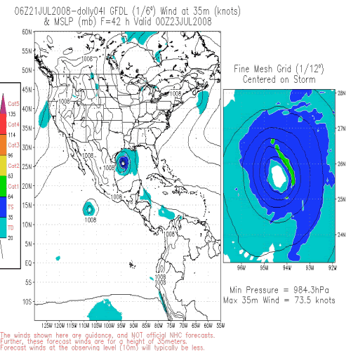
I've been waiting on this, thank you. And is it just me or do most of them models show a lot of "wobbles" in the track? Is that normal? I can't remember seeing ones that looked so much like the lines was drawn on with a squiggly pen.
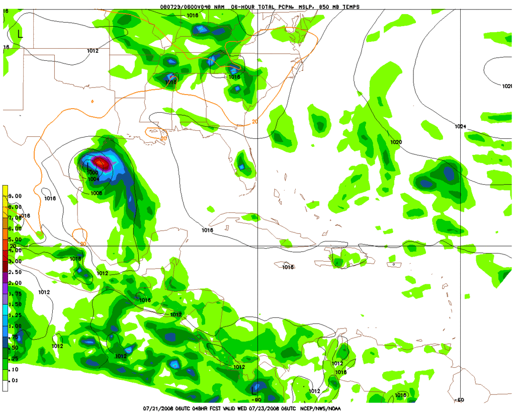
It shows models coming toward Houston and Beaumont/Pt. Arthur area. Is this correct. Because all I have been hearing is Mexico/S. Tex. Have these readjusted since Dolly made her trip over the Yuc.

sphelps8681 wrote:It shows models coming toward Houston and Beaumont/Pt. Arthur area. Is this correct. Because all I have been hearing is Mexico/S. Tex. Have these readjusted since Dolly made her trip over the Yuc.

PauleinHouston wrote:Agreed. Recon hasn't found a good westerly wind component as yet, however, MLC appears to be in control at the time. When the LLC reforms, I think it will do so farther north and lay the models out more towards mid-Texas coast and points south.
PauleinHouston wrote:Agreed. Recon hasn't found a good westerly wind component as yet, however, MLC appears to be in control at the time. When the LLC reforms, I think it will do so farther north and lay the models out more towards mid-Texas coast and points south.


Users browsing this forum: No registered users and 49 guests


