ATL: IKE Discussion

Moderator: S2k Moderators

Message
Author
User avatar
Aristotle
Tropical Storm
Tropical Storm
Posts: 141
Age: 59
Joined: Wed Aug 27, 2008 8:16 pm
Location: Crowley, TX

Re: Re:

#6881 Postby Aristotle » Tue Sep 09, 2008 7:59 pm

Stormcenter wrote:
KWT wrote:
Stormcenter wrote:Ike is going to hit a brick wall (High) and be shoved back down to the west.
I'm sure the NHC has done their homework. They are even better at what they do now
then they were with Rita.


To be fair though they are using the models and they can still make mistakes like they did with Rita. Of course the general evolution looks good but obviously small details like the curve north happening 6-12hrs will have a big impact on the actual track and landfall of Ike.


Gustav had a ton of wobbles and it still ended up exactly where they said it was 4 days out.....Central LA. coastline.


that storm was going generally nw so wobbles didn't effect that much. When a turn is involved then wobbles mean a lot more.. Picture yourself starting from a point and walking dead straight from 359 degrees instead of 360. How far apart are the paths miles out? When a turn starts matters! I would think!
0 likes   

tolakram
Admin
Admin
Posts: 20018
Age: 62
Joined: Sun Aug 27, 2006 8:23 pm
Location: Florence, KY (name is Mark)

Re: ATL IKE: Category 1 - Discussion

#6882 Postby tolakram » Tue Sep 09, 2008 8:00 pm

Ike's pausing for a few frames. :) Observation, nothing more.

Image
0 likes   

User avatar
Weatherfreak14
Category 5
Category 5
Posts: 1383
Joined: Sat Sep 24, 2005 3:40 pm
Location: Beaufort, SC
Contact:

Re: Re:

#6883 Postby Weatherfreak14 » Tue Sep 09, 2008 8:01 pm

Stormcenter wrote:
KWT wrote:
Stormcenter wrote:Ike is going to hit a brick wall (High) and be shoved back down to the west.
I'm sure the NHC has done their homework. They are even better at what they do now
then they were with Rita.


To be fair though they are using the models and they can still make mistakes like they did with Rita. Of course the general evolution looks good but obviously small details like the curve north happening 6-12hrs will have a big impact on the actual track and landfall of Ike.


Gustav had a ton of wobbles and it still ended up exactly where they said it was 4 days out.....Central LA. coastline.


im sorry. I do respect you stormcenter, but we are not dealing with gustav.... Lets face it NHC has been right with some storms and completly wrong on other which you can never tell the difference until it happens, but we cant compare how NHC does with a comptley different storm in a different situation.
0 likes   

User avatar
El Nino
Category 1
Category 1
Posts: 454
Age: 47
Joined: Sun Oct 16, 2005 3:18 pm
Location: Lima - Miraflores (Peru)
Contact:

Re: ATL IKE: Category 1 - Discussion

#6884 Postby El Nino » Tue Sep 09, 2008 8:02 pm

I really don't see any movement of the eye now ...
0 likes   

Stormcenter
S2K Supporter
S2K Supporter
Posts: 6684
Joined: Wed Sep 03, 2003 11:27 am
Location: Houston, TX

Re: Re:

#6885 Postby Stormcenter » Tue Sep 09, 2008 8:02 pm

superfly wrote:
artist wrote:you can't go by VDM's as they aren't always in the dead center of the eye.

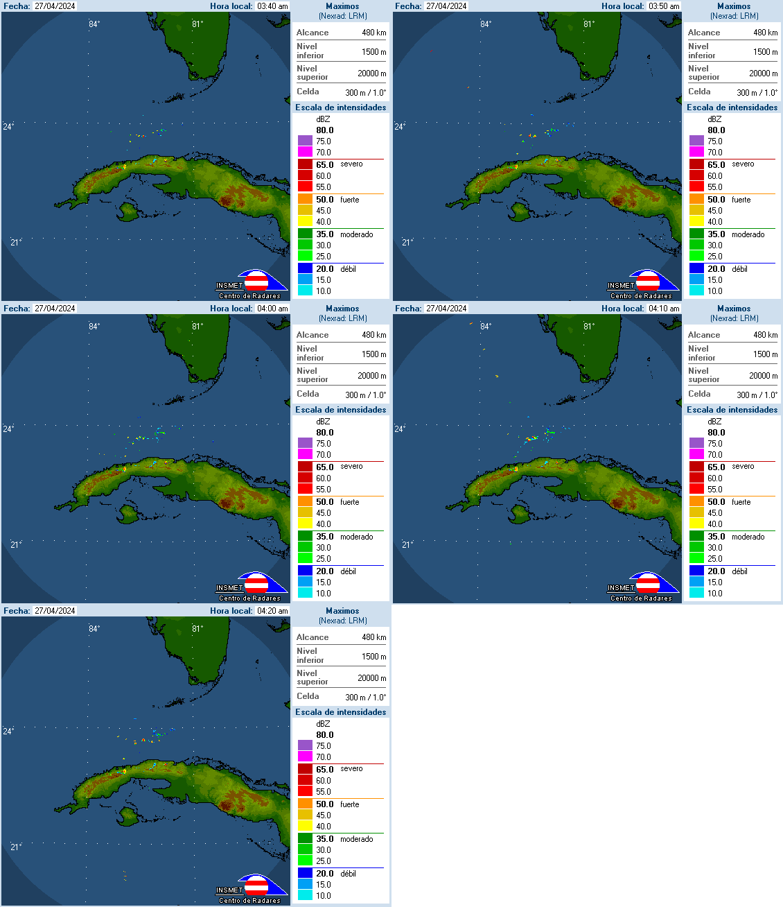
Shrug, Cuban radar shows the same WNW movement, if not due west.

Image


Hey look I've been guilty of "wobble watching" but after Gustav I think I might
have finally seen the light.

Anyway maybe this radar loop will put this to rest for at least a few minutes.
Thank you.
Last edited by Stormcenter on Tue Sep 09, 2008 8:03 pm, edited 1 time in total.
0 likes   

jinftl
Category 5
Category 5
Posts: 4312
Joined: Tue Aug 31, 2004 4:47 pm
Location: fort lauderdale, fl

Re: ATL IKE: Category 1 - Discussion

#6886 Postby jinftl » Tue Sep 09, 2008 8:02 pm

Thanks! Perhaps some of the pros can assess which are met...but right off the bat, if you look at last 12-hours...even though he has been over land, there has been weakening. Not sure if a 12-hour weakening or strengthening is ndicative of potential RI to come.

AL Chili Pepper wrote:
jinftl wrote:I recall that in discussions where the NHC is cautiously forecasting a period of rapid intensification, they say that 4 of the factors 'needed' for RI are present, for example. What are those factors and which are or are not present with Ike.


here's the 5 factors....don't know which one's missing.

1. previous 12-hour intensity change
2. SST
3. low level RH
4. vertical shear
5. difference between the current intensity and max potential tropical cyclone intensity

http://cyclone.atms.unca.edu/documents/ ... eprint.pdf
0 likes   

Weatherfreak000

Re: Re:

#6887 Postby Weatherfreak000 » Tue Sep 09, 2008 8:02 pm

I really think some of our members... (Curious our Texan members..) are having a little bit of difficulty understanding this forecast.


This is MID SEPTEMBER...peak time of the year to see considerable forecast difficulty. Fay even before that earlier was a storm with a considerable amount of difficulty in forecasting. The proof is in the pudding...has the NHC...the Models...THE PRO METS....been even CLOSE determining where Ike is now?


Two scenarios exist now:

1. The NHC's track holds up...which is the weakness is underdeveloped...the Trough never comes...and Texas suffers a disaster.

2. The weakness is overdeveloped.....the high isn't as strong/or the storm slows down....the trough comes through...and it COULD honestly make a turn.


We are talking considerable uncertainties here...lest I have to quote the NHC discussion...and you know times are getting desperate on these forums if I do that...


IT CANNOT BE OVEREMPHASIZED THAT ONE SHOULD NOT FOCUS ON 4 AND 5 DAY
FORECAST POINTS SINCE THESE CAN BE SUBJECT TO SUBSTANTIAL ERRORS.
DO NOT FORGET THAT FEW DAYS AGO...THE GUIDANCE UNANIMOUSLY HAD IKE
NEAR SOUTH FLORIDA AND THEN GRADUALLY SHIFTED THE DANGER TOWARD
WESTERN CUBA AND THE GULF OF MEXICO.
Last edited by Weatherfreak000 on Tue Sep 09, 2008 8:05 pm, edited 1 time in total.
0 likes   

tolakram
Admin
Admin
Posts: 20018
Age: 62
Joined: Sun Aug 27, 2006 8:23 pm
Location: Florence, KY (name is Mark)

Re: ATL IKE: Category 1 - Discussion

#6888 Postby tolakram » Tue Sep 09, 2008 8:03 pm

El Nino wrote:I really don't see any movement of the eye now ...


Put your mouse cursor over the eye in the last frame. It's moving slowly.
0 likes   

User avatar
Sean in New Orleans
Category 5
Category 5
Posts: 1794
Joined: Thu Aug 28, 2003 7:26 pm
Location: New Orleans, LA 30.0N 90.0W
Contact:

Re:

#6889 Postby Sean in New Orleans » Tue Sep 09, 2008 8:03 pm

jasons wrote:People - I feel AFM's frustration in the models thread.

Please READ a few pages before posting. Use your noggin. There are "veteran" members making posts that make no sense.

A temporary northern jog is expected. That weakness will eventually close. There is nothing to suggest Ike will move into the NC Gulf Coast. Give it a rest. Please.

This storm has 3 days and 3 warm eddies to go before landfall. The core is very well-organized. The setup is there for intensification. If that doesn't concern you then you need to read more and post less.

I agree, but, I do think that it could turn NW sooner than expected and I really feel that Houston members here should be on guard. I think the ridge is going to back off sooner than expected and the storm will head towards Galveston. Just my amateur opinion, but, I'm watching cloud patterns nationwide, even more than nationwide.
0 likes   

rtd2
Category 5
Category 5
Posts: 1183
Joined: Tue Aug 12, 2003 12:45 pm
Location: Biloxi, MS

Re: ATL IKE: Category 1 - Discussion

#6890 Postby rtd2 » Tue Sep 09, 2008 8:04 pm

El Nino wrote:I really don't see any movement of the eye now ...


said about 20 pages ago it looked to be slowing...man i was only away for 1hr and have 20 pages to catch up on...wonder if there are in wobble post??? :D :lol:
Last edited by rtd2 on Tue Sep 09, 2008 8:05 pm, edited 1 time in total.
0 likes   

User avatar
KWT
Category 5
Category 5
Posts: 31415
Joined: Tue Aug 17, 2004 11:02 am
Location: UK!!!

#6891 Postby KWT » Tue Sep 09, 2008 8:04 pm

Radar does suggest a WNW motion still, IR does sort of suggest a motion of WNW as well, its close to the NHC right now.
0 likes   

6SpeedTA95
Category 5
Category 5
Posts: 1206
Joined: Wed Oct 19, 2005 3:25 pm
Location: Oklahoma
Contact:

#6892 Postby 6SpeedTA95 » Tue Sep 09, 2008 8:04 pm

Any of the pro's currently in the thread? I Just talked with a friend of mine who works for the national weather service. He said something about anti cyclonic winds aloft possibly slowing intesification? He didn't have much time to talk, can anyone shed some light on this or should I just send him an email and wait for his response tomorrow morning?
0 likes   

Stormcenter
S2K Supporter
S2K Supporter
Posts: 6684
Joined: Wed Sep 03, 2003 11:27 am
Location: Houston, TX

Re: Re:

#6893 Postby Stormcenter » Tue Sep 09, 2008 8:06 pm

Sean in New Orleans wrote:
jasons wrote:People - I feel AFM's frustration in the models thread.

Please READ a few pages before posting. Use your noggin. There are "veteran" members making posts that make no sense.

A temporary northern jog is expected. That weakness will eventually close. There is nothing to suggest Ike will move into the NC Gulf Coast. Give it a rest. Please.

This storm has 3 days and 3 warm eddies to go before landfall. The core is very well-organized. The setup is there for intensification. If that doesn't concern you then you need to read more and post less.

I agree, but, I do think that it could turn NW sooner than expected and I really feel that Houston members here should be on guard. I think the ridge is going to back off sooner than expected and the storm will head towards Galveston. Just my amateur opinion, but, I'm watching cloud patterns nationwide, even more than nationwide.


Nah that's not going to happen...... :eek:
0 likes   

tolakram
Admin
Admin
Posts: 20018
Age: 62
Joined: Sun Aug 27, 2006 8:23 pm
Location: Florence, KY (name is Mark)

Re:

#6894 Postby tolakram » Tue Sep 09, 2008 8:07 pm

6SpeedTA95 wrote:Any of the pro's currently in the thread? I Just talked with a friend of mine who works for the national weather service. He said something about anti cyclonic winds aloft possibly slowing intesification? He didn't have much time to talk, can anyone shed some light on this or should I just send him an email and wait for his response tomorrow morning?


Derek mentioned this a few pages back. The anti-cyclone is not centered directly over Ike which will cause some shear.
0 likes   

Stormcenter
S2K Supporter
S2K Supporter
Posts: 6684
Joined: Wed Sep 03, 2003 11:27 am
Location: Houston, TX

Re: ATL IKE: Category 1 - Discussion

#6895 Postby Stormcenter » Tue Sep 09, 2008 8:08 pm

tolakram wrote:
El Nino wrote:I really don't see any movement of the eye now ...


Put your mouse cursor over the eye in the last frame. It's moving slowly.


Please don't post that it's moving NE now.
You'll give all of the Fl. posters a heart attack...... :D
0 likes   

User avatar
HouTXmetro
Category 5
Category 5
Posts: 3949
Joined: Sun Jun 13, 2004 6:00 pm
Location: District of Columbia, USA

#6896 Postby HouTXmetro » Tue Sep 09, 2008 8:08 pm

Wobbles will correct themselves. Stop arguing... Ike just wobbled back to the W so if there was a NNW wobble it's corrected now.
0 likes   

User avatar
Sabanic
Category 2
Category 2
Posts: 683
Age: 65
Joined: Wed Aug 01, 2007 7:01 am
Location: Mobile, AL
Contact:

Re: ATL IKE: Category 1 - Discussion

#6897 Postby Sabanic » Tue Sep 09, 2008 8:08 pm

Kind of surprised that there have been a few posts asking people to do no speculation on what they may see with Ike, or to say what they are thinking. Basically don't speculate anything that opposes what the pros say, or what the NHC says. I realize what is supposed to happen, and where Ike is supposed to go, but I also realize there is a whole lot of real estate along the GOM, and we have a hurricane that is supposed to strengthen into a major sitting just off the coast of Cuba. It hasn't made landfall yet and doesn't everyone along the coast have the right to be concerned until it does???
0 likes   

6SpeedTA95
Category 5
Category 5
Posts: 1206
Joined: Wed Oct 19, 2005 3:25 pm
Location: Oklahoma
Contact:

Re: Re:

#6898 Postby 6SpeedTA95 » Tue Sep 09, 2008 8:08 pm

tolakram wrote:
6SpeedTA95 wrote:Any of the pro's currently in the thread? I Just talked with a friend of mine who works for the national weather service. He said something about anti cyclonic winds aloft possibly slowing intesification? He didn't have much time to talk, can anyone shed some light on this or should I just send him an email and wait for his response tomorrow morning?


Derek mentioned this a few pages back. The anti-cyclone is not centered directly over Ike which will cause some shear.

Yeah...I'll have to backtrack and see if I can find it...anyone (Derek?) have anything to add perhaps some meteorological details?
0 likes   

rtd2
Category 5
Category 5
Posts: 1183
Joined: Tue Aug 12, 2003 12:45 pm
Location: Biloxi, MS

Re:

#6899 Postby rtd2 » Tue Sep 09, 2008 8:09 pm

HouTXmetro wrote:Wobbles will correct themselves. Stop arguing... Ike just wobbled back to the W so if there was a NNW wobble it's corrected now.


agreed wobbles dont matter till near landfall...like in my case with Katrina :eek:
0 likes   

shah8
Category 1
Category 1
Posts: 363
Joined: Wed Aug 30, 2006 4:36 pm

#6900 Postby shah8 » Tue Sep 09, 2008 8:09 pm

He probably means that the anticyclone is to the east of Ike, and as Ike moves westward, the edge of the anticyclone will shear Ike.
0 likes   


Return to “2008”

Who is online

Users browsing this forum: No registered users and 6 guests