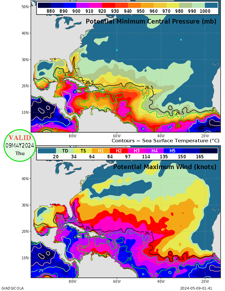
The current Maximum Potential Intensity (MPI) graphics suggest that a sub-900 mb Gustav in the Gulf is extremely unlikely. 910-920 mb is possible (based on SSTs, TCHP, etc), but getting that low may be difficult unless shear can decrease to <10 kts.
Gustav MAY have been able to hit <920 mb if it weren't for its interaction with Cuba (i.e. if it had more time to organize over the extremely hot water), but that's very difficult to say. The TCHP (see
HERE)and SSTs were highest in that part of the Caribbean (highest anywhere in the Atlantic), and shear looked to be ~15-20 kts, which is certainly far from uber-favorable. As others have noted, conditions really need to be nearly perfect to get a Cat 5 storm (or a storm <920 mb), and I certainly wouldn't say the conditions now are perfect. The mentioned MPI graphics suggest that the only area that would support a <900 mb storm would be in the far NW Caribbean south of Cuba (right where Gustav was). Outflow is being significantly enhanced by strong upper-level divergence over the northern Gulf downstream of an upper-level trough axis (see
HERE; note that the upper-level divergence associated with Gustav is enhancing what appears to the "ambient" / environmental divergence as well). 15-20 kts of vertical shear is quite significant, and I have a hard time believing it'll be able to intensify to Cat 5 again if such shear persists (remember, TCHP is lower in the Gulf, particularly as it approaches the coast than it was south of Cuba!).

For the Maximum Potential Intensity (minimum pressure and maximum winds) graphics for the Atlantic (and elsewhere) see -->
http://wxmaps.org/pix/hurpot.html#ATLThis may well have a different "mode of flooding" in New Orleans compared to Katrina. Instead of being flooded by Lake Ponch. (strong easterly winds preceding the eye squeezed a lot of water up into the lake, and strong northerly winds to the west of the eye pushed all that accumulated water southward into New Orleans), New Orleans may be levee problems with water pushed up the river from the south. Of course, some water will likely be pumped westward into Lake Ponch., but it doesn't seem as likely that such water will be pushed southward into New Orleans given the current forecast of Gustav staying west of New Orleans (in southerly or southeasterly surface flow at closest approach).
Of course, we are STILL >36 hours from projected landfall, and even a 20 mile diversion to the right / east of the projected track may be all it takes to have another catastrophe on our hands. Right now, it looks like Gustav's official forecast has it ~45-50 miles from New Orleans at closest approach. The "worst case scenario" that I can think of would bring the eastern eyewall over NOLA, which would require only a ~45 mile shift eastward from current forecast. At ~42 hours out, a 45 mile error would be almost nothing relative to historical errors at that forecast hour. If Gustav takes a westward jog to move it another 45-50 miles to the left of the current track (and, therefore, 80-100 miles WSW of NOLA at closest approach), the probably of catastrophic flooding in NOLA is
significantly reduced.


