ATL GUSTAV: Tropical Depression - Discussion

Moderator: S2k Moderators

Message
Author
User avatar
Extremeweatherguy
Category 5
Category 5
Posts: 11095
Joined: Mon Oct 10, 2005 8:13 pm
Location: Florida

Re: Cat. 3 Hurricane Gustav in Gulf of Mexico

#8421 Postby Extremeweatherguy » Sun Aug 31, 2008 12:55 pm

bigjohn wrote:
That seems to be a point of contention The NWS confirms that there were sustained winds of in excess of 142 mph in Slidell, LA. My SS scale says that is a Cat 4
Can you please point out where you found the NWS confirming sustained winds of 142mph in Slidell?

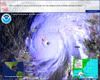
The highest report I can find from the NHC post-storm report is an unofficial gust to 121mph in Slidell: http://www.nhc.noaa.gov/pdf/TCR-AL122005_Katrina.pdf

And at the Slidell airport, winds were even lower. The NHC storm report indicates an unofficial sustained speed of 70mph with gusts to 100mph.

These speeds do not correspond to category 4-force winds.
Last edited by Extremeweatherguy on Sun Aug 31, 2008 12:57 pm, edited 2 times in total.
0 likes   

User avatar
jasons2k
Storm2k Executive
Storm2k Executive
Posts: 8245
Age: 51
Joined: Wed Jul 06, 2005 12:32 pm
Location: The Woodlands, TX

Re:

#8422 Postby jasons2k » Sun Aug 31, 2008 12:55 pm

Derek Ortt wrote:Please look at a visible loop instead. It is clearly reorganizing. I also know of some pro mets who have access to other views that show the center becoming better stacked than earlier. There is no question it is getting better organized and will probably commence a deepening phase soon. All I can say is if you don't believe me, have some patience, we will see soon enough.

I am not at all sure what you're seeing. I am seeing a cyclone that continues to experience strong shear.

I also see one with a very broad windfield, which is bad from a surge perspective

even if this comes in as a 2... remember the damage that Dolly caused and it was "just a borderline cat 1/2"


Yes, it is experiencing shear hence the not-so-great appearence. But you have to admit it's getting better organized than it was earlier today. I still expect this to stenghthen but to clarify I never said "rapidly" or anything like that. But I think it's clear it's not weakening as some have posted.
0 likes   

User avatar
SoupBone
Category 5
Category 5
Posts: 3111
Joined: Tue Sep 20, 2005 5:24 pm

Re: Cat. 3 Hurricane Gustav in Gulf of Mexico

#8423 Postby SoupBone » Sun Aug 31, 2008 12:57 pm

Anyone have access to the 2pm update? I was told that the wind speeds decreased a bit.

EDIT: Down to 115 mph so that's definately not that much of a decrease.
Last edited by SoupBone on Sun Aug 31, 2008 12:58 pm, edited 1 time in total.
0 likes   

User avatar
ColdFusion
S2K Supporter
S2K Supporter
Posts: 444
Joined: Wed Feb 13, 2008 3:46 pm
Location: Addison, TX

Re: Cat. 3 Hurricane Gustav in Gulf of Mexico

#8424 Postby ColdFusion » Sun Aug 31, 2008 12:57 pm

So latest recon finds a still open eyewall and maximum surface winds of 107mph....

Encouraging right?
0 likes   

User avatar
Hurricaneman13
Tropical Low
Tropical Low
Posts: 33
Joined: Tue Jul 22, 2008 10:33 pm

Re: Cat. 3 Hurricane Gustav in Gulf of Mexico

#8425 Postby Hurricaneman13 » Sun Aug 31, 2008 12:58 pm

000
WTNT32 KNHC 311750
TCPAT2
BULLETIN
HURRICANE GUSTAV INTERMEDIATE ADVISORY NUMBER 28A
NWS TPC/NATIONAL HURRICANE CENTER MIAMI FL AL072008
100 PM CDT SUN AUG 31 2008

...GUSTAV WEAKENS A LITTLE MORE...BUT STILL A MAJOR HURRICANE...

A HURRICANE WARNING REMAINS IN EFFECT FOR THE NORTHERN GULF COAST
FROM CAMERON LOUISIANA EASTWARD TO THE ALABAMA-FLORIDA BORDER...
INCLUDING THE CITY OF NEW ORLEANS AND LAKE PONTCHARTRAIN. A
HURRICANE WARNING MEANS THAT HURRICANE CONDITIONS ARE EXPECTED
WITHIN THE WARNING AREA WITHIN THE NEXT 24 HOURS. PREPARATIONS TO
PROTECT LIFE AND PROPERTY SHOULD BE RUSHED TO COMPLETION.

A TROPICAL STORM WARNING REMAINS IN EFFECT FROM EAST OF THE
ALABAMA-FLORIDA BORDER TO THE OCHLOCKONEE RIVER....AND FROM WEST OF
CAMERON LOUISIANA TO JUST EAST OF HIGH ISLAND TEXAS. A TROPICAL
STORM WARNING MEANS THAT TROPICAL STORM CONDITIONS ARE EXPECTED
WITHIN THE WARNING AREA WITHIN THE NEXT 24 HOURS.

A HURRICANE WATCH REMAINS IN EFFECT FROM WEST OF CAMERON LOUISIANA
TO JUST EAST OF HIGH ISLAND TEXAS. A HURRICANE WATCH MEANS THAT
HURRICANE CONDITIONS ARE POSSIBLE WITHIN THE WATCH AREA...GENERALLY
WITHIN 36 HOURS.

AT 2 PM EDT...1800 UTC...THE TROPICAL STORM WARNING IS DISCONTINUED
FOR THE FLORIDA KEYS EXCEPT FOR THE DRY TORTUGAS. A TROPICAL STORM
WARNING REMAINS IN EFFECT FOR THE DRY TORTUGAS.

FOR STORM INFORMATION SPECIFIC TO YOUR AREA...INCLUDING POSSIBLE
INLAND WATCHES AND WARNINGS...PLEASE MONITOR PRODUCTS ISSUED
BY YOUR LOCAL WEATHER OFFICE.

AT 100 PM CDT...1800Z...THE CENTER OF HURRICANE GUSTAV WAS LOCATED
NEAR LATITUDE 25.9 NORTH...LONGITUDE 86.6 WEST OR ABOUT 270 MILES...
520 KM...SOUTHEAST OF THE MOUTH OF THE MISSISSIPPI RIVER.

GUSTAV IS MOVING TOWARD THE NORTHWEST NEAR 17 MPH...28 KM/HR. THIS
GENERAL MOTION IS EXPECTED TO CONTINUE WITH A DECREASE IN FORWARD
SPEED DURING THE NEXT COUPLE OF DAYS. ON FORECAST TRACK...GUSTAV
SHOULD MAKE LANDFALL ON THE NORTHERN GULF COAST ON MONDAY.

REPORTS FROM AN AIR FORCE RESERVE HURRICANE HUNTER AIRCRAFT INDICATE
MAXIMUM SUSTAINED WINDS HAVE TO DECREASED TO NEAR 115 MPH...185
KM/HR...WITH HIGHER GUSTS. GUSTAV IS A CATEGORY THREE HURRICANE ON
THE SAFFIR-SIMPSON SCALE. SOME RE-INTENSIFICATION IS FORECAST
DURING THE NEXT 12 TO 24 HOURS...AND GUSTAV COULD REGAIN CATEGORY
FOUR STRENGTH LATER TODAY OR TONIGHT. FLUCTUATIONS IN STRENGTH ARE
LIKELY THEREAFTER...BUT GUSTAV IS FORECAST TO REMAIN A MAJOR
HURRICANE UNTIL LANDFALL.

GUSTAV IS A LARGE TROPICAL CYCLONE. HURRICANE FORCE WINDS EXTEND
OUTWARD UP TO 50 MILES...85 KM...FROM THE CENTER...AND TROPICAL
STORM FORCE WINDS EXTEND OUTWARD UP TO 200 MILES...325 KM. NOAA
BUOY 42003 RECENTLY REPORTED 8-MINUTE AVERAGE WINDS OF 60 MPH...
97 KM/HR...WITH A GUST TO 78 MPH...126 KM/HR.

THE MINIMUM CENTRAL PRESSURE JUST REPORTED BY AN AIR FORCE RESERVE
HURRICANE HUNTER AIRCRAFT IS 960 MB...28.35 INCHES.

AN EXTREMELY DANGEROUS STORM SURGE OF 12 TO 16 FEET ABOVE NORMAL
TIDAL LEVELS IS EXPECTED NEAR AND TO THE EAST OF WHERE THE CENTER
OF GUSTAV CROSSES THE NORTHERN GULF COAST. A STORM SURGE OF 1 TO
3 FEET ABOVE NORMAL TIDE LEVELS IS POSSIBLE IN THE DRY TORTUGAS AS
GUSTAV PASSES TO ITS WEST.

GUSTAV IS EXPECTED TO PRODUCE TOTAL RAINFALL ACCUMULATIONS OF 6 TO
12 INCHES OVER PORTION OF LOUISIANA...SOUTHERN MISSISSIPPI AND
SOUTHERN ARKANSAS...WITH ISOLATED MAXIMUM AMOUNTS OF UP TO 20
INCHES POSSIBLE THROUGH WEDNESDAY MORNING. ADDITIONAL RAINFALL
AMOUNTS OF ABOUT AN INCH ARE POSSIBLE OVER FLORIDA KEYS AND
SOUTH FLORIDA.

ISOLATED TORNADOES ARE POSSIBLE OVER THE CENTRAL GULF COAST LATER
TODAY AND TONIGHT.

REPEATING THE 100 PM CDT POSITION...25.9 N...86.6 W. MOVEMENT
TOWARD...NORTHWEST NEAR 17 MPH. MAXIMUM SUSTAINED WINDS...115 MPH.
MINIMUM CENTRAL PRESSURE...960 MB.

THE NEXT ADVISORY WILL BE ISSUED BY THE NATIONAL
HURRICANE CENTER AT 400 PM CDT.

$$
FORECASTER BEVEN
0 likes   

Derek Ortt

#8426 Postby Derek Ortt » Sun Aug 31, 2008 12:59 pm

what we have now is a legitimate 95-100KT cat 3 hurricane. This is very similar to Rita when it made landfall
0 likes   

User avatar
KWT
Category 5
Category 5
Posts: 31415
Joined: Tue Aug 17, 2004 11:02 am
Location: UK!!!

#8427 Postby KWT » Sun Aug 31, 2008 12:59 pm

superfly, its only 50 miles inland and given the size of the system I guess the hurricane force winds would extend further then that, seriously I think if gustav takes the right path those skyscrapers are still going to get 105-115mph gusts even if the system does weaken to a cat-2 IMO...

The surge however is still the biggest worry I agree.
0 likes   

User avatar
ColdFusion
S2K Supporter
S2K Supporter
Posts: 444
Joined: Wed Feb 13, 2008 3:46 pm
Location: Addison, TX

Re: Cat. 3 Hurricane Gustav in Gulf of Mexico

#8428 Postby ColdFusion » Sun Aug 31, 2008 1:00 pm

ColdFusion wrote:So latest recon finds a still open eyewall and maximum surface winds of 107mph....

Encouraging right?


Nevermind...lol
0 likes   

simplykristi
S2K Supporter
S2K Supporter
Posts: 1220
Joined: Sat May 10, 2003 1:59 pm
Location: Near KCMO
Contact:

Re: Cat. 3 Hurricane Gustav in Gulf of Mexico

#8429 Postby simplykristi » Sun Aug 31, 2008 1:00 pm

I keep thinking back to Katrina three years ago. She came in as a Cat 3 but her surge was more like a Cat 5 if I remember correctly. Gustav should not be taken lightly. Gustav could remain a Cat 3 or even drop down to a Cat 2. The bottom line: Gustav will still cause damage wherever he makes landfall.

Kristi
0 likes   

Nexus
Tropical Storm
Tropical Storm
Posts: 137
Joined: Sat Sep 11, 2004 12:13 am

#8430 Postby Nexus » Sun Aug 31, 2008 1:01 pm

Lastest VDM is 960 - they've been 959-962 for 12+ hours now.
0 likes   

User avatar
dhweather
S2K Supporter
S2K Supporter
Posts: 6199
Joined: Sat Aug 14, 2004 9:29 pm
Location: Heath, TX
Contact:

#8431 Postby dhweather » Sun Aug 31, 2008 1:02 pm

Louisiana Governer Bobby Jindall is the fastest talking man on the planet. He's going warp factor 10 in his new conference.

Kudos to him, Louisiana is 1000 times better prepared this time, no Kathleen Baboon governor this time.
0 likes   

User avatar
JtSmarts
S2K Supporter
S2K Supporter
Posts: 1437
Age: 39
Joined: Thu Jul 10, 2003 1:29 pm
Location: Columbia, South Carolina

Re:

#8432 Postby JtSmarts » Sun Aug 31, 2008 1:02 pm

Derek Ortt wrote:what we have now is a legitimate 95-100KT cat 3 hurricane. This is very similar to Rita when it made landfall


I posed earlier that it looks a lot like Rita at landfall especially with the disappearing eye, and everyone knows Rita was nothing to sneeze at.
0 likes   

User avatar
vaffie
Category 3
Category 3
Posts: 898
Joined: Sat Sep 11, 2004 5:11 pm
Location: Houston, Texas

Re: Cat. 3 Hurricane Gustav in Gulf of Mexico

#8433 Postby vaffie » Sun Aug 31, 2008 1:03 pm

Latest GFDL, GFS, and UKMET models have shifted landfall westward.
0 likes   

njweather
Tropical Storm
Tropical Storm
Posts: 169
Joined: Fri Aug 17, 2007 10:45 pm
Location: Washington, DC

Re: Cat. 3 Hurricane Gustav in Gulf of Mexico

#8434 Postby njweather » Sun Aug 31, 2008 1:03 pm

SOME RE-INTENSIFICATION IS FORECAST
DURING THE NEXT 12 TO 24 HOURS...AND GUSTAV COULD REGAIN CATEGORY
FOUR STRENGTH LATER TODAY OR TONIGHT.


Quick question: what is the NHC seeing that would indicate re-intensification during the next 12-24 hours?
0 likes   

User avatar
SoupBone
Category 5
Category 5
Posts: 3111
Joined: Tue Sep 20, 2005 5:24 pm

Re:

#8435 Postby SoupBone » Sun Aug 31, 2008 1:03 pm

Nexus wrote:Lastest VDM is 960 - they've been 959-962 for 12+ hours now.


Wouldn't this be a "trend" to show that he is neither strengthening or weakening but mainly holding steady? I know things can and do change but as the current info is he's just holding his own but trying to dig down and strengthen.
0 likes   

User avatar
HarlequinBoy
Category 5
Category 5
Posts: 1400
Age: 34
Joined: Wed Nov 29, 2006 1:57 am
Location: Memphis

#8436 Postby HarlequinBoy » Sun Aug 31, 2008 1:03 pm

Wow, I'm not sure I've ever seen such disagreement on here before, lol. I can see why there is so much intensity confusion, but it is really confusing reading through.
0 likes   

User avatar
dhweather
S2K Supporter
S2K Supporter
Posts: 6199
Joined: Sat Aug 14, 2004 9:29 pm
Location: Heath, TX
Contact:

Re: Cat. 3 Hurricane Gustav in Gulf of Mexico

#8437 Postby dhweather » Sun Aug 31, 2008 1:03 pm

simplykristi wrote:I keep thinking back to Katrina three years ago. She came in as a Cat 3 but her surge was more like a Cat 5 if I remember correctly. Gustav should not be taken lightly. Gustav could remain a Cat 3 or even drop down to a Cat 2. The bottom line: Gustav will still cause damage wherever he makes landfall.

Kristi


Katrina's surge was at heights seen with cat 5 storms, and yes, she was a 3 at landfall in Mississippi.
0 likes   

User avatar
HouTXmetro
Category 5
Category 5
Posts: 3949
Joined: Sun Jun 13, 2004 6:00 pm
Location: District of Columbia, USA

Re: Cat. 3 Hurricane Gustav in Gulf of Mexico

#8438 Postby HouTXmetro » Sun Aug 31, 2008 1:04 pm

vaffie wrote:Latest GFDL, GFS, and UKMET models have shifted landfall westward.


link?
0 likes   

User avatar
KWT
Category 5
Category 5
Posts: 31415
Joined: Tue Aug 17, 2004 11:02 am
Location: UK!!!

#8439 Postby KWT » Sun Aug 31, 2008 1:04 pm

Looks like its right on the NHC path, no need to doubt the NHC for now...

One thing to watch for is a slight east shift as it feels the fricition from the land, so many hurricane have shifted slight east of previous headings before gulf landfall.
0 likes   

User avatar
gboudx
S2K Supporter
S2K Supporter
Posts: 4080
Joined: Thu Sep 04, 2003 1:39 pm
Location: Rockwall, Tx but from Harvey, La

Re: Cat. 3 Hurricane Gustav in Gulf of Mexico

#8440 Postby gboudx » Sun Aug 31, 2008 1:05 pm

HouTXmetro wrote:
vaffie wrote:Latest GFDL, GFS, and UKMET models have shifted landfall westward.


link?


https://my.sfwmd.gov/sfwmd/common/image ... s/storm_07

It's posted in the Model Runs thread too.
0 likes   


Return to “2008”

Who is online

Users browsing this forum: Google Adsense [Bot] and 15 guests