Aristotle wrote:can someone help me make sense of this?
UZNT13 KNHC 110553
XXAA 61067 99250 70872 08157 99950 27000 34574 00955 ///// /////
92240 26000 02061 85987 23200 02556 70674 16409 05052 88999 77999
31313 09608 80539
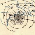
61616 AF308 2309A IKE OB 06
62626 EYEWALL 315 SPL 2499N08727W 0543 MBL WND 01562 AEV 00000 DL
M WND 02555 949705 WL150 36071 083 =
XXBB 61068 99250 70872 08157 00950 27000 11850 23200 22735 18203
33703 18210 44695 13808
21212 00950 34574 11940 00572 22928 01566 33923 02059 44915 02060
55908 02054 66850 02556 77695 05050
31313 09608 80539
61616 AF308 2309A IKE OB 06
62626 EYEWALL 315 SPL 2499N08727W 0543 MBL WND 01562 AEV 00000 DL
M WND 02555 949705 WL150 36071 083 =
here you go... this is the decoder that we use at work.
UZNT13 KNHC 061851
XXAA 56185 99251 70786 08158 99016 26444 18501 00140 26247 07004 92827
22856 10509 85560 17834 07510 70200 09045 07012 50591 05532 07016 88999
77999
61616 AF968 0204A BONNIE OB 04
62626 RAINBAND SPL 2635N08996W LST WND 001 MBL WND 04010
XXBB 56188 99251 70786 08158 00016 26444 11005 25841 2291 26657 33860
18233 44719 10657 55679 07023 66624 03656 77555 01917 88541 02556 99523
11497 05927
21212 00016 18501 11983 07510 22959 10010 33865 09511
44787 06510 55719 08011 66695 06512 77646 08512 88597 07011 99570 03511
11538 08014 22523 08516 33497 07016
31313 09608 81828
51515 10166 02050
61616 AF968 0204A BONNIE OB 04
62626 RAINBAND SPL 2635N08996W LST WND 001 MBL WND 04010
XXAA – Identifier for a temp drop code
Date/Time Group: YYGGId
•Identifier: YY – Date Group, Identifier: GG – Time Group, Identifier: Id - The highest mandatory level for which wind is available
LATTITUDE: 99LaLaLa
•Identifier: 99 – Indicator for data on position, Identifier: LaLaLa – Latitude in tenths of degrees
LONGITUDE: QcLoLoLoLo
•Identifier: Qc – The octant of the globe, Identifier: LoLoLoLo – Longitude in tenths of degrees
MARSDEN SQUARE: MMMUlaUlo
•Identifier and explain: MMM – Marsden square, Identifier and explain: UlaUlo – Units
SEA LEVEL PRESSURE: 99PoPoPo ToToToDoDo dodofofofo
•Identifier: 99 – Indicator for data at the surface level follows
•Identifier: PoPoPo –Pressure of specified levels in whole millibar (thousands digit omitted)
•Identifier: ToToTo – Tens and digits of air temperature (not rounded off) in degrees Celsius, at specified levels beginning with surface
•Identifier: DoDo – Dewpoint depression at standard isobaric surfaces beginning with surface level
NOTE
When the depression is 4.9C or less encode the units and tenths digits of the depression. Encode depressions of 5.0 through 5.4C as 50. Encode depressions of 5.5C through 5.9C as 56. Dew point
repressions of 6.0 and above are encoded in tens and units with 50 added. Dew point depressions for relative humidities less then 20% are encoded as 80. When air temperature is below –40C report DaDa as // Identifier: dodo – True direction from which the wind is blowing rounded to nearest 5 degrees. Report hundreds and tens digits. The unit (0 and 5) is added to the hundreds digit of wind.
•Identifier: fofofo – Wind speed in knots. Hundreds digit is sum of hundreds digit of speed and unit digit of direction. Example: 295 degrees at 125 knots is encoded as 29625
STANDARD ISOBARIC SURFACES: P1P1h1h1h1 T1T1T1D1D1 d1d1f1f1f1
•Identifier: P1P1 – Pressure of standard isobaric surfaces in units of tens of millibars. (1000mbs = 00, 925mbs = 92, 850mbs = 85, 700mbs = 70, 500mbs = 50, 400mbs = 40, 300mbs = 30, 250mbs = 25)
•Identifier: h1h1h1 – Heights of the standard pressure level in geopotential meters or decameters above the surface. Encoded in decameters at and above 500mbs omitting, if necessary, the thousands or tens of thousands digits. Add 500 to hhh for negative 1000mb or 925mb heights. Report 1000mb group as 00/// ///// ///// when pressure is less than 950mbs.
•Identifier: T1T1T1D1D1 – Same temperature/dew point encoding procedures apply to all levels
•Identifier: d1d1f1f1f1 – Same wind encoding procedures apply to all levels
DATA FOR TROPOPAUSE LEVELS: 88PnPnPn TnTnTnDnDn dndnfnfnfn
•Identifier: 88 – Indicator for Tropopause level follows
•Identifier: PnPnPn – Pressure at the tropopause level reported in whole millibars. Report 88PnPnPn as 88999 when tropopause is not observed
•Identifier: TnTnTnDnDn – Same temperature/dew point encoding procedures apply
•Identifier: dndnfnfnfn - Same wind encoding procedures apply
MAXIMUM WIND DATA: 77PnPnPn dndnfnfnfn 4vbvbvava
•Identifier: 77 – Indicator that data for maximum wind level and for vertical wind shear follow when max wind does not coincide at flight. If maximum wind level coincides with flight level encode 66
•Identifier: PnPnPn – Pressure at maximum wind level in whole millibars
•Identifier: dndnfnfnfn – Same wind encoding procedures apply
•Identifier: 4 – Data for vertical wind shear follow
•Identifier: vbvb – Absolute value of vector difference between max wind and wind 3000 feet BELOW the level of max wind, reported to the nearest knot. Use "//" if missing and a 4 is reported. A vector difference of 99 knots or more is reported with the code figure "99".
•Identifier: vava – Absolute value of vector difference between max wind and wind 3000 feet ABOVE the level of max wind, reported to the nearest knot. Use "//" if missing and a 4 is reported. A vector difference of 99 knots or more is reported with the code figure "99".
AIRCRAFT AND MISSION IDENTIFICATION: 61616 AFXXX XXXXX XXXXX OB XX
•Identifier: 61616 – Aircraft and mission identification data follows
•Identifier: AFXXX XXXX XXXXX: Mission ID
•Identifier: OB 04 – The observation number as transmitted from the aircraft.
NATIONALLY DEVELOPED CODES: 62626
•Identifier: 62626 – This is the remarks section. Only the remarks: EYE EYEWALL XXX (eyewall will be followed by the radian to the eye center procured from the ARWO), or RAINBAND, if release was made in a feeder band. The splash location will be recorded automatically by computer. Followed by last wind height in meters and the mean boundary layer wind with degrees to the nearest five-degree and knots.
PART BRAVO (B)
•XXBB – Identifier for a temp drop code
•The following 4 groups same as in PART ALPHA: Date/Time and location and SLP
SIGNIFICANT ISOBARIC LEVELS: nonoPoPoPo ToToToDoDo
•Identifier: nono – Number of level starting with surface level. Only surface will be numbered as "00". When a standard level is also selected as significant, repeat the level.
•Identifier: PoPoPo – Pressure at specified levels in whole millibars.
•Identifier: ToToToDoDo – Same temperature/dew point encoding applies.
SIGNIFICANT WIND LEVELS: 21212 nnPPP ddfff
•Identifier: nono – Number of level starting with surface level. Only surface will be numbered as "00". When a standard level is also selected as significant, repeat the level.
•Identifier: d1d1f1f1f1 – Same wind encoding procedures apply to all levels
SOUNDING SYSTEM INDICATION, RADIOSONDE/SYSTEM STATUS, LAUNCH TIME:
•31313 srrarasasa 8GGgg
ADDITIONAL DATA GROUPS: 51515 101XX 0PnPnPnPn
•Identifier: 51515 – Additional data in regional code follow
•Identifier: 10166 – Geopotential data are doubtful between the following levels 0PnPnPnPn.
•Identifier: 10167 – Temperature data are doubtful between the following levels 0PnPnPnPn.
•Identifier: 10190 – Extrapolated altitude data follows:
a.When the sounding begins within 25mbs below a standard surface, the height of the surface is reported in the format 10190 PnPnhnhnhn. The temperature group is not reported
b.When the sounding does not reach surface, but terminates within 25mbs of a standard surface, the height of the standard surface is reported in Part A of the code in standard format and also at the end of Part A and Part B of the code in the format as 10190 PnPnhnhnhn.
•Identifier: 10191 – Extrapolated surface pressure preceds. Extrapolated surface pressure is only reported when the termination occurs between 850mbs and the surface. Surface pressure is reported in Part A as 99PoPoPo ///// and in Part B as 00PoPoPo /////. When surface pressure is extrapolated the 10191 group is the last additional data group reported in Part B.
61616, 62626 – Same procedures as Part A