Sanibel wrote:No doubter from center burst behavior IMO.
how can it be a center burst when there is 1. No center and 2. the greatest convergence/increase in low level vorticity is to the west?
Moderator: S2k Moderators
Sanibel wrote:No doubter from center burst behavior IMO.


Derek Ortt wrote:'CaneFreak wrote:Derek Ortt wrote:I agree, the best convergence is ahead of the convection. That is likely where the wave axis is
the convection is merely due to favorable UL divergence
agreed...have you been able to find any kind of center of late? Any center at this point would be Mid-Level of course...
nope... no center. Only WEAK wave axis
Derek Ortt wrote:Sanibel wrote:No doubter from center burst behavior IMO.
how can it be a center burst when there is 1. No center and 2. the greatest convergence/increase in low level vorticity is to the west?


dixiebreeze wrote:I'll bet at least a TD by 2 a.m. Wed.
http://www.ssd.noaa.gov/goes/flt/t1/flash-rb.html

wxman57 wrote:dixiebreeze wrote:I'll bet at least a TD by 2 a.m. Wed.
http://www.ssd.noaa.gov/goes/flt/t1/flash-rb.html
I'll take that bet! Maybe late Wed or Thu.


gatorcane wrote:Keep in mind if it takes long for this to develop that consensus will just keep shifting left.
I expect things will change with that track guidance as its going to be a few days before anything gets going, so they should shift left.
Derek Ortt wrote:wxman57 wrote:dixiebreeze wrote:I'll bet at least a TD by 2 a.m. Wed.
http://www.ssd.noaa.gov/goes/flt/t1/flash-rb.html
I'll take that bet! Maybe late Wed or Thu.
I'll put 20 on that as well of no TD before Tuesday at 2 a.m.
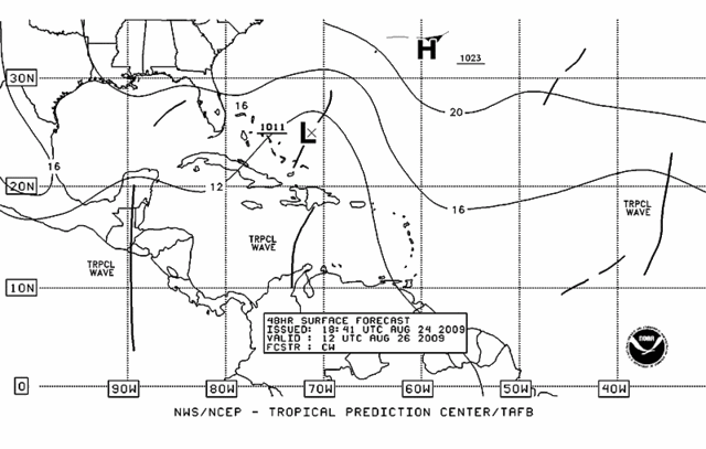
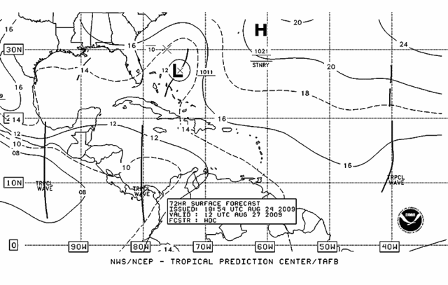
deltadog03 wrote:The shear is going to have to really relax before this can do whatever its gonna do... The shear is forecasted to lessen fairly quickly. As, I posted back on page 3, the models do build a very nice size upper anticyclone on top of this once it hits the bahamas. As far as track, its really going to depend on that trof split and where the upper low thats over the SE moves.

deltadog03 wrote:gatorcane wrote:Keep in mind if it takes long for this to develop that consensus will just keep shifting left.
I expect things will change with that track guidance as its going to be a few days before anything gets going, so they should shift left.
I agree 100% IMO this could easily shift back towards florida to the carolinas. I think euro/cmc looks pretty good (from a very early look at things) In fact I think the EURO got closer to the FL coast on the 12z run
HURRICANELONNY wrote:Computer models without anything to initialize. Is garbage. Until a depression forms (LLC). The models are useless.
Users browsing this forum: No registered users and 52 guests