HURAKAN wrote:
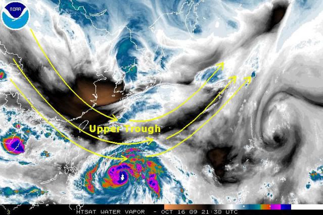
Giant storm
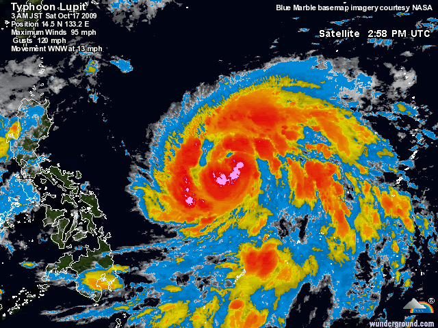
That's enough to cover the whole country!!!! We're in for a BAD week!!!
Moderator: S2k Moderators

leanne_uk wrote::uarrow: WOW this storm is just amazingly big. I did not realise till just now as I have been on the mobile looking today and everything looks big, so I tend to not realise. Seeing this on my full computer screen now is staggering.

leanne_uk wrote::uarrow: WOW this storm is just amazingly big. I did not realise till just now as I have been on the mobile looking today and everything looks big, so I tend to not realise. Seeing this on my full computer screen now is staggering.


cycloneye wrote:oaba09,are the authorities there warning the population to prepare right now?

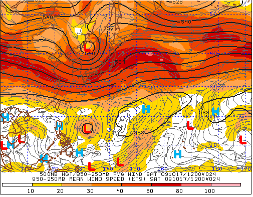
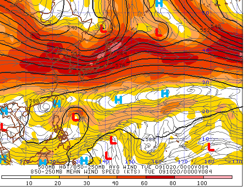
Derek Ortt wrote:this is going to slow and do a loop in all likliehood
MM5 was showing the current slowing. A trough is passing by to the north. May even have a brief NE motion, but then a motion back to the west.
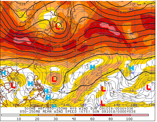
Typhoon10 wrote:So is there any models, opinions or probability how close this storm could come to HK?

ozonepete wrote:Typhoon10 wrote:So is there any models, opinions or probability how close this storm could come to HK?
Most of the models go far enough out that they forecast all the way to next weekend. They are "all over the place", however, so they are not of much value right now. If you want to know if it's a possibility that a strong typhoon LUPIT could come close to Hong Kong next weekend based on the current computer runs, I'd have to say that yes, it's a small possibility. But it's way too early. The general rule is to not trust ANY weather forecast past 3-5 days. That means that you wouldn't even bother looking seriously at a possible path towards Hong Kong until Tuesday or Wednesday. We currently just do not have the science to make a trustworthy forecast that far out. Anyone who tells you different just doesn't understand weather forecasting.
Thanks for that, really appreciate you sharing your knowledge. As you are probably aware, am very much a amateur and really just want to experience a "proper" typhoon.
I always look at the site, current storms and hope they come my way!
Personal Forecast Disclaimer:
The posts in this forum are NOT official forecast and should not be used as such. They are just the opinion of the poster and may or may not be backed by sound meteorological data. They are NOT endorsed by any professional institution or storm2k.org. For official information, please refer to the NHC and NWS products.


Users browsing this forum: No registered users and 52 guests


