For now,there are no plans to send recon to investigate 97L.
000
NOUS42 KNHC 191400
WEATHER RECONNAISSANCE FLIGHTS
CARCAH, NATIONAL HURRICANE CENTER, MIAMI, FL.
1000 AM EDT SUN 19 JULY 2009
SUBJECT: TROPICAL CYCLONE PLAN OF THE DAY (TCPOD)
VALID 20/1100Z TO 21/1100Z JULY 2009
TCPOD NUMBER.....09-052
I. ATLANTIC REQUIREMENTS
1. NEGATIVE RECONNAISSANCE REQUIREMENTS.
2. OUTLOOK FOR SUCCEEDING DAY.....NEGATIVE.
ATL: INVEST (97L)
Moderator: S2k Moderators
-
cycloneye

- Admin

- Posts: 149276
- Age: 69
- Joined: Thu Oct 10, 2002 10:54 am
- Location: San Juan, Puerto Rico
Re: ATL: INVEST (97L)
0 likes
-
Ed Mahmoud
Re: ATL: INVEST (97L)
Got out the NASA cake mix again and cooked up, with love, a close-up visible floater.
Visible floater, enjoy!
Visible floater, enjoy!
0 likes


-
wxman57

- Moderator-Pro Met

- Posts: 23172
- Age: 68
- Joined: Sat Jun 21, 2003 8:06 pm
- Location: Houston, TX (southwest)
Re: ATL: INVEST (97L)
Looks like the deepening trof along the east U.S. coast will draw it northwestward rather than it continuing moving to the west. That'll move it into increasing shear in a few days.
0 likes

Re: ATL: INVEST (97L)
wxman57 wrote:Looks like the deepening trof along the east U.S. coast will draw it northwestward rather than it continuing moving to the west. That'll move it into increasing shear in a few days.
Even though the system is so far south?
0 likes
-
wxman57
- Moderator-Pro Met
- Posts: 23172
- Age: 68
- Joined: Sat Jun 21, 2003 8:06 pm
- Location: Houston, TX (southwest)
Re: ATL: INVEST (97L)
poof121 wrote:wxman57 wrote:Looks like the deepening trof along the east U.S. coast will draw it northwestward rather than it continuing moving to the west. That'll move it into increasing shear in a few days.
Even though the system is so far south?
With the trof deepening along the East U.S. Coast, the westward extent of the Bermuda high is not as great. Movement should be WNW across NE Caribbean then northward with the vorticity. Part of the wave could continue westward, though, but without significant convection.
Here, run the 850mb vorticity loop and track it across the NE Caribbean then right into the east coast trof and northward:
http://www.nco.ncep.noaa.gov/pmb/nwprod ... loop.shtml
Last edited by wxman57 on Sun Jul 19, 2009 9:33 am, edited 1 time in total.
0 likes
Re: ATL: INVEST (97L)
I don't know, its looking a lot better than yesterday, and it beginning to draw moisture up from the ITCZ giving it a weak 'S' look about it. Shear will lessen over time and its pretty far south still. I would think it chances of becoming a TD are increasing, though not imminent.
0 likes
-
Gustywind

- Category 5

- Posts: 12334
- Joined: Mon Sep 03, 2007 7:29 am
- Location: Baie-Mahault, GUADELOUPE
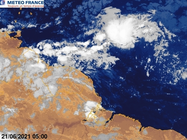
Slight increase of convection...
http://www.meteo.fr/temps/domtom/antill ... imVS2.html
Clik on animation
http://www.meteo.fr/temps/domtom/antill ... Tagguy.jpg
Another view at 9AM
http://www.meteo.fr/temps/domtom/antill ... Tagant.jpg
10 AM
http://www.meteo.fr/temps/domtom/antill ... imVS2.html
Clik on animation
http://www.meteo.fr/temps/domtom/antill ... Tagguy.jpg
Another view at 9AM
http://www.meteo.fr/temps/domtom/antill ... Tagant.jpg
10 AM
0 likes
-
gatorcane

- S2K Supporter

- Posts: 23708
- Age: 48
- Joined: Sun Mar 13, 2005 3:54 pm
- Location: Boca Raton, FL
darn, I thought 97L was dead. But as I mentioned a few days ago, if it managed to stay on or just south of 10N moving west, it had a chance as it would avoid the TUTT just to the north (now the TUTT axis is more north though). Recall the models wanted to lift it WNW right into the TUTT, destroying it.
AT least that trough along the Eastern CONUS should scoop it up even if it develops down the road. Thankfully the CONUS trough seems to be a semi-permanent feature this hurricane season so far
AT least that trough along the Eastern CONUS should scoop it up even if it develops down the road. Thankfully the CONUS trough seems to be a semi-permanent feature this hurricane season so far
Last edited by gatorcane on Sun Jul 19, 2009 9:40 am, edited 1 time in total.
0 likes
-
cycloneye
- Admin
- Posts: 149276
- Age: 69
- Joined: Thu Oct 10, 2002 10:54 am
- Location: San Juan, Puerto Rico
Re: ATL: INVEST (97L)
Thunderstorm activity has increased in the past few hours.Also,if you look closely,an outflow channel is forming.I am not saying anything more,only my personal observations. 

0 likes

Re:
gatorcane wrote:darn, I thought 97L was dead. But as I mentioned a few days ago, if it managed to stay on or just south of 10N moving west, it had a chance as it would avoid the TUTT just to the north (now the TUTT axis is more north though). Recall the models wanted to lift it WNW right into the TUTT, destroying it.
AT least that trough along the Eastern CONUS should scoop it up even if it develops down the road. Thankfully the CONUS trough seems to be a semi-permanent feature this hurricane season so far.
Actually GC, that trough may not be a good thing as instead of the system motoring into CA it'll get pulled north into the GOM or FL. Of course, it still has to develop first. Interesting that the BAM deep takes it into CA while the Shallow and Medium take it to the NW caribbean. GFS doesn't show the system affected by the trough over the next 4-5 days. Steering is generally W-NW through the caribbean.
0 likes
-
HURRICANELONNY
- Category 5
- Posts: 1390
- Joined: Wed May 07, 2003 6:48 am
- Location: HOLLYWOOD.FL
Re: ATL: INVEST (97L) Models
Every year we look at the models without a center point. There useless without a center. No guidance until a depression forms. Then Global and tropical models can get a grip on it. Don't even look. It will drive you nuts. 
0 likes
-
gatorcane
- S2K Supporter
- Posts: 23708
- Age: 48
- Joined: Sun Mar 13, 2005 3:54 pm
- Location: Boca Raton, FL
Re: ATL: INVEST (97L)
Ronjon, true that scenario must always be watched but hopefully 97L never even becomes anything significant anyway.
One thing I am wondering is whether this sudden increase in convection is due to warmer SSTs it is now over. Looks like it is over 28-29C SSTs and will be moving over an even warmer pocket tonight. Keep in mind this area of the MDR is running slightly above normal as far as SSTs are concerned, where 97L has been over the past several days has been slightly below normal. I also see some dry air out to the NW but it seems far less dry air is in the area than has been over the past several days. Shear is only running about 10-15K and is dropping ahead of the system. It may burst even more convection later tonight, wouldn't surprise me.
One thing I am wondering is whether this sudden increase in convection is due to warmer SSTs it is now over. Looks like it is over 28-29C SSTs and will be moving over an even warmer pocket tonight. Keep in mind this area of the MDR is running slightly above normal as far as SSTs are concerned, where 97L has been over the past several days has been slightly below normal. I also see some dry air out to the NW but it seems far less dry air is in the area than has been over the past several days. Shear is only running about 10-15K and is dropping ahead of the system. It may burst even more convection later tonight, wouldn't surprise me.
Last edited by gatorcane on Sun Jul 19, 2009 9:48 am, edited 2 times in total.
0 likes


Re: ATL: INVEST (97L)
cycloneye i realize it's your personal take on 97L, but i think you are on to something.
0 likes
-
cycloneye
- Admin
- Posts: 149276
- Age: 69
- Joined: Thu Oct 10, 2002 10:54 am
- Location: San Juan, Puerto Rico
Re: ATL: INVEST (97L)


0 likes
-
wxman57
- Moderator-Pro Met
- Posts: 23172
- Age: 68
- Joined: Sat Jun 21, 2003 8:06 pm
- Location: Houston, TX (southwest)
Re: ATL: INVEST (97L)
I think that the sudden increase in convection is happening for the same reason the wave in front of it flared up there - the approach to the TUTT. The TUTT will improve outflow at first, as is happening now to 97L. But once the wave passes the trof axis, the convection dies out (like the first wave). In this case, if the TUTT does lift out then what's left of 97L will probably be drawn northward up the east coast. Could bring some rain to the east coast, or it may stay offshore. But shear off the east coast will be high ahead of the trof.
Time to head out on our bikes. Back in 4 hours.
Time to head out on our bikes. Back in 4 hours.
0 likes
-
HouTXmetro

- Category 5
- Posts: 3949
- Joined: Sun Jun 13, 2004 6:00 pm
- Location: District of Columbia, USA
Re: ATL: INVEST (97L) Models
I know it's early but those runs are suggesting the CONUS may be threatened at some point should 97L survive.
0 likes
Who is online
Users browsing this forum: No registered users and 74 guests